 W
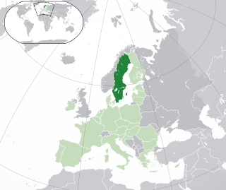
WSweden is a country in Northern Europe on the Scandinavian Peninsula. It borders Norway to the west; Finland to the northeast; and the Baltic Sea and Gulf of Bothnia to the south and east. At 450,295 km2 (173,860 sq mi), Sweden is the largest country in Northern Europe, the fifth largest in Europe, and the 55th largest country in the world.
 W
WBaltoscandian Confederation or Baltoscandia is a geopolitical concept of a Baltic–Scandinavian (Nordic) union. The idea was proposed by a Swedish professor Sten de Geer (1886–1933) in the journal Geografiska Annaler in 1928 and further developed by Professor Kazys Pakštas (1893–1960), a Lithuanian scientist in the field of geography and geopolitics.
 W
WThe Cap of the North consists of the counties Troms og Finnmark and Nordland in Norway, Norrbotten County in Sweden, Lapland/Lappi Region in Finland and Murmansk Oblast in Russia.
 W
WThe central Swedish ice-edge zone was formed when the melting of inland ice slowed during a cold period approximately 12,000 years ago and the ice edge stood relatively still for around 800 years. This occurred during the Younger Dryas period. The two main terminal moraines of this zone are the Skövde and Billigen ones. These two terminal moraines form parallel and semicontinuous ridges spanning from the Västgöta plains though the Östgöta plains to the Stockholm archipelago.
 W
WEast Sweden is a NUTS 1 region in Sweden. The region is defined and used by the European Union for statistical purposes, it is not used as a region by Sweden which uses other divisions of the country.
 W
WJämtland is a large land-locked Swedish province in the heart of the Scandinavian peninsula in northern Europe. Jämtland covers an area of 34,009 square kilometres, 8.3 per cent of Sweden's total area and is the second largest province in Sweden.
 W
WNorrforsen are rapids in the Ume River, between the towns of Norrfors and Sörfors 15 kilometers west of Umeå. The place has several rockcarvings, it was discovered when the penstock was lifted the first time.
 W
WNorrland terrain is a geomorphic unit covering the bulk of Norrland and the northwestern half of Svealand. Except for The High Coast the coastal areas of Norrland do not belong to the Norrland terrain. The southern and eastern boundary of the Norrland terrain is made up of geological faults that disrupt the Sub-Cambrian peneplain found the lowlands. In some locations these faults have been extensively eroded making the Norrland terrain boundary partly a result of erosion. Karna Lidmar-Bergström categorizes the Norrland Terrain into the following classes:Highlands with well developed valleys above 500 m.a.s.l. Plains with residual hills of Northern Sweden Undulating hilly land of Övertorneå/Överkalix Undulating hilly land of Boden area Large scale joint valley landscapes Plains with residual hills of Dalarna Undulating hilly land of central Sweden
 W
WSweden proper is a term used to distinguish those territories that were fully integrated into the Kingdom of Sweden, as opposed to the dominions and possessions of, or states in union with, Sweden. Only the estates of the realm of Sweden proper were represented in the Riksdag of the Estates.
 W
WSöderslätt is a Swedish agricultural district, known for its very high quality soil. It is located in the south-west of Scania, at the southernmost peak of the Scandinavian peninsula. It isn't an administrative area but is usually considered to comprise four municipalities: Skurup, Svedala, Trelleborg and Vellinge. Malmö, Scania's largest city, is not really associated with this agricultural area. But that city's eastern end equals Söderslätt's western boundary. Whilst the smaller town Trelleborg sooner is a part of the area. It's the southernmost town at the entire Scandinavian peninsula and has extensive car ferry traffic with the European continent.
 W
WThe subarctic zone is a region in the Northern Hemisphere immediately south of the true Arctic and covering much of Alaska, Canada, Iceland, the north of Scandinavia, Siberia, the Shetland Islands, and the Cairngorms. Generally, subarctic regions fall between 50°N and 70°N latitude, depending on local climates. Precipitation is low, and vegetation is characteristic of the taiga.