 W
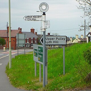
WBayston Hill is a large village and civil parish in central Shropshire, England. It is 3 miles (5 km) south of the county town Shrewsbury and located on the main A49 road, the Shrewsbury to Hereford road.
 W
WBrown Clee Hill is the highest hill in the rural English county of Shropshire, at 540 metres (1,770 ft) above sea level. It is one of the Clee Hills, and is in the Shropshire Hills Area of Outstanding Natural Beauty.
 W
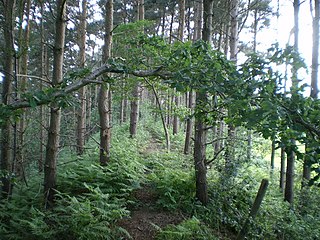
WBury Ditches is a British Iron Age hill fort between Clun and Bishop's Castle in the Shropshire Hills of central England.
 W
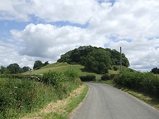
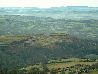
WBury Walls is an Iron Age hillfort about 1 mile (1.6 km) south-east of Weston-under-Redcastle, in Shropshire, England. It is a scheduled monument.
 W
WCaer Caradoc is a hill in the English county of Shropshire. It overlooks the town of Church Stretton and the village of All Stretton and offers panoramic views to the north towards the Wrekin, east to Wenlock Edge, and west over the nearby Long Mynd. On a clear day it is possible to see the hills of north-east Wales to the north, the high-rise buildings of Birmingham to the east, Worcester Beacon in the Malvern Hills to the south-east, and Hay Bluff in the Black Mountains and the peaks of the Brecon Beacons, to the south. Caer Caradoc is hill G/WB-006 in Summits on the Air. It is not to be confused with another hillfort of the same name 1 km west of Chapel Lawn near Bucknell.
 W
WCaer Caradoc is an Iron Age hill fort and Scheduled Monument in the south-west of the English county of Shropshire, near the town of Clun. It overlooks the village of Chapel Lawn. It is located within an area of Open Access land and can be reached via a public footpath between the farms of Wax Hall to the west and Bryncambric to the east.
 W
WCaus Castle is a ruin of a hill fort and medieval castle in the civil parish of Westbury in the English county of Shropshire. It is situated up on the eastern foothills of the Long Mountain guarding the route from Shrewsbury, Shropshire to Montgomery, Powys on the border between England and Wales. It was destroyed during the English Civil War and has been in ruins since.
 W
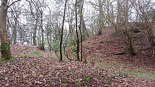
WCoxall Knoll is an Iron Age hillfort in Buckton and Coxall, Herefordshire, England.
 W
WFor the children's novel by Sheena Porter, please see Nordy Bank (novel).
 W
WOld Oswestry is a large early Iron Age hill fort in the Welsh Marches near Oswestry in north west Shropshire. The earthworks, which remain one of the best preserved hill forts in the UK, have been described as "The Stonehenge of the Iron Age Period". After the hill fort was abandoned, it was incorporated into Wat's Dyke by the Mercians during the Early Medieval period.
 W
WThe Wrekin is a hill in east Shropshire, England. It is located some five miles (8 km) west of Telford, on the border between the unitary authorities of Shropshire and Telford and Wrekin. Rising above the Shropshire Plain to a height of 407 metres above sea level, it is a prominent and well-known landmark, signalling the entrance to Shropshire for travellers westbound on the M54 motorway. The Wrekin is contained within the northern salient of the Shropshire Hills AONB. The hill is popular with walkers and tourists and offers good views of Shropshire. It can be seen well into Staffordshire and the Black Country, and even as far as the Beetham Tower in Manchester, Winter Hill in Lancashire and Cleeve Hill in Gloucestershire.