 W
WThe Chattahoochee River forms the southern half of the Alabama and Georgia border, as well as a portion of the Florida - Georgia border. It is a tributary of the Apalachicola River, a relatively short river formed by the confluence of the Chattahoochee and Flint rivers and emptying from Florida into Apalachicola Bay in the Gulf of Mexico. The Chattahoochee River is about 430 miles (690 km) long. The Chattahoochee, Flint, and Apalachicola rivers together make up the Apalachicola–Chattahoochee–Flint River Basin. The Chattahoochee makes up the largest part of the ACF's drainage basin.
 W
WThe Chattahoochee Nature Center is a private, non-profit environmental education facility in Roswell, Georgia. Located on 127 acres (0.51 km2) adjacent to the Chattahoochee River, the nature center focuses on educational outreach through the use of live flora and fauna. The mission of the Chattahoochee Nature Center is to connect people to nature.
 W
WClear Creek is a stream in northeast Atlanta that is a tributary to Peachtree Creek and part of the Chattahoochee River watershed. It has two main branches, one originating east of the high ground along which Boulevard runs and another to the west originating on the northeast side of downtown Atlanta. The easterly branch of Clear Creek begins in several springs and branches in what are now Inman Park and the Old Fourth Ward. Flowing north, the creek was joined by other branches and springs, including Angier Springs near the end of Belgrade Avenue and the so-called Ponce de Leon Springs, which were “discovered” during railroad construction in the 1860s and gave rise to the eponymous park and avenue.
 W
WEufaula National Wildlife Refuge is an 11,184 acre (45.26 km2) National Wildlife Refuge located in Barbour and Russell counties in Alabama and Stewart and Quitman counties in Georgia. Eufaula NWR is located on the Walter F. George Lake along the Chattahoochee River between Alabama and Georgia. Of the 11,184 acres (45.26 km2) of managed property, 7,953 acres (32.18 km2) are in Alabama and 3,231 acres (13.08 km2) are in Georgia.
 W
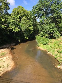
WNancy Creek is a 16.3-mile-long (26.2 km) stream in northern Atlanta, Georgia, United States. It begins in far northern DeKalb County, just north of Chamblee, and flows southwestward into Fulton County, through the far southeast corner of Sandy Springs, then through the Buckhead area of Atlanta. It empties into Peachtree Creek, which then flows into the Chattahoochee River, south of Vinings and Paces. The Chattahoochee eventually joins with the Flint River to create the Apalachicola River, which flows into the Gulf of Mexico. The North Fork Nancy Creek is a major tributary, while Little Nancy Creek tends to run low or dry. Other tributaries include Bubbling Creek which originates in Chamblee, Perimeter Creek which originates in Dunwoody and Silver Creek which includes the 38-acre Silver Lake and Little Silver Lake.
 W
WPeachtree Creek is a major stream in Atlanta. It flows for 7.5 miles (12.1 km) almost due west into the Chattahoochee River just south of Vinings.
 W
WThe Ramblin' Raft Race was an annual Memorial Day weekend raft race on the Chattahoochee River in Atlanta that lasted from 1969 to 1980. At its peak, more than 300,000 rafters partook in the race. Amid increasing environmentalism, the race was cancelled. The race was associated with consumption of alcohol and illegal drugs, both by the rafters and the thousands of spectators that lined a route that began in Sandy Springs and ended in Vinings.
 W
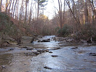
WSope Creek is an 11.6-mile-long (18.7 km) stream located in Cobb County, Georgia, United States. It is a significant tributary of the Chattahoochee River. It was known as Soap Creek during the 19th century. A section of Sope Creek runs through the Chattahoochee River National Recreation Area.
 W
WThe Soque River and its watershed are located entirely within the county boundaries of Habersham County in northeast Georgia. The Soque is a tributary of the Chattahoochee River. Portions of the river run along State Route 197.
 W
WVickery Creek or Big Creek is a 26.5-mile-long (42.6 km) stream in Forsyth and Fulton counties in Georgia. The creek mouth into the Chattahoochee River is located at the southern border of Roswell where State Route 9 crosses the river. Its source is located just north of the intersection of Georgia State Route 9 and Georgia State Route 20, in Forsyth County, about 1 mile directly south of downtown Cumming.
 W
WThe Walter F. George Lake, named for Walter F. George (1878–1957), a United States Senator from Georgia, is formed on the Chattahoochee River along the state line between Alabama and Georgia. It is also widely known by the name, Lake Eufaula – particularly in Alabama, where the state legislature passed a resolution on June 25, 1963, to give the lake that name. The 46,000-acre lake extends north about 85 miles (140 km) from the Walter F. George Lock and Dam and has approximately 640 miles (1,030 km) of shoreline. Popular activities along the lake include camping and trophy fishing.
 W
WWest Point Lake is a man-made reservoir located mostly in west-central Georgia on the Chattahoochee River and maintained by the U.S. Army Corps of Engineers (USACE). The Chattahoochee river flows in from the north, before flowing through the West Point Dam, which impounds the lake, and continuing to Columbus, Georgia. Of the four major USACE lakes in the ACF River Basin, West Point Lake is the smallest by area containing 25,864 acres (10,467 ha) of water, and has the second shortest shoreline at 604 mi (972 km). The purposes of the reservoir are to provide flood control, hydroelectric power, and water storage to aid the navigation of the lower Chattahoochee.
 W
WWilleo Creek is a 6.7-mile-long (10.8 km) stream in the U.S. state of Georgia, and is located in the north-northwestern part of metro Atlanta. It is a significant tributary of the Chattahoochee River, into which it flows at Bull Sluice Lake, just upstream from Morgan Falls Dam and downstream from the Chattahoochee Nature Center. Together, the two streams form nearly all of the county line between Fulton to the east and Cobb to the west.