 W
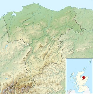
WArdoch Roman Fort is an archaeological site just outside the village of Braco in Perthshire, Scotland, about 7 miles south of Crieff.
 W
WAuchinhove, located to the east of Keith in Moray, Scotland, is the site of a Roman marching camp, first discovered by aerial photography in 1949.
 W
WBattledykes is a Roman Camp established slightly to the north of Forfar, Scotland. According to Hector Boece, Pictish chiefs met at a castle by Forfar Loch to plan how to repel the Roman armies, who invaded several times between the 1st and 4th centuries AD. Eventually, the better equipped Romans prevailed, to be displaced again by the Picts. The Romans established a Roman Camp at Battledykes, approximately three miles north of Forfar; this camp was assessed to have held 50,000 to 60,000 men. From Battledykes northward the Romans established a succession of camps including Stracathro, Raedykes and Normandykes.
WBellie is a locality in Moray, Scotland. Little survives of the old parish church at Bellie, located 2 miles north of Fochabers, although its graveyard is preserved. There is a Bellie Kirk in Fochabers, which replaced the old church in 1798.
 W
WBurnfield, located on the banks of the River Deveron in Aberdeenshire, Scotland, near Milltown of Rothiemay, is the site of a probable Roman marching camp, first discovered by aerial photography in 1982.
 W
WBurnswark Hill, situated to the east of the A74(M) between Ecclefechan and Lockerbie in Dumfries and Galloway, Scotland, sits prominently in the landscape. Its rich history has been a consistent source of archaeological interpretation for generations. The most recent active archaeological research, undertaken by the Trimontium Trust has furthered the understanding of the site narrative in respect of the apparent relationship between the local population and occupying Roman forces.
WDurno or Logie Durno, located 6 miles (9.7 km) north west of Inverurie in Aberdeenshire, Scotland, is the site of a Roman marching camp, first discovered by aerial photography in July 1975 and excavated in 1976 and 1977.
 W
WNormandykes is the site of a Roman marching camp 1 mile (1.6 km) to the southwest of Peterculter, City of Aberdeen, Scotland. The near-rectangular site, measuring approximately 860 by 510 metres, covers about 106 acres (43 ha) of the summit and eastern slopes of a hill overlooking the River Dee and the B9077 road further south. Aerial photographs for Normandykes have been archived between 1947 and 1976. The camp is about 6 miles (10 km), or less than half a day's march, north of the Raedykes camp. It is possible that the actual route taken would have entailed one day's march, over a route likely chosen to avoid the Red Moss, a virtually uncrossable bog near the present day village of Netherley. Normandykes was first excavated in the year 1935 by Richmond and MacIntyre; construction is thought to date to the Antonine or Severan periods.
 W
WThe Pennymuir Roman camps are situated southeast of Jedburgh in the Scottish Borders area of Scotland, near the Anglo-Scottish border, in the former Roxburghshire. The site, alongside the course of the Roman road known as Dere Street, consists of the remains of four Roman temporary camps, a linear earthwork and an area of rig. The site is also sometimes referred to as the Towford camps.
 W
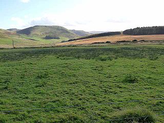
WRaedykes is the site of a Roman marching camp located just over 3 miles (5 km) NW of Stonehaven, Aberdeenshire, Scotland. National Grid Reference NO 842902. It is designated as a scheduled monument. A marching camp was a temporary camp used mainly for overnight stops on a long route between more permanent forts, or as a temporary base while on campaign in hostile territory.
 W
WStracathro is a small place in Angus, Scotland.
 W
WStrageath is a Roman camp near the River Earn in eastern Scotland. Strageath was one of a chain of camps that the Romans used in their march northward. Other notable camps in this chain are Ardoch, Battledykes, Stracathro, Raedykes and Normandykes.
 W
WYthan Wells, also known as Glenmailen, is the site of a Roman military camp, near the farm of Glenmellan, 2.1 kilometres (1.3 mi) east of the village of Ythanwells in Aberdeenshire, Scotland. The site is a designated scheduled monument.