 W
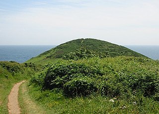
WBartinney Castle is an Iron Age enclosure located in the Penwith Peninsula of Southwest Cornwall, England, United Kingdom, it is surrounded by a circular earthwork standing on a hill surrounded by various archaeological prehistoric remains, including ancient settlements, field systems, tumuli and cairns.
 W
WBlack Head is a headland at the western end of St Austell Bay, in Cornwall, England. It is owned by the National Trust.
 W
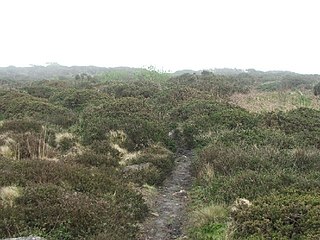
WCadson Bury is an Iron Age hillfort about 2 miles (3.2 km) south-west of Callington, in Cornwall, England.
 W
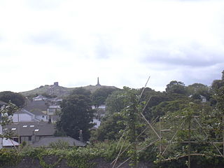
WCaer Bran Hill Fort is an archaeological site near Sancreed and Carn Euny Iron Age village, on the Penwith peninsula in Cornwall.
 W
WCarn Brea is a civil parish and hilltop site in Cornwall, England, United Kingdom. The population of Carn Brea including Bosleake and Church Coombe was 8,013 at the 2011 census. The hilltop site is situated approximately one mile (1.6 km) southwest of Redruth. The settlements of Bosleake, Brea, Broad Lane, Carn Arthen, Carn Brea Village, Carnkie, Four Lanes, Grillis, Illogan Highway, Pencoys, Penhallick, Piece, Pool, Tolskithy, Tregajorran, Treskillard, Tuckingmill and West Tolgus are in the parish.
 W
WCastle an Dinas is an Iron Age hillfort at the summit of Castle Downs near St Columb Major in Cornwall, UK and is considered one of the most important hillforts in the southwest of Britain. It dates from around the 3rd to 2nd century BCE and consists of three ditch and rampart concentric rings, 850 feet (260 m) above sea level. During the early 1960s it was excavated by a team led by Dr Bernard Wailes of the University of Pennsylvania during two seasons of excavation.
 W
WChûn Castle is a large Iron Age hillfort (ringfort) near Penzance in Cornwall, England, United Kingdom. The fort was built about 2,500 years ago, and fell into disuse until the early centuries AD when it was possibly re-occupied to protect the nearby tin mines. It stands beside a prehistoric trackway that was formerly known as the Old St Ives Road and the Tinners’ Way. The name Chûn derives from Cornish: Chi an Woon. The area is now sometimes known as Chûn Downs. Nearby is Chûn Quoit.
 W
WDodman Point near Mevagissey is the highest headland on the south Cornwall coast, measuring 374 feet (114 m). It is also known by its earlier names of the Deadman and Deadman's Point. It hosts the remains of an Iron Age promontory fort, and at its seaward end is "Parson Martin's Cross"; a large granite cross erected in 1896 to encourage those involved in Christian service, and which aids navigation around the headland. Dodman Point is mentioned in the shanty Spanish Ladies.
 W
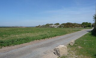
WGurnard's Head is a prominent headland on the north coast of the Penwith peninsula in Cornwall, England, UK. The name is supposed to reflect the fact that the rocky peninsula resembles the head of the gurnard fish.
 W
WKelly Rounds, or Castle Killibury is an Iron Age hill fort in Cornwall, England, United Kingdom. It is situated beside the A39 trunk road approximately two miles east of Wadebridge.
 W
WKelsey Head is a coastal Site of Special Scientific Interest (SSSI) and headland in north Cornwall, England, UK, noted for its biological interest. The site contains an Iron Age hill fort.
 W
WLargin Castle is a contour hillfort and scheduled monument in Cornwall, England, presumed to date from the Iron Age.
 W
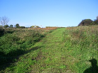
WLescudjack Hill fort is the name given to the unexcavated Iron Age settlement located in Penzance, Cornwall. It is positioned on the summit of a steep hill in the east of Penzance and consists of a single rampart enclosing an area of 3 acres (12,000 m2). The site has been damaged and contains allotments and an open area of land which has recently been cleared of thick undergrowth. It is reported that a small lead-copper mine was situated "just outside" the ramparts, however all trace of this appears to have vanished.
 W
WLesingey Round is a ringfort, a smaller type of hillfort, about 1 mile (1.6 km) west of Penzance, in Cornwall, England. It is a scheduled monument.
 W
WMaen Castle is an Iron Age promontory fort or 'cliff castle' close to Land's End in Cornwall. It is one of only two fortified sites in Cornwall where Early Iron Age pottery has been found. Excavations took place in 1939 and 1948-9 and about 300 sherds were unearthed.
 W
WPadderbury Top is a hillfort about 2 miles (3.2 km) south-east of Menheniot, in Cornwall, England, named after the hill on which it is situated. It is a scheduled monument.
 W
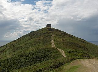
WRame Head or Ram Head is a coastal headland, southwest of the village of Rame in southeast Cornwall, United Kingdom. It is part of the larger Rame Peninsula.
 W
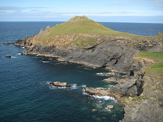
WThe Rumps is a twin-headland promontory at the north-east corner of Pentire Head in north Cornwall, United Kingdom.
 W
WSt Dennis is a civil parish and village in Cornwall, England, United Kingdom. The village is situated on the B3279 between Newquay and St Austell.
 W
WTrencrom Hill is a prominent hill fort, owned by the National Trust, near Lelant, Cornwall. It is crowned by an univallate Neolithic tor enclosure and was re-used as a hillfort in the Iron Age. Cairns or hut circles can be seen in the level area enclosed by the stone and earth banks. The hill overlooks the Hayle Estuary and river, and Mount's Bay and St Michael's Mount can be seen to the south. The hill was recorded as Torcrobm in 1758 which is derived from Cornish "torr crobm", i.e. 'hunched bulge'.
 W
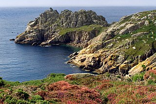
WTreryn Dinas is a headland near Treen, on the Penwith peninsula between Penberth Cove and Porthcurno in Cornwall, England.
 W
WTrevelgue Head, also known as Porth Island, is a headland north-east of Newquay, Cornwall, England, next to Porth at the eastern end of Newquay Bay.
 W
WTrink Hill is a 212-metre-high hill that lies between the hamlets of Trink and Cripplesease, near to the village of Nancledra, Cornwall, UK. Trencrom Hill lies one kilometre to the South East.
 W
WWarbstow Bury is an Iron Age hillfort about 0.5 miles (0.80 km) west of the village of Warbstow, in Cornwall, England. It is a scheduled monument.