 W
WAgia is a village and a municipality in the Larissa regional unit, Thessaly, Greece. Agia is located east of Larissa and south of Melivoia. The Mavrovouni mountains dominate the south and the Aegean Sea lies to the east.
 W
WAlmyros or Halmyros is a town and a municipality of the regional unit of Magnesia, region of Thessaly, Greece. It lies in the center of prosperous fertile plain known as 'Krokio Pedio', which is crossed by torrents. Almyros is an important agricultural and commercial center of Magnesia, and is also developing as a tourist center for the area. The main agricultural products are tomatoes, cotton, wheat, almonds, peanuts and pistachio nuts.
 W
WAlonnisos, also transliterated as Alonissos, is a Greek island in the Aegean Sea. After Skiathos and Skopelos it is the third member of the Northern Sporades. It is 3 km (2 mi) (2 nm) east of the island of Skopelos. Alonnisos is also the name of a village on the island, as well as the municipality that encompasses the island and the village.
 W
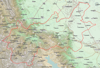
WArgithea is a village and a historic municipality in the Karditsa regional unit of Greece. The seat of the municipality is in Anthiro. The name derives from ἀργός + θέα.
 W
WElassona is a town and a municipality in the Larissa regional unit in Greece. During antiquity Elassona was called Oloosson (Ὀλοοσσών) and was a town of the Perrhaebi tribe. It is situated at the foot of Mount Olympus. Elassona is bypassed by the GR-3.
 W
WFarkadona is a municipality in the southeastern Trikala regional unit, part of Thessaly in Greece. In 2011 its population was 2,652 for the town and 13,396 for the municipality. It is located about halfway between the cities Larissa to the east, and Trikala to the west, at about 30 km from both. It is situated in the Thessalian Plain, near the river Pineios. Farkadona is on the Greek National Road 6.
 W
WFarsala, known in Antiquity as Pharsalos, is a city in southern Thessaly, in Greece. Farsala is located in the southern part of Larissa regional unit, and is one of its largest towns. Farsala is an economic and agricultural centre of the region. Cotton and livestock are the main agricultural products, and many inhabitants are employed in the production of textile. Farsala is famous for its distinctive halva, but even more so for its significance in ancient history. It is inhabited by a large Aromanian (Vlach) population.
 W
WKarditsa is a city in western Thessaly in mainland Greece. The city of Karditsa is the capital of Karditsa regional unit of region of Thessaly.
 W
WKileler is a village and a municipality in the regional unit of Larissa in Greece. The seat of the municipality is in Nikaia. The village became known for the Kileler incident that occurred on March 6, 1910.
 W
WLake Plastiras is a municipality in the Karditsa regional unit, Thessaly, Greece. The seat of the municipality is the town Morfovouni. The municipal unit has an area of 198.350 km2. The municipality was named after the artificial Lake Plastiras, that was named in turn after the general and three-time Prime Minister Nikolaos Plastiras.
 W
WLarissa is the capital and largest city of the Thessaly region in Greece. It is the fifth-most populous city in Greece with a population of 144,651 according to the 2011 census. It is also capital of the Larissa regional unit. It is a principal agricultural centre and a national transport hub, linked by road and rail with the port of Volos, the cities of Thessaloniki and Athens. The municipality of Larissa has 162,591 inhabitants, while the regional unit of Larissa reached a population of 284,325.
WMeteora is a municipality in the regional unit of Trikala in the Thessaly region in Greece. Its seat is the town Kalampaka.
 W
WMouzaki is a town and a municipality in the northwestern part of the Karditsa regional unit, Greece. Mouzaki is located on the southwestern edge of the Thessalian plain, where the river Pamisos descends from the Agrafa mountains. It is 17 km southwest of Trikala and 24 km northwest of Karditsa. The Greek National Road 30 passes north of the town.
 W
WPalamas is a town and a municipality in the Karditsa regional unit, Greece. Population 16,726 (2011). Palamas is located south-southwest of Larissa, the capital of Thessaly, northwest of Lamia, north of Sofades, east-northeast of Karditsa and east-southeast of Trikala. Palamas is linked with the road linking Karditsa and Larissa. It also serves roads with the GR-6 and Sofades. The Pineios River is to the north as well as the Trikala regional unit.
 W
WPyli is a municipality in the Trikala regional unit, Greece. Situated 18 km west of Trikala, right at the bottom of two mountains Itamos, and Koziakas, which mark the beginning of the Pindos mountainline, Pyli marks the entrance to a great gorge and the natural path that leads to the city of Arta. The river Portaikos, a tributary of the river Pineios, runs through this location. The municipality of Pyli contains 7 municipal units, but the town itself has a population of about 2,000. Most inhabitants are either self-employed in small business establishments or work in Trikala. Agriculture and animal herding as an occupation has been largely abandoned, though the surrounding area is ideal for both. Pyli had always been the major trade center for the surrounding settlements.
 W
WRigas Feraios is a municipality in the Magnesia regional unit, Thessaly, Greece. The seat of the municipality is the town Velestino. The municipality has an area of 551 km2 (213 sq mi). The municipality was named after the Greek writer and revolutionary Rigas Feraios, whose hometown was Velestino.
 W
WSkiathos is a small Greek island in the northwest Aegean Sea. Skiathos is the westernmost island in the Northern Sporades group, east of the Pelion peninsula in Magnesia on the mainland, and west of the island of Skopelos.
 W
WSkopelos is a Greek island in the western Aegean Sea. Skopelos is one of several islands which comprise the Northern Sporades island group, which lies east of the Pelion peninsula on the mainland and north of the island of Euboea. It is part of the Thessaly region. Skopelos is also the name of the main port and the municipal center of the island. The other communities of the island are Glossa and Neo Klima (Elios). The geography of Skopelos includes two mountains over 500 m (1,640 ft); Delphi (681 m/2,234 ft) in the center of the island, and Palouki in the southeast. With an area of 96 km2 (37 sq mi) Skopelos is slightly larger than Mykonos (85 km2/33 sq mi) and Santorini (73 km2/28 sq mi). The nearest inhabited islands are Skiathos to the west and Alonissos to the east.
 W
WSofades is a town and municipality in Thessaly, central Greece belonging to the regional unit of Karditsa. Its 2011 census population was 6,056 people and 18,864 for the municipality, including a large Gypsy community. Its elevation is around 120 m above sea level, and the economy is mainly agricultural. It is the only municipality that has one municipal district with settlements. Sofades is located south of Palamas, southwest of Larissa, the capital of Thessaly, northwest of Lamia and southeast of Karditsa and Trikala. Sofades is on GR-30 as well as the road between Mataragka and Palamas. It is on the OSE railway line linking Kalambaka and the main line and has a station. The native Greek inhabitants of the region are commonly known as Karagounides (Καραγκούνηδες).
 W
WSouth Pelion is a municipality in the Magnesia regional unit, Thessaly, Greece. The seat of the municipality is the town Argalasti. The municipality has an area of 368.539 km2. It comprises the southern part of Mount Pelion.
 W
WTempi is a municipality in the Larissa regional unit, Thessaly, Greece. The seat of the municipality is the town Makrychori. The municipality was named after the Vale of Tempe.
 W
WTrikala is a city in northwestern Thessaly, Greece, and the capital of the Trikala regional unit. The city straddles the Lithaios river, which is a tributary of Pineios. According to the Greek National Statistical Service, Trikala is populated by 81,355 inhabitants (2011), while in total the Trikala regional unit is populated by 131,085 inhabitants (2011).
WTyrnavos is a municipality in the Larissa regional unit, of the Thessaly region of Greece. It is the second-largest town of the Larissa regional unit, after Larissa. The town is near the mountains and the Thessalian Plain. The river Titarisios, a tributary of the Pineios, flows through the town. Tyrnavos is bypassed by the GR-3 and has an old road connecting the town to Elassona. It will be linked with a superhighway numbered 3 (A3) with an unscheduled opening date. Tyrnavos is located south-southwest of Thessaloniki and Katerini, northwest of Larissa, east-northeast of Trikala and south-southeast of Elassona and Kozani. Here live an important community of Aromanians (Vlachs).
 W
WVolos is a coastal port city in Thessaly situated midway on the Greek mainland, about 330 kilometres north of Athens and 220 kilometres south of Thessaloniki. It is the sixth most populous city of Greece, and the capital of the Magnesia regional unit of the Thessaly Region. Volos is also the only outlet to the sea from Thessaly, the country's largest agricultural region. With a population of 144,449 (2011), the city is an important industrial centre, and its port provides a bridge between Europe and Asia.
 W
WZagora–Mouresi is a municipality in the Magnesia regional unit, Thessaly, Greece. The seat of the municipality is the town Zagora. The municipality has an area of 150.315 km2.