 W
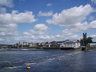
WLimerick is a city in County Limerick, Ireland. It is located in the Mid-West Region and is also part of the province of Munster. With a population of 94,192 at the 2016 census, Limerick is the third-most populous urban area in the state, and the fourth-most populous city on the island of Ireland at the 2011 census. The city lies on the River Shannon, with the historic core of the city located on King's Island, which is bounded by the Shannon and Abbey Rivers. Limerick is also located at the head of the Shannon Estuary, where the river widens before it flows into the Atlantic Ocean. Limerick City and County Council is the local authority for the city.
 W
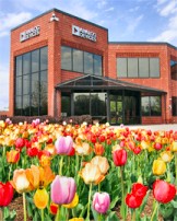
WAnalog Devices, Inc. (ADI), also known simply as Analog, is an American multinational semiconductor company specializing in data conversion, signal processing and power management technology, headquartered in Wilmington, Massachusetts.
 W
WAnnacotty is a suburban town on the outskirts of Limerick, Ireland, 7 km (4.3 mi) from the centre of the city. It is situated where the old N7 main road between Limerick and Dublin crosses the Mulkear River, 1 km (0.62 mi) upstream of where it flows into the River Shannon.
 W
WBallynanty, or Ballynantybeg, is a neighbourhood and electoral district on the north side of Limerick in the mid-west of Ireland.
 W
WCastletroy is a suburb of Limerick, Ireland.
 W
WSir Thomas Henry Cleeve was a Canadian-born businessman, domiciled in Ireland, who was elected High Sheriff of Limerick City on three occasions.
WCoonagh is an area, comprising the townlands of:Coonagh West Coonagh East
 W
WEarl of Limerick is a title that has been created twice in the Peerage of Ireland, associated first with the Dongan family, then with the Pery family.
 W
WLimerick is the third largest city in the Republic of Ireland and is the capital of Ireland's Mid-West Region comprising the counties of Limerick, Clare and North Tipperary. Traditionally Limerick's economy was mainly agricultural of which a lot of industry in the city was based around due to the city's proximity to the Golden Vale. Important industries at this time were the bacon industry and Limerick lace which provided much employment. Limerick Port was also the main port on the west of Ireland where much this produce was exported. Today Limerick's economy is driven by a cluster of industrial and business parks located along the Limerick/Shannon corridor which include the National Technology Park, Raheen Business Park and the Shannon Free Zone. Limerick/Shannon is also classified as a gateway city as part of the National Spatial Strategy.
WGarryowen Irish: Garraí Eoin is a neighbourhood in Limerick, Ireland. The word Garryowen is a transliteration of the Irish Garraí Eoin - "the garden of Owen" - and relates to the association in the 12th century between St John's Church and the Knights Templar whose house in Limerick was dedicated to John the Baptist. In medieval times Garryowen was located just outside the Irishtown area of the walled city of Limerick. The citadel was the Irishtown's main fortification. In 1690, it was the scene of a heroic Jacobite defence-the battle of the breach-which was fought nearby during the Williamite War of 1688–91. The sally port of the original stronghold has been incorporated into the structure of St John's Hospital. Other parts of the city walls can still be seen within the hospital grounds. The Citadel remained in use as a military barracks until 1752. St John's Gate was situated on the main roadway, nearby, but no trace of it now remains.
 W
WIrishtown is an area of central Limerick, Ireland. The area along with Englishtown and Newtown Pery forms Limerick City Centre. Broad Street, John Street and Mungret Street are the main streets in the district. St. John's Square, a prized early Georgian development is located here as is St. John's Cathedral and the Milk Market which is located off Mungret Street.
WKilleedy is a civil parish located south of Newcastle West in Co. Limerick in Ireland. This parish consists of two villages, Ashford and Raheenagh. The elevation of the parish varies from 1,184 ft. OS at Mauricetown and 1,082 ft. at Dromdeeveen to 200 ft. OS at Ballintubber. The parish is overlooked by the Mullaghareirk Mountains. The patron saint of Killeedy is Saint Ita. Killeedy used to be known as Cluain Chreadhail but in later ages it had taken the name of Cill íde, the Church of Saint Ita, from a nunnery which was founded there in the sixth century. On 15 January of each year, the feast of St. Ita's Day is celebrated in Killeedy.
 W
WKing's Island is an area of central Limerick, Ireland. The area is often referred to colloquially as The Island and consists of two distinct areas, Englishtown and St Mary's Park. The historical city of Limerick known as Englishtown is located on the southern end and St Mary's Park; a local authority housing estate is located on the northern end.
 W
WThe Limerick Leader is a weekly local newspaper in Limerick, Ireland. It was founded in 1889. The newspaper is headquartered on Glentworth Street in the City.
 W
WAs with other cities in Ireland, Limerick has a history of great architecture. A 1574 document prepared for the Spanish ambassador attests to its wealth and fine architecture:Limerick is stronger and more beautiful than all the other cities of Ireland, well walled with stout walls of hewn marble... There is no entrance except by stone bridges, one of the two of which has 14 arches, and the other 8 ... for the most part the houses are of square stone of black marble and built in the form of towers and fortresses.
 W
WLimerick Museum, previously known as the Jim Kemmy Municipal Museum, is a city museum in Limerick, Ireland.
 W
WLimerick lace is a specific class of lace originating in Limerick, Ireland, which was later produced throughout the country. It evolved from the invention of a machine which made net in 1808. Until John Heathcoat invented a net-making machine in Devon in 1815, handmade net was a very expensive fabric. This meant cheap net became available to Irish lacemakers, particularly after 1823 when Heathcoat's patent expired.
 W
WLimerick Suburban Rail are a group of Iarnród Éireann commuter train services from Limerick Colbert to various other destinations on three different lines.Limerick – Ennis, calling at Sixmilebridge Limerick – Nenagh, calling at Castleconnell and Birdhill Limerick – Limerick Junction
 W
WThe Milk Market is a food market located on Mungret Street, Limerick, Ireland. Despite the name, the market has diversified over the years from its initial purpose and now sells a wide variety of foodstuffs, much of which is produced locally. The market is one of the oldest in Ireland. The flagship market day is the Saturday food market, however, markets are also held on Fridays and Sundays.
 W
WNewtown Pery is an area of central Limerick, Ireland, and forms the main city centre of the city. The district is known for its Georgian architectural heritage and is the core area of Limerick's Georgian Quarter. It is one of the three towns that make up modern-day Limerick City Centre, the other two being the older Englishtown and Irishtown, which date from the medieval period. Newtown Pery houses the largest collection of Georgian townhouses in Ireland outside of Dublin. In 1837, Samuel Lewis in his Topographical Dictionary of Ireland described Newtown Pery as "one of the handsomest towns in Ireland".
 W
WThe People's Park is a park located by Pery Square in Limerick, Ireland, just west of the railway station and bus terminal. At the northern edge of the park is the Limerick City Gallery of Art.
 W
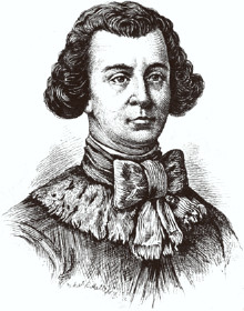
WRobert Clive was awarded an Irish peerage in 1762, being created Baron Clive of Plassey, County Clare; he bought lands in County Limerick and County Clare, Ireland, naming part of his lands near Limerick city, Plassey. Following Irish independence, these lands became state property. In the 1970s a technical college, which later became the University of Limerick, was built at Plassey. Plassey is an area of Limerick City, about 5km upstream on the River Shannon from Limerick City centre. It is located near the suburbs of Castletroy and Monaleen. The University of Limerick has its main campus in the area, which is the site of Plassey House, a country house that serves as the University's administrative centre. The University's other main campus is located across the River Shannon, with the two campuses connected by two bridges.
 W
WThe Limerick Post is a free weekly newspaper, distributed throughout Limerick city and county, parts of counties Clare, Tipperary in the province of Munster, Ireland.
 W
WThe R509 road, following part of the Childers Road, is a regional road in Ireland, running through the southeastern side of Limerick City. It forms what is somewhat akin to an inner ring road.
 W
WThe River Shannon, at 360.5 km in length, is the longest river on the island of Ireland, as well as the longest river in either Great Britain or Ireland. It drains the Shannon River Basin, which has an area of 16,865 km2 (6,512 sq mi), - one fifth of the area of the island.
 W
WThe Strand Barracks is the former army barracks on Clancy's Strand in Limerick city, Ireland.
 W
WThe Crescent is a street in Limerick, Ireland and is one of the highlights of Georgian Limerick. The area takes its name from the shape of the terraced buildings on both sides. The two sides combined give the street a distinctive crescent oval shape. The Crescent was originally known as Richmond Place . A monument to Daniel O'Connell; the 19th Century Irish political leader stands at the centre of The Crescent overlooking O'Connell Street. On the west side is the Church of the Sacred Heart, a former Jesuit church that closed in 2006. In 2012 the church was bought by a new religious order known as the Institute of Christ the King Sovereign Priest who hope to restore the church. Adjoining the Church of the Sacred Heart was Crescent College run by the Jesuit Order. It is now located in Dooradoyle suburbs. The site is now occupied by Limerick Tutorial College, a fee paying private school.
 W
W W
W