 W
WThe Arizona Sun Corridor, shortened Sun Corridor, is a megaregion, or megapolitan area, in the southern area of the U.S. state of Arizona. The Sun Corridor is comparable to Indiana in both size and population. It is one of the fastest growing conurbations in the country and is speculated to double its population by 2040. The largest metropolitan areas are the Phoenix metropolitan area - Valley of the Sun - and the Tucson metropolitan area. The regions' populace is nestled in the valley of a desert environment. Similar to Southern California, the urban area extends into Mexico, reaching the communities of Nogales and Agua Prieta.
 W
WCharlanta is one of the Megaregions of the United States, and is part of the Piedmont Atlantic Megaregion. Extending along the I-85 Corridor, the region stretches from Charlotte to Atlanta. With more than $1 trillion in economic output, it is considered one of the 12 regional powerhouses that drive the economy of the United States. Based on projections, this region's urban areas will "expand 165%, from 17,800 km2 in 2009 to 47,500 km2 in 2060," ultimately connecting the urban sprawl of Atlanta and Charlotte. Researchers have expressed concern that this urban development will create a warmer climate along the corridor and increase flood risks in the region.
 W
WThe Front Range Urban Corridor is an oblong region of urban population located along the eastern face of the Southern Rocky Mountains, encompassing 18 counties in the US states of Colorado and Wyoming. The corridor derives its name from the Front Range, the mountain range that defines the western boundary of the corridor which serves as a gateway to the Rocky Mountains. The region comprises the northern portion of the Southern Rocky Mountain Front geographic area, which in turn comprises the southern portion of the Rocky Mountain Front geographic area of Canada and the United States. The Front Range Urban Corridor had an estimated population of 4,976,781 on July 1, 2018, an increase of +14.84% since the 2010 United States Census. The population exceeded 5 million in 2019. Roughly 98% of the population within the entire urban corridor region is within Colorado and roughly 85% of Colorado's population resides within the urban corridor region.
 W
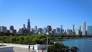
WThe Great Lakes Megalopolis consists of the group of metropolitan areas in North America largely in the Great Lakes region and along the Saint Lawrence River. It extends from the Midwestern United States in the south and west to western Pennsylvania and Western New York in the east and northward through Southern Ontario into southwestern Quebec in Canada. It is the most populated and largest megalopolis in North America.
 W
WThe Gulf Coast of the United States is the coastline along the Southern United States where they meet the Gulf of Mexico. The coastal states that have a shoreline on the Gulf of Mexico are Texas, Louisiana, Mississippi, Alabama, and Florida, and these are known as the Gulf States.
 W
WThe Northeast megalopolis is the most populous megalopolis located entirely in the United States, with over 50 million residents, as well as the most urbanized megalopolis in the United States and the megalopolis with the world's largest economic output. Located primarily on the Atlantic Coast in the Northeastern United States, with its lower terminus in the upper Southeast, it runs primarily northeast to southwest from the northern suburbs of Boston to the Northern Virginia suburbs of Washington, D.C. It includes the major cities of Boston, Providence, Hartford, New Haven, New York City, Newark, Philadelphia, Baltimore, and Washington, D.C., along with their metropolitan areas and suburbs. It is sometimes defined to include smaller urban agglomerations beyond this, such as Richmond and Norfolk, Virginia, to the south, Portland, Maine, to the north, and Harrisburg, Pennsylvania, to the west.
 W
WThe Piedmont Atlantic Megaregion (PAM) is a neologism created by the Regional Plan Association for an area of the Southeastern United States that includes the Atlanta, Birmingham, Charlotte, Memphis, Nashville, Research Triangle (Raleigh-Durham), and Greensboro-Winston-Salem-High Point metropolitan areas. The megaregion generally follows the Interstate 85/20 corridor. According to Georgia Tech, PAM represents over 12 percent of the total United States population and covers over 243,000 square miles (630,000 km2) of land.
 W
WThe Southern Rocky Mountain Front is a megaregion of the United States, otherwise known as a megalopolis, with population centers consisting mainly of the Front Range Urban Corridor and the Albuquerque–Santa Fe–Las Vegas combined statistical area, located along the eastern and southern face of the Southern Rocky Mountains in the U.S. states of Wyoming, Colorado, and New Mexico. The region comprises the southern portion of the Rocky Mountain Front geographic region of Canada and the United States, extending into the Southwestern United States. The Southern Rocky Mountain Front had a population of 5,467,633 according to the 2010 United States Census. The region is one of the fastest growing regions in the United States and its population is projected to grow by 87% to 10,222,370 by 2050. In 2005 the GDP of the region was $229,202,000,000 making up 2% of the United States GDP.
 W
WThe Texas Triangle is a region of Texas which contains the state's five largest cities and is home to the majority of the state's population. The Texas Triangle is formed by the state's four main urban centers, Houston, Dallas–Fort Worth, San Antonio and Austin, connected by Interstate 45, Interstate 10, and Interstate 35. In 2020, the population of the Texas Triangle reached nearly 21 million following rapid growth across much of Texas. The Texas Triangle is one of eleven megaregions in the United States, clusters of urban areas which share economic and cultural ties.