 W
WTyphoon Angela, known in the Philippines as Typhoon Rosing, was a catastrophic Category 5 typhoon with 180 mph (290 km/h) sustained winds. Typhoon Angela was the third storm in a row that struck the Philippines, following Yvette and Zack. Typhoon Angela was the twenty-ninth tropical cyclone, and the fifth super typhoon of the moderately active 1995 Pacific typhoon season.
 W
WTyphoon Bopha, known in the Philippines as Typhoon Pablo, was the strongest tropical cyclone on record to ever affect the southern Filipino island of Mindanao, making landfall as a Category 5 super typhoon with winds of 175 mph (280 km/h). The twenty-fourth tropical storm, along with being the fourth and final super typhoon of the 2012 Pacific Typhoon season, Bopha originated unusually close to the equator, becoming the second-most southerly Category 5 super typhoon, reaching a minimum latitude of 7.4°N on December 3, 2012, as only Typhoon Louise-Marge of 1964 came closer to the equator at this strength, at 7.3°N. After first landfalling in Palau, where it destroyed houses, disrupted communications and caused power outages, flooding and uprooted trees, Bopha made landfall late on December 3 on Mindanao, an island that had been devastated by the much weaker Tropical Storm Washi in December 2011. The storm caused widespread destruction on Mindanao, leaving thousands of people homeless and killing 1901 people.
 W
WTyphoon Chataan, known in the Philippines as Typhoon Gloria, was the deadliest natural disaster in the history of Chuuk, a state in the Federated States of Micronesia (FSM). The typhoon formed on June 28, 2002, near the FSM, and for several days it meandered while producing heavy rainfall across the region. On Chuuk, the highest 24-hour precipitation total was 506 mm (19.9 in), which was greater than the average monthly total. The rain produced floods up to 1.5 m (4.9 ft) deep, causing landslides across the island that killed 47 people. There was also one death on nearby Pohnpei, and damage in the FSM totaled over $100 million.
 W
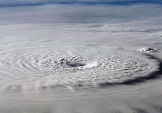
WThe effects of Typhoon Bopha in the Federated States of Micronesia and Palau were significant, though limited in extent in comparison to the cyclone's intensity. Typhoon Bopha originated from a tropical depression south of Pohnpei on November 25, 2012, and tracked generally westward for more than a week. During this time, it threatened several islands across Micronesia, prompting the issuance of typhoon watches and warnings. The system skirted the Nomoi Islands on November 28 where it caused limited damage. Thereafter, it became a threat to Palau as an intense typhoon. Residents there boarded up their homes and some evacuated to public shelters while officials enacted a strict curfew during the typhoon's passage. Bopha passed 55 km (35 mi) south of Angaur island, or 100 km (65 mi) south of Babeldaob, on December 2 with winds of 185 km/h (115 mph).
 W
WTyphoon Hagupit, known in the Philippines as Typhoon Ruby, was the second most intense tropical cyclone in 2014. Hagupit particularly impacted the Philippines in early December while gradually weakening, killing 18 people and causing $114 million in the country. Prior to making landfall, Hagupit was considered the worst threat to the Philippines in 2014, but it was significantly smaller than 2013's Typhoon Haiyan.
 W
WTyphoon Haiyan, known in the Philippines as Super Typhoon Yolanda, was one of the most powerful tropical cyclones ever recorded. On making landfall, Haiyan devastated portions of Southeast Asia, particularly the Philippines. It is one of the deadliest Philippine typhoons on record, killing at least 6,300 people in that country alone. In terms of JTWC-estimated 1-minute sustained winds, Haiyan is tied with Meranti in 2016 for being the second strongest landfalling tropical cyclone on record. In January 2014, bodies were still being found.
 W
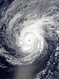
WTyphoon Lupit, known in the Philippines as Typhoon Yoyoy, destroyed the food supply in several small islands in Yap State in the Federated States of Micronesia (FSM). It formed on November 18, 2003, from the monsoon trough to the west of the Marshall Islands. Early in its duration, it moved generally to the west or west-southwest. On November 21, the depression intensified into Tropical Storm Lupit, the 21st storm named by the Japan Meteorological Agency of the 2003 Pacific typhoon season. Two days later, it strengthened into a typhoon and developed an eye. Lupit later began a prolonged movement to the northwest, during which it passed near several islands in Yap State. The typhoon reached peak intensity on November 26, with peak 10‑minute sustained winds of 185 km/h (115 mph). It later weakened due to increasing wind shear and drier air, and after recurving to the northeast, Lupit became extratropical south of Japan on December 2.
 W
WTyphoon Maysak, known in the Philippines as Typhoon Chedeng, was the most powerful pre-April tropical cyclone on record in the Northwestern Pacific Ocean. The fourth named storm of the 2015 Pacific typhoon season, Maysak originated as a tropical depression on March 26. The next day, the Japan Meteorological Agency (JMA) upgraded the depression to a tropical storm and assigned it the name Maysak. According to the JMA, Maysak became the second typhoon of the year on March 28. The typhoon explosively intensified into a Category 5 super typhoon on March 31, passing near the islands of Chuuk and Yap in the Federated States of Micronesia. After maintaining that intensity for 18 hours, Maysak weakened, made landfall over the Philippine island of Luzon as a minimal tropical storm, and dissipated shortly afterwards.
 W
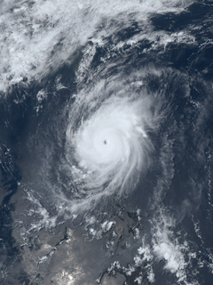
WTyphoon Mitag, known in the Philippines as Typhoon Basyang, was the first super typhoon on record in the month of March. The second storm of the 2002 Pacific typhoon season, Mitag developed from a trough near the equator on February 25 near the Federated States of Micronesia (FSM). It moved westward through the archipelago and intensified into a typhoon before passing near Yap on March 2. High winds and heavy rainfall affected the state, resulting in an islandwide power outage and destroying hundreds of houses. Mitag caused severe crop damage that resulted in food shortages. The rainfall and storm surge flooded much of the coastline as well as Yap's capital, Colonia. Damage totaled $150 million, mostly from crop damage. There was one death related to the storm's aftermath.
 W
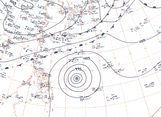
WTyphoon Noul, known in the Philippines as Typhoon Dodong, was a relatively small but powerful tropical cyclone that affected several areas but caused minor damage. The sixth named storm and third typhoon of the annual typhoon season, Noul formed as a tropical depression over the eastern Caroline Islands on May 2, 2015. It moved generally to the west and west-northwest, gradually intensifying into a tropical storm and later typhoon. On May 9, Noul began rapid deepening as it developed a well-defined eye. Early the next day, the Japan Meteorological Agency (JMA) estimated peak 10 minute sustained winds of 205 km/h (125 mph), while the American-based Joint Typhoon Warning Center (JTWC) estimated peak 1 minute winds of 260 km/h (160 mph), equivalent to Category 5 on the Saffir–Simpson hurricane wind scale. Noul struck northeastern Luzon in the Philippines at that intensity and greatly weakened. After passing east of Taiwan, the typhoon accelerated to the northeast and weakened due to unfavorable conditions. On May 12, Noul became extratropical south of Japan, and the remnants continued to the northeast for several days, dissipating on May 16.
 W
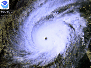
WTyphoon Ophelia was a long-lived and powerful tropical cyclone that had devastating impacts on the small atoll of Ulithi in the Caroline Islands. Forming as a tropical depression on November 21, 1960 near Enewetak Atoll, the incipient cyclone struggled to develop. Moving haphazardly along an s-shaped track over the western Pacific Ocean, it degenerated into a disturbance two days later. By November 27, the system reorganized and was classified a tropical depression for a second time well to the southeast of Guam. Moving slowly west-southwest, it steadily intensified into a tropical storm later that day and further into a typhoon on November 29 as it gained a steady westward track. The following day, the eye of Ophelia passed directly over Ulithi atoll with winds estimated at 230 km/h (145 mph).
 W
WTyphoon Paka, known in the Philippines as Typhoon Rubing, was the last tropical cyclone of the 1997 Pacific hurricane and typhoon season, and was among the strongest Pacific typhoons in the month of December. Paka, which is the Hawaiian name for Pat, developed on November 28 from a trough well to the southwest of Hawaii. The storm tracked generally westward for much of its duration, and on December 7 it crossed into the western Pacific Ocean. Much of its track was characterized by fluctuations in intensity, and on December 10 the cyclone attained typhoon status as it crossed the Marshall Islands. On December 16, Paka struck Guam and Rota with winds of 230 km/h (145 mph), and it strengthened further to reach peak winds on December 18 over open waters as the final super typhoon of the year. Subsequently, it underwent a steady weakening trend, and on December 23 Paka dissipated.
 W
WTyphoon Pamela was a powerful typhoon that struck the U.S. territory of Guam in May 1976, causing about $500 million in damage (USD). The sixth named storm and third typhoon of the 1976 Pacific typhoon season, Pamela developed on May 14 from a trough in the Federated States of Micronesia in the area of the Nomoi Islands. It executed a counterclockwise loop and slowly intensified, bringing heavy rains to the islands in the region. Ten people died on Chuuk due to a landslide. After beginning a steady northwest motion toward Guam, Pamela attained its peak winds of 240 km/h (150 mph).
 W
WTyphoon Sudal, known in the Philippines as Typhoon Cosme, was the strongest typhoon to strike the island of Yap in the Federated States of Micronesia (FSM) in about 50 years. Yap is one of the four administrative divisions of the FSM. The entire island, only 17 km (11 mi) in length, experienced typhoon force winds, and 90% of the structures were damaged or destroyed. Damage was most severe in southeastern Yap, where the eyewall struck and winds exceeded 185 km/h (115 mph), but the center of the typhoon passed south of the island.
 W
WSuper Typhoon Yuri was the most intense tropical cyclone in 1991 In terms of minimum central pressure. The nineteenth typhoon and final super typhoon of the 1991 Pacific typhoon season, Yuri was a tropical disturbance that strengthened into a tropical depression on November 22 in the Philippine Sea. Moving rather slowly at first, the system continued to intensify, and was given the name Yuri. It had become a severe tropical storm about 1,480 kilometers east of Truk Island and took on a west-northwestward track at 22 km/h. Typhoon intensity was attained that night when Yuri was 1,050 km. Yuri turned more to the west on 26 November and reached peak intensity the following morning packing winds of over 220 km/h near its centre. Moving northwestwards at 30 km/h, Yuri passed 140 km to the south-southwest of Guam on the evening of November 27. After recurving November 29, Yuri accelerated northeastwards on November 30 and weakened to a severe tropical storm that night. By the morning of December 1, it had degenerated into a tropical storm about a few hundred kilometers east-northeast of Iwo Jima. Extratropical transition was completed soon afterward, and the storm's remnants persisted until December 3.