 W
WThe 1970 Bhola cyclone was a devastating tropical cyclone that struck East Pakistan and India's West Bengal on November 11, 1970. It remains the deadliest tropical cyclone ever recorded and one of the world's deadliest natural disasters. At least 500,000 people lost their lives in the storm, primarily as a result of the storm surge that flooded much of the low-lying islands of the Ganges Delta. Bhola was the sixth and strongest cyclonic storm of the 1970 North Indian Ocean cyclone season.
 W
WThe 1994 Bangladesh cyclone was a powerful and tropical cyclone in the Bay of Bengal. The cyclone closely followed the path, strength, and time of year of a deadly cyclone in 1991 that killed more than 138,000 people. The 1994 cyclone formed on April 29 as a depression, which organized and intensified significantly over the subsequent few days. On May 2, the cyclone attained winds of 215 km/h (130 mph), according to the India Meteorological Department (IMD). That day, the storm made landfall in southeastern Bangladesh, and rapidly weakened over land, before dissipating on May 3.
 W
WThe 1998 Gujarat cyclone was a deadly tropical cyclone that killed at least 10,000 people in India.
 W
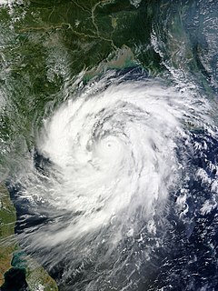
WThe 1999 Pakistan cyclone was a deadly tropical cyclone that brought further devastation to a region struck by a powerful storm nearly a year earlier.
 W
WExtremely Severe Cyclonic Storm BOB 05 was the strongest, most intense tropical cyclone of the fairly-quiet 2000 North Indian Ocean cyclone season. The fifth cyclone, and the fourth named storm, Extremely Severe Cyclonic Storm BOB 05 started as an upper-level low over the Andaman Sea on November 24. On early November 26, the group of thunderstorms was classified as a depression by the IMD. The system slowly began to organize, and late on November 26 the JTWC named it as Tropical Cyclone 03B. By November 28, a 20 km (12 mi) wide eye was developing, prompting the JTWC to upgrade the storm to the equivalent of a minimal hurricane with winds of 120 km/h (75 mph). By comparison, the IMD estimated peak winds of 190 km/h (115 mph). Wind shear in the region prevented further strengthening, and the storm weakened slightly before making landfall on November 29 in eastern India near Cuddalore. A station there recorded a pressure of 983 mbar (29.0 inHg). The storm rapidly weakened over land, and degenerated into a remnant low on November 30. The remnants emerged into the eastern Arabian Sea on December 1, by which time most thunderstorms had dissipated over the deteriorating center. Two days later, the JTWC reissued advisories, based on an increase in outflow and convective organization. This was short-lived, as the thunderstorms soon dwindled, and the JTWC ceased issuing advisories on December 5. The remnants continued westward without development toward eastern Somalia.
 W
WThe 2000 Sri Lanka cyclone was the strongest tropical cyclone to strike Sri Lanka since 1978 Sri Lanka cyclone. The fourth tropical storm and the second severe cyclonic storm of the 2000 North Indian Ocean cyclone season, it developed from an area of disturbed weather on December 25, 2000. It moved westward, and quickly strengthened under favorable conditions to reach top wind speeds of 75 mph (120 km/h). The cyclone hit eastern Sri Lanka at peak strength, then weakened slightly while crossing the island before making landfall over southern India on December 28. The storm degenerated into a remnant low later that day, before merging with another trough on the next day.
 W
WThe 2001 India cyclone was the third strongest tropical cyclone, in terms of barometric pressure, to form in the Arabian Sea on record; only Cyclones Gonu in 2007 and Kyarr in 2019 were stronger. The storm originated from a tropical disturbance that formed east of Somalia on May 18. Over the following few days, the system gradually organized into a tropical depression. Tracking eastward, towards the coastline of southwestern India, the storm slowly intensified. Shortly before reaching shore, the system turned north and later west, away from land. After taking this turn, the storm intensified into a very severe cyclonic storm, attaining its peak intensity on May 24 with winds of 215 km/h and a barometric pressure of 932 mbar (hPa). At the time, this ranked the cyclone as the strongest known storm in the Arabian Sea.
 W
WThe 2004 Myanmar cyclone was considered the worst to strike the country since 1968. The second tropical cyclone of the 2004 North Indian Ocean cyclone season, it formed as a depression on May 16 in the central Bay of Bengal. With low wind shear and a surge in the monsoon trough, the storm intensified while meandering over open waters. The storm eventually began a steady northeastward motion due to a ridge to the north over India. While approaching land, an eye developed in the center of the storm, indicative of a strong cyclone. On May 19, the cyclone made landfall along northwestern Myanmar near Sittwe, with maximum sustained winds estimated at 165 km/h (105 mph) by the India Meteorological Department. The storm rapidly weakened over land, although its remnants spread rainfall into northern Thailand and Yunnan province in China.
 W
WExtremely Severe Cyclonic Storm Chapala was a powerful tropical cyclone that caused moderate damage in Somalia and Yemen during November 2015. Chapala was the third named storm of the 2015 North Indian Ocean cyclone season. It developed as a depression on 28 October off western India, and strengthened a day later into a cyclonic storm. Chapala then rapidly intensified amid favorable conditions. On 30 October, the India Meteorological Department (IMD) estimated that Chapala attained peak three-minute sustained winds of 215 km/h (130 mph). The American-based Joint Typhoon Warning Center (JTWC) estimated sustained winds of 240 km/h (150 mph), making Chapala among the strongest cyclones on record in the Arabian Sea. After peak intensity, Chapala skirted the Yemeni island of Socotra on 1 November, becoming the first hurricane-force storm there since 1922. High winds and heavy rainfall resulted in an island-wide power outage, and severe damage was compounded by Cyclone Megh, which struck Yemen a week later.
 W
WExtremely Severe Cyclonic Storm Fani was the strongest tropical cyclone to strike the Indian state of Odisha since the 1999 Odisha cyclone. The second named storm and the first severe cyclonic storm of the 2019 North Indian Ocean cyclone season, Fani originated from a tropical depression that formed west of Sumatra in the Indian Ocean on 26 April. Vertical wind shear at first hindered the storm's development, but conditions became more favorable for Fani on 30 April. Fani rapidly intensified into an extremely severe cyclonic storm and reached its peak intensity on 2 May, with 1-minute sustained winds equivalent to a Category 5 major hurricane. Fani weakened before making its landfall, and its convective structure rapidly degraded thereafter, degenerating into a remnant low on 4 May, and dissipating on the next day.
 W
WCyclone Forrest, also referred to as Tropical Storm Forrest, was a powerful tropical cyclone that prompted the evacuation of 600,000 people in Bangladesh in late November 1992. Originating from an area of disturbed weather near the Caroline Islands on November 9, Forrest was classified as a tropical depression three days later over the South China Sea. Tracking generally west, the system steadily organized into a tropical storm, passing Vietnam to the south, before striking Thailand along the Malay Peninsula on November 15. Once over the Bay of Bengal, Forrest turned northward on November 17 and significantly intensified. It reached its peak intensity on November 20 as a Category 4-equivalent cyclone on the Saffir–Simpson hurricane scale with winds of 230 km/h (145 mph). Hostile environmental conditions soon affected the cyclone as it turned abruptly east-northeastward. Forrest made landfall in northwestern Myanmar as a weakening system on November 21 before dissipating early the next day.
 W
WExtremely Severe Cyclonic Storm Giri was a powerful tropical cyclone which caused catastrophic damage in parts of Myanmar in late October 2010. Originating from an area of low pressure over the Bay of Bengal on October 19, the system began as a weak depression 250 km (155 mi) south of Myanmar. Over the following few days, the depression underwent explosive intensification, reaching its peak intensity with winds of 195 km/h on October 22. Cyclone Giri made landfall roughly 50 km (31 mi) northwest of Kyaukpyu, shortly after peaking. Within hours of moving onshore, the system had substantially weakened. By the following day, Giri had degenerated into a tropical depression and the final advisory was issued on the storm.
 W
WExtremely Severe Cyclonic Storm Hudhud was a strong tropical cyclone that caused extensive damage and loss of life in eastern India and Nepal during October 2014. Hudhud originated from a low pressure system that formed under the influence of an upper-air cyclonic circulation in the Andaman Sea on October 6. Hudhud intensified into a cyclonic storm on October 8 and as a Severe Cyclonic Storm on October 9. Hudhud underwent rapid deepening in the following days and was classified as a Very Severe Cyclonic Storm by the IMD. Shortly before landfall near Visakhapatnam, Andhra Pradesh, on October 12, Hudhud reached its peak strength with three-minute wind speeds of 185 km/h (115 mph) and a minimum central pressure of 960 mbar (28.35 inHg). The system then drifted northwards towards Uttar Pradesh and Nepal, causing widespread rains in both areas and heavy snowfall in the latter.
WBehind super cyclonic storms, extremely severe cyclonic storms are the second-highest classification on the India Meteorological Department (IMD)'s intensity scale. There have been 31 of them since reliable records began in 1960. The most recent extremely severe cyclonic storm was Cyclone Maha in the 2019 North Indian Ocean cyclone season.
 W
WExtremely Severe Cyclonic Storm Mala was the strongest tropical cyclone of the 2006 North Indian Ocean cyclone season. In mid-April 2006, an area of disturbed weather formed over the southern Bay of Bengal and nearby Andaman Sea. Over a period of several days, the system became increasingly organized and was classified as a depression on April 24. Situated within a region of weak steering currents, the storm slowly intensified as it drifted in a general northward direction. It attained gale-force winds and was named Mala the next day. Conditions for strengthening improved markedly on April 27 and Mala subsequently underwent rapid intensification which culminated in the cyclone attaining its peak. Early on April 28, the cyclone had estimated winds of 185 km/h (115 mph). The Joint Typhoon Warning Center considered Mala to have been slightly stronger, classifying it as a Category 4-equivalent cyclone. Steady weakening ensued thereafter and the storm made landfall in Myanmar's Rakhine State on April 29. Rapid dissipation took place once onshore and Mala was last noted early the next morning.
 W
WThe May 1997 Bangladesh cyclone was a powerful storm that caused widespread damage and loss of life throughout Bangladesh. Originating from a near-equatorial trough on May 15, 1997, the cyclone tracked in a general northward direction throughout its existence. The system gradually intensified over the following days, reaching the equivalent of a Category 1 hurricane on the Saffir-Simpson Hurricane Scale by May 17. The following day, the storm attained its peak intensity with winds of 215 km/h (135 mph) according to the JTWC and 165 km/h (105 mph) according to the IMD along with a barometric pressure of 964 mbar. On May 19, the cyclone made landfall near Chittagong, Bangladesh before rapidly dissipating the next day.
 W
WExtremely Severe Cyclonic Storm Megh is regarded as the worst tropical cyclone to ever strike the Yemeni island of Socotra, causing additional destruction there after Cyclone Chapala hit the same island. Megh formed on November 5, 2015, in the eastern Arabian Sea, and followed a path similar to Chapala. After moving northward, the cyclone turned to the west, and fueled by warm water temperatures, it quickly intensified. On November 7, the storm developed an eye in the center and began to rapidly intensify into a mature cyclone. By the next day, the India Meteorological Department estimated peak 3 minute sustained winds of 175 km/h (110 mph), and the American-based Joint Typhoon Warning Center estimated 1 minute winds of 205 km/h (125 mph). Shortly thereafter, the cyclone brushed the northern coast of Socotra. The storm steadily weakened thereafter, especially after it skirted the northern Somalia coast. After entering the Gulf of Aden, Megh turned to the west-northwest and struck southwestern Yemen on 10 November as a deep depression, dissipating shortly thereafter.
 W
WExtremely Severe Cyclonic Storm Mekunu was the strongest storm to strike Oman's Dhofar Governorate since 1959. The second named storm of the 2018 North Indian Ocean cyclone season, Mekunu developed out of a low pressure area on May 21. It gradually intensified, passing east of Socotra on May 23 as a very intense tropical cyclone. On May 25, Mekunu reached its peak intensity. The India Meteorological Department estimated 10 minute sustained winds of 175 km/h (110 mph), making Mekunu an extremely severe cyclonic storm. The American-based Joint Typhoon Warning Center estimated slightly higher 1 minute winds of 185 km/h (115 mph). While at peak intensity, Mekunu made landfall near Raysut, Oman, on May 25. The storm rapidly weakened over land, dissipating on May 27.
 W
WExtremely Severe Cyclonic Storm Nargis was an extremely destructive and deadly tropical cyclone that caused the worst natural disaster in the recorded history of Myanmar during early May 2008. The cyclone made landfall in Myanmar on Friday, 2 May 2008, sending a storm surge 40 kilometres up the densely populated Irrawaddy delta, causing catastrophic destruction and at least 138,373 fatalities. The Labutta Township alone was reported to have 80,000 dead, with about 10,000 more deaths in Bogale. There were around 55,000 people missing and many other deaths were found in other towns and areas, although the Myanmar government's official death toll may have been under-reported, and there have been allegations that government officials stopped updating the death toll after 138,000 to minimise political fallout. The feared 'second wave' of fatalities from disease and lack of relief efforts never materialised. Damage was at $12 billion, making Nargis the costliest tropical cyclone on record in the North Indian Ocean at the time, before that record was broken by Cyclone Amphan in 2020.
 W
WExtremely Severe Cyclonic Storm Nilofar was, at the time, the third-strongest cyclone in the Arabian Sea. In late October 2014, it reached peak maximum sustained winds estimated between 205 km/h (125 mph) and 215 km/h (130 mph). The India Meteorological Department (IMD) named it Nilofar; the name refers to the water lily, and was suggested by Pakistan. The western fringes of the storm caused flash flooding in northeastern Oman, killing four people.
 W
WExtremely Severe Cyclonic Storm Phailin was the most intense tropical cyclone to make landfall in India since the 1999 Odisha cyclone. The system was first noted as a tropical depression on October 4, 2013 within the Gulf of Thailand, to the west of Phnom Penh in Cambodia. Over the next few days, it moved westwards within an area of low to moderate vertical wind shear, before as it passed over the Malay Peninsula, it moved out of the Western Pacific Basin on October 6. It emerged into the Andaman Sea during the next day and moved west-northwest into an improving environment for further development before the system was named Phailin on October 9, after it had developed into a cyclonic storm and passed over the Andaman and Nicobar Islands into the Bay of Bengal.
 W
WExtremely Severe Cyclonic Storm Sidr was a tropical cyclone that resulted in one of the worst natural disasters in Bangladesh. The fourth named storm of the 2007 North Indian Ocean cyclone season, Sidr formed in the central Bay of Bengal, and quickly strengthened to reach peak 1-minute sustained winds of 260 km/h (160 mph), making it a Category-5 equivalent tropical cyclone on the Saffir-Simpson Scale. The storm eventually made landfall in Bangladesh on November 15, 2007, causing large-scale evacuations. At least 3,447 deaths have been blamed on the storm, with some estimates reaching 15,000.