 W
WA tornado is a violently rotating column of air that is in contact with both the surface of the Earth and a cumulonimbus cloud or, in rare cases, the base of a cumulus cloud. The windstorm is often referred to as a twister, whirlwind or cyclone, although the word cyclone is used in meteorology to name a weather system with a low-pressure area in the center around which, from an observer looking down toward the surface of the earth, winds blow counterclockwise in the Northern Hemisphere and clockwise in the Southern. Tornadoes come in many shapes and sizes, and they are often visible in the form of a condensation funnel originating from the base of a cumulonimbus cloud, with a cloud of rotating debris and dust beneath it. Most tornadoes have wind speeds less than 110 miles per hour (180 km/h), are about 250 feet (80 m) across, and travel a few miles before dissipating. The most extreme tornadoes can attain wind speeds of more than 300 miles per hour (480 km/h), are more than two miles (3 km) in diameter, and stay on the ground for dozens of miles.
 W
WAn anticyclonic tornado is a tornado which rotates in a clockwise direction in the Northern Hemisphere and a counterclockwise direction in the Southern Hemisphere. The term is a naming convention denoting the anomaly from normal rotation which is cyclonic in upwards of 98 percent of tornadoes. Many anticyclonic tornadoes are smaller and weaker than cyclonic tornadoes, forming from a different process, as either companion/satellite tornadoes or nonmesocyclonic tornadoes.
 W
WA funnel cloud is a funnel-shaped cloud of condensed water droplets, associated with a rotating column of wind and extending from the base of a cloud but not reaching the ground or a water surface. A funnel cloud is usually visible as a cone-shaped or needle like protuberance from the main cloud base. Funnel clouds form most frequently in association with supercell thunderstorms, and are the precursor to tornadoes. Funnel clouds are visual phenomena, these are not the vortex of wind itself.
 W
WA gustnado is a brief, shallow surface-based vortex which forms within the downburst emanating from a thunderstorm. The name is a portmanteau by elision of "gust front tornado", as gustnadoes form due to non-tornadic straight-line wind features in the downdraft (outflow), specifically within the gust front of strong thunderstorms. Gustnadoes tend to be noticed when the vortices loft sufficient debris or form condensation cloud to be visible although it is the wind that makes the gustnado, similarly to tornadoes. As these eddies very rarely connect from the surface to the cloud base, they are very rarely considered as tornadoes. The gustnado has little in common with tornadoes structurally or dynamically in regard to vertical development, intensity, longevity, or formative process—as classic tornadoes are associated with mesocyclones within the inflow (updraft) of the storm, not the outflow.
 W
WA hook echo is a pendant or hook-shaped weather radar signature as part of some supercell thunderstorms. It is found in the lower portions of a storm as air and precipitation flow into a mesocyclone, resulting in a curved feature of reflectivity. The echo is produced by rain, hail, or even debris being wrapped around the supercell. It is one of the classic hallmarks of tornado-producing supercells. The National Weather Service may consider the presence of a hook echo coinciding with a tornado vortex signature as sufficient to justify issuing a tornado warning.
 W
WLandspout is a term created by atmospheric scientist Howard B. Bluestein in 1985 for a kind of tornado not associated with a mesocyclone. The Glossary of Meteorology defines a landspout as"Colloquial expression describing tornadoes occurring with a parent cloud in its growth stage and with its vorticity originating in the boundary layer. The parent cloud does not contain a preexisting mid-level mesocyclone. The landspout was so named because it looks like "a weak Florida Keys waterspout over land."
 W
WA multiple-vortex tornado is a tornado that contains several vortices revolving around, inside of, and as part of the main vortex. The only times multiple vortices may be visible are when the tornado is first forming or when condensation and debris are balanced such that subvortices are apparent without being obscured. They can add over 100 mph to the ground-relative wind in a tornado circulation and are responsible for most cases where narrow arcs of extreme destruction lie right next to weak damage within tornado paths.
The National Wind Institute (NWI) at Texas Tech University (TTU) was established in December 2012, and is intended to serve as Texas Tech University’s intellectual hub for interdisciplinary and transdisciplinary research, commercialization and education related to wind science, wind energy, wind engineering and wind hazard mitigation and serves faculty affiliates, students, and external partners.
 W
WA power flash is a flash of light caused by arcing electrical discharges from damaged electrical equipment, most often severed power lines. They are often caused by strong winds, especially those from tropical cyclones and tornadoes, and occasionally by intense downbursts and derechoes. Storm spotters and meteorologists use these flashes to spot tornadoes which would otherwise be invisible due to rain or darkness. They can be distinguished from lightning by the fact that they originate at ground level, the blue color of the flash, and depending on distance, the sound of high-voltage lines shorting out.
 W
WThe radius of maximum wind (RMW) is the distance between the center of a cyclone and its band of strongest winds. It is a parameter in atmospheric dynamics and tropical cyclone forecasting. The highest rainfall rates occur near the RMW of tropical cyclones. The extent of a cyclone's storm surge and its maximum potential intensity can be determined using the RMW. As maximum sustained winds increase, the RMW decreases. Recently, RMW has been used in descriptions of tornadoes. When designing buildings to prevent against failure from atmospheric pressure change, RMW can be used in the calculations.
 W
WA satellite tornado is a tornado that revolves around a larger, primary tornado and interacts with the same mesocyclone. Satellite tornadoes occur apart from the primary tornado and are not considered subvortices; the primary tornado and satellite tornadoes are considered to be separate tornadoes. The cause of satellite tornadoes is not known. Such tornadoes are more often anticyclonic than are typical tornadoes and these pairs may be referred to as tornado couplets. Satellite tornadoes most commonly form in association with very large and intense tornadoes.
 W
WStorm Data and Unusual Weather Phenomena (SD) is a monthly NOAA publication with comprehensive listings and detailed summaries of severe weather occurrences in the United States. Included is information on tornadoes, high wind events, hail, lightning, floods and flash floods, tropical cyclones (hurricanes), ice storms, snow, extreme temperatures such as heat waves and cold waves, droughts, and wildfires. Photographs of weather and attendant damage are used as much as possible. Maps of significant weather are also included.
 W
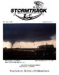
WStorm Track was the first magazine for and about storm chasing. The magazine was in circulation between 1977 and 2002.
 W
WTornado Alley is a loosely defined area of the central United States where tornadoes are most frequent. The term was first used in 1952 as the title of a research project to study severe weather in areas of Texas, Louisiana, Oklahoma, Kansas, South Dakota, Iowa and Nebraska. Tornado climatologists distinguish peaks in activity in certain areas and storm chasers have long recognized the Great Plains tornado belt.
 W
WTornadoes have been recorded on all continents except Antarctica and are most common in the middle latitudes where conditions are often favorable for convective storm development. The United States has the most tornadoes of any country, as well as the strongest and most violent tornadoes. A large portion of these tornadoes form in an area of the central United States popularly known as Tornado Alley. Canada experiences the second most tornadoes. Ontario and the prairie provinces see the highest frequency, particularly with southward extent. Other areas of the world that have frequent tornadoes include significant portions of Europe, South Africa, Philippines, Bangladesh, parts of Argentina, Uruguay, and southern and southeast Brazil, northern Mexico, New Zealand, and far eastern Asia.
 W
WA tornadic debris signature (TDS), often colloquially referred to as a debris ball, is an area of high reflectivity on weather radar caused by debris lofting into the air, usually associated with a tornado. A TDS may also be indicated by dual-polarization radar products, designated as a polarimetric tornado debris signature (PTDS). Polarimetric radar can discern meteorological and nonmeteorological hydrometeors and the co-location of a PTDS with the enhanced reflectivity of a debris ball are used by meteorologists as confirmation that a tornado is occurring.
 W
WA tornado family is a series of tornadoes spawned by the same supercell thunderstorm. These families form a line of successive or parallel tornado paths and can cover a short span or a vast distance. Tornado families are sometimes mistaken as a single continuous tornado, especially prior to the 1970s. Sometimes the tornado tracks can overlap and expert analysis is necessary to determine whether or not damage was created by a family or a single tornado. In some cases, such as the Hesston-Goessel, Kansas tornadoes of March 1990, different tornadoes of a tornado family merge, making discerning whether an event was continuous or not more difficult.
 W
WTornado intensity can be measured by in situ or remote sensing measurements, but since these are impractical for wide-scale use, intensity is usually inferred by proxies, such as damage. The Fujita scale and the Enhanced Fujita scale rate tornadoes by the damage caused. The Enhanced Fujita scale was an upgrade to the older Fujita scale, with engineered wind estimates and better damage descriptions, but was designed so that a tornado rated on the Fujita scale would receive the same numerical rating. An EF0 tornado will probably damage trees and peel some shingles off the roof. An EF5 tornado can rip well-anchored homes off their foundations, leaving them bare, and can even deform large skyscrapers. The similar TORRO scale ranges from a T0 for extremely weak tornadoes to T11 for the most powerful known tornadoes. Doppler radar data, photogrammetry, and ground swirl patterns may also be analyzed to determine intensity and assign a rating.
 W
WThe Tornado Intercept Vehicle 1 and Tornado Intercept Vehicle 2 are vehicles used to film with an IMAX camera from very close to or within a tornado. They were designed by film director Sean Casey. On May 27, 2013, the TIV2 filmed the inside of a tornado in Kansas with Casey inside.
 W
WTornado myths are incorrect beliefs about tornadoes, which can be attributed to many factors, including stories and news reports told by people unfamiliar with tornadoes, sensationalism by news media, and the presentation of incorrect information in popular entertainment. Common myths cover various aspects of the tornado, and include ideas about tornado safety, the minimization of tornado damage, and false assumptions about the size, shape, power, and path of the tornado itself.
 W
WThis article lists various tornado records. The most "extreme" tornado in recorded history was the Tri-State Tornado, which spread through parts of Missouri, Illinois, and Indiana on March 18, 1925. It is considered an F5 on the Fujita Scale, even though tornadoes were not ranked on any scale at the time. It holds records for longest path length at 219 miles (352 km), longest duration at about 3½ hours, and fastest forward speed for a significant tornado at 73 mph (117 km/h) anywhere on Earth. In addition, it is the deadliest single tornado in United States history with 695 fatalities. It was also the third-costliest tornado in history at the time, but has been surpassed by several others non-normalized. When costs are normalized for wealth and inflation, it still ranks third today.
 W
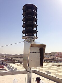
WA civil defense siren is a siren used to provide an emergency population warning to the general population of approaching danger. It is sometimes sounded again to indicate the danger has passed. Some sirens are also used to call the volunteer fire department when needed. Initially designed to warn city dwellers of air raids in World War II, they were later used to warn of nuclear attack and natural destructive weather patterns such as tornadoes. The generalized nature of sirens led to many of them being replaced with more specific warnings, such as the broadcast-based Emergency Alert System and the Cell Broadcast-based Wireless Emergency Alerts and EU-Alert mobile technologies.
WA tornado warning is an alert issued by national weather forecasting agencies to warn the public that severe thunderstorms with tornadoes are imminent or occurring. It can be issued after a tornado, funnel cloud and rotation in the clouds has been spotted by the public, storm chasers, emergency management or law enforcement.
 W
WA tornado watch is an alert issued by national weather forecasting agencies when weather conditions are favorable for the development of severe thunderstorms that are capable of producing tornadoes. A tornado watch therefore implies that it is also a severe thunderstorm watch. A tornado watch must not be confused with a tornado warning. In most cases, the potential exists for large hail and/or damaging winds in addition to tornadoes.
 W
WTornadogenesis is the process by which a tornado forms. There are many types of tornadoes and these vary in methods of formation. Despite ongoing scientific study and high-profile research projects such as VORTEX, tornadogenesis is a volatile process and the intricacies of many of the mechanisms of tornado formation are still poorly understood.
 W
WTWISTEX was a tornado research experiment that was founded and led by Tim Samaras of Bennett, Colorado, US. The experiment announced in 2015 that there were some plans for future operations, but no additional information has been announced since.
 W
WThe Verification of the Origins of Rotation in Tornadoes Experiment or VORTEX are field experiments that study tornadoes. VORTEX1 was the first time scientists completely researched the entire evolution of a tornado with an array of instrumentation, enabling a greater understanding of the processes involved with tornadogenesis. A violent tornado near Union City, Oklahoma was documented in its entirety by chasers of the Tornado Intercept Project (TIP) in 1973 and visual observations led to advancement in understanding of tornado structure and life cycles. VORTEX2 utilized enhanced technology allowing scientists to improve forecasting capabilities to improve advanced warnings to residents. VORTEX2 sought to elucidate how tornadoes form, how long they last and why they last that long, and what causes them to dissipate.
 W
WA waterspout is an intense columnar vortex that occurs over a body of water. Some are connected to a cumulus congestus cloud, some to a cumuliform cloud and some to a cumulonimbus cloud. In the common form, it is a non-supercell tornado over water.
 W
W