 W
WSpatial analysis or spatial statistics includes any of the formal techniques which studies entities using their topological, geometric, or geographic properties. Spatial analysis includes a variety of techniques, many still in their early development, using different analytic approaches and applied in fields as diverse as astronomy, with its studies of the placement of galaxies in the cosmos, to chip fabrication engineering, with its use of "place and route" algorithms to build complex wiring structures. In a more restricted sense, spatial analysis is the technique applied to structures at the human scale, most notably in the analysis of geographic data.
 W
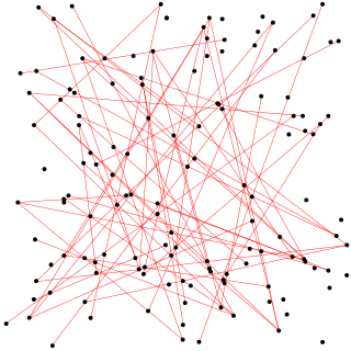
WAlignments of random points in a plane can be demonstrated by statistics to be counter-intuitively easy to find when a large number of random points are marked on a bounded flat surface. This has been put forward as a demonstration that ley lines and other similar mysterious alignments believed by some to be phenomena of deep significance might exist solely due to chance alone, as opposed to the supernatural or anthropological explanations put forward by their proponents. The topic has also been studied in the fields of computer vision and astronomy.
 W
WA correlation function is a function that gives the statistical correlation between random variables, contingent on the spatial or temporal distance between those variables. If one considers the correlation function between random variables representing the same quantity measured at two different points, then this is often referred to as an autocorrelation function, which is made up of autocorrelations. Correlation functions of different random variables are sometimes called cross-correlation functions to emphasize that different variables are being considered and because they are made up of cross-correlations.
 W
WCrimeStat is a crime mapping software program. CrimeStat is Windows-based program that conducts spatial and statistical analysis and is designed to interface with a geographic information system (GIS). The program is developed by Ned Levine & Associates under the direction of Ned Levine, with funding by the National Institute of Justice (NIJ), an agency of the United States Department of Justice. The program and manual are distributed for free by NIJ.
 W
WThe modifiable areal unit problem (MAUP) is a source of statistical bias that can significantly impact the results of statistical hypothesis tests. MAUP affects results when point-based measures of spatial phenomena are aggregated into districts, for example, population density or illness rates. The resulting summary values are influenced by both the shape and scale of the aggregation unit.
 W
WIn statistics, Moran's I is a measure of spatial autocorrelation developed by Patrick Alfred Pierce Moran. Spatial autocorrelation is characterized by a correlation in a signal among nearby locations in space. Spatial autocorrelation is more complex than one-dimensional autocorrelation because spatial correlation is multi-dimensional and multi-directional.
 W
WPrimary Care Service Areas are geographic areas that are self-sufficient markets of primary care. These areas are designed in a manner such that the majority of patients living in these areas use primary care services form within the area. This ensures that any geographic targeting of policies and resources reach the patients they are meant for. These geographies have been created in Australia, United States and Switzerland using big data and Geographic information systems. In Australia, while they have been developed for the state of New South Wales, they have not found application among policymakers, where, as of 2016 much larger geographies called Primary Health Networks are used for primary care management. However, they have found an especially wide audience amongst policymakers and researchers in the United States, where they were first developed. Thus for example the Health Resources and Services Administration uses them to designate areas of workforce shortage. Primary Care Service Areas are thus for example an appropriate geography for measuring primary care physician supply or geographic access to General practitioners.