 W
WThe Upper Harz Ditches are hillside ditches, running roughly parallel to the contour lines, that were laid out in the Upper Harz in Germany from the 16th to the 19th centuries to supply water power to the silver mines there. They are an important component of the Upper Harz Water Regale, a historical water system that is now a cultural monument.
 W
WThe Upper Harz Water Regale is a system of dams, reservoirs, ditches and other structures, much of which was built from the 16th to 19th centuries to divert and store the water that drove the water wheels of the mines in the Upper Harz region of Germany. The term regale, here, refers to the granting of royal privileges or rights in this case to permit the use of water for mining operations in the Harz mountains of Germany.
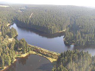
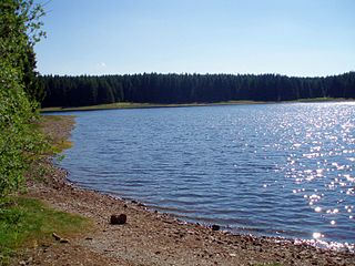
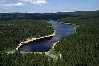
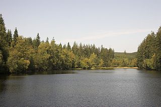
WThe Upper Harz Ponds are found mainly around the mining town of Clausthal-Zellerfeld and the nearby villages of Buntenbock and Hahnenklee in the Upper Harz mountains of central Germany. There are around 70 ponds in total, both large and small. They were built by the miners of the Upper Harz, mostly between the 16th and 18th centuries, and are important components of the cultural monument known as the Upper Harz Water Regale - a network of dams, ditches, ponds and tunnels that was built to supply much-needed water power for the mining industry in the Harz mountains. Today the Water Regale is being proposed as a UNESCO World Heritage Site. About half the dammed ponds are classified today as reservoirs, but they have now become characteristic features of the Upper Harz and are home to some extremely rare plant and animal species.
 W
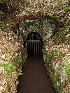
WThe Upper Harz Water Tunnels are part of the Upper Harz Water Regale - a network of reservoirs, ditches, tunnels and other structures in the Harz mountains of central Germany. The German term Wasserlauf refers to the underground element of the network of watercourses used in the historic silver mining industry of the Upper Harz. This network of ditches and tunnels was used to supply the mines with headrace waters for their water wheels from the 16th century onwards. In the system of the Upper Harz Water Regale there are over 35 such tunnels with a total length of about 30 km.
 W
WThe Bärenbrucher Teich is an historic reservoir in the Harz Mountains of central Germany. It lies east of Buntenbock near Clausthal-Zellerfeld.
 W
WThe Dyke Ditch is the longest artificial ditch in the Upper Harz in central Germany. Its purpose was to collect surface runoff for the operation of the Upper Harz mining industry from precipitation-heavy regions a long way away. It was laid in 1732 and continually extended eastwards until 1827. Its original length was about 25 km; this was successively shortened by water tunnels between 1820 and 1861 to around 19 km. It is a central component of the Upper Harz Water Regale. Its takes its name from the Sperberhai Dyke which is, in fact, an embankment on top of which the Dyke Ditch runs in an aqueduct in order to cross a depression.
 W
WThe Huttaler Widerwaage is a small reservoir that is a part of the Upper Harz Water Regale, an old mining water management system in the Harz Mountains of Germany that is now a UNESCO World Heritage Site. The reservoir lies east of the mining town of Clausthal-Zellerfeld. It is designed to feed water from the Huttal river during times of low water to the reservoir pond of the Hirschler Teich and, during times of high water, to handle the overflow of water from it.
 W
WThe Jägersbleeker Teich in the Harz Mountains of central Germany is a storage pond near the town of Clausthal-Zellerfeld in the county of Goslar in Lower Saxony. It is one of the Upper Harz Ponds that were created for the mining industry.
 W
WThe Lower Grumbach Pond, usually just Grumbach Pond, is an old mining reservoir or Kunstteich between Hahnenklee and Wildemann in the Upper Harz mountains in Germany
 W
WThe Rammelsberg is a mountain, 635 metres (2,083 ft) high, on the northern edge of the Harz range, south of the historic town of Goslar in the North German state of Lower Saxony. The mountain is the location of an important silver, copper, and lead mine, the only mine which had been working continuously for over 1,000 years when it finally closed in 1988. Since 1992, the visitor mine of Rammelsberg has become a UNESCO World heritage site.
 W
WThe Oderteich is an historic reservoir about seven kilometres northeast of Sankt Andreasberg in the Upper Harz in central Germany. It was built by miners from St. Andreasberg in the years 1715 to 1722 and, today, is an important component of the water supply network known as the Upper Harz Water Regale. Moreover, for 170 years, from the time it was completed to the end of the 19th century, the Oderteich had the largest dam in Germany. The dam lies at a height of 725 m above NN by the B 242 federal highway, about a kilometre west of its intersection with the B 4.
 W
WThe Polsterberg Pumphouse is a pumping station above the Dyke Ditch in the Upper Harz in central Germany which is used today as a forest restaurant.
WThe Rammelsberg is a mountain, 635 metres (2,083 ft) high, on the northern edge of the Harz range, south of the historic town of Goslar in the North German state of Lower Saxony. The mountain is the location of an important silver, copper, and lead mine, the only mine which had been working continuously for over 1,000 years when it finally closed in 1988. Since 1992, the visitor mine of Rammelsberg has become a UNESCO World heritage site.
 W
WThe Sieberstollen is an adit for water drainage in Sankt Andreasberg, in the Harz mountains. It was created during mining in the Upper Harz and named after the river Sieber into which it discharges its water. The opening position is in the Sieber Valley.
 W
WThe Silberteich is a man-made reservoir, of a type called a Kunstteich, and lies on the upper reaches of the Brunnenbach stream between Braunlage and Sankt Andreasberg in the Harz Mountains of Germany. It was built as part of the historic Upper Harz Water Regale.
 W
WThe Sperberhai Dyke is in fact an aqueduct which forms part of the Upper Harz Water Regale network of reservoirs, ditches, dams and tunnels in the Harz mountains of central Germany. It carries the water of the Dyke Ditch over the depression of the Sperberhai to the Clausthal plateau.