 W
WAgua Caliente in Maricopa County, Arizona on the border with Yuma County, is a place north of the Gila River near Hyder, Arizona. Named 'Santa Maria del Agua Caliente' in 1744 by Father Jacob Sedelmayer. In 1775, Father Francisco Garces used the current short form. The location was the site of a resort established at the site of nearby hot springs. Agua Caliente, a name derived from Spanish meaning "hot water", received its name from nearby hot springs which were originally used by the local Indians.
 W
WAntelope Peak Station, a later Butterfield Overland Mail station located 15.14 miles east of Mission Camp, at the foot of Antelope Peak. It replaced Filibusters Camp Station, 6 miles to the west. The Overland Mail Company replaced Filibusters Camp, because Antelope Peak Station had a better water supply. Its location is thought to be 32°42′47.17″N 114°00′54.3″W.
 W
WApache Pass, also known by its earlier Spanish name Puerto del Dado, is a historic mountain pass in the U.S. state of Arizona between the Dos Cabezas Mountains and Chiricahua Mountains at an elevation of 5,110 feet (1,560 m). It is approximately 20 miles (32 km) east-southeast of Willcox, Arizona, in Cochise County.
WBurke's Station was a stagecoach station on the Butterfield Overland Mail route in Arizona. It was named in 1858 after Patrick Burke, the first proprietor of the station. It was temporarily closed when the Butterfield line shut down during 1861 due to the American Civil War. Burke's was located 9.43 miles from Grinnels Ranch approximately halfway over the difficult route to Oatman Flat. It was afterward purchased by King Woolsey. Later revived as a stagecoach station in 1866, it was purchased by William Fourr who also sold flour and groceries there and acquired a dairy herd. Then in 1869, Fourr sold Burkes Station and it continued as a stage station until the Southern Pacific Railroad arrived in Arizona, making it obsolete. After closure as a stage station, the name was changed to 'Burkes Ranch' and by 1900 to 'Alpha' (AZ-T101).
 W
WCasa Blanca is a census-designated place (CDP) in Pinal County, Arizona, United States, located in the Gila River Indian Community. The population was 1,388 at the 2010 census.
WDesert Station is a historic locale, the site of a later station of the Butterfield Overland Mail, in what is now Maricopa County, Arizona.
WDome is a ghost town located in Yuma County, in southwestern Arizona, United States. Originally Swiveler's Station, 20 miles (32 km) east of Fort Yuma on the Butterfield Overland Mail route, a post office was established here in 1858. It was first under the name of Gila City, the nearby boomtown one and a half miles (2.4 km) west of Swiveler's, but the post office closed July 14, 1863, after most of the town was swept away in the Great Flood of 1862, and then abandoned for the La Paz gold rush along the Colorado River. After the railroad passed by the site and an attempt at large scale mining of the placers began, a new post office was established as Dome in 1892 but soon closed when the attempt failed. Subsequently it opened and closed several times before finally closing in 1940.
WDragoon Springs is an historic site in what is now Cochise County, Arizona, at an elevation of 4,925 feet (1,501 m). The name comes from a nearby natural spring, Dragoon Spring, to the south in the Dragoon Mountains at 5,148 feet (1,569 m). The name originates from the 3rd U.S. Cavalry Dragoons who battled the Chiricahua, including Cochise, during the Apache Wars. The Dragoons established posts around 1856 after the Gadsden Purchase made the area a U.S. territory.
WFilibuster Camp is the historic locale of a camp along the Gila River route of the Southern Emigrant Trail in Yuma County, Arizona, named in memory of a failed filibuster (military) expedition to Sonora that began there in 1856.
 W
WGila Bend, founded in 1872, is a town in Maricopa County, Arizona, United States. The town is named for an approximately 90-degree bend in the Gila River, which is near the community's current location. According to the 2010 census, the population of the town is 1,922.
WGila City is a ghost town in Yuma County in the U.S. state of Arizona. The town was settled in 1858 in what was then the New Mexico Territory.
WGriswell's or Griswell's Station was a stagecoach station of the Butterfield Overland Mail located along the Gila River in Arizona. It was located 12 miles east of Peterman's Station and 15 miles west of Flap Jack Ranch Station.
 W
WMarana is a town in Pima County, Arizona, located northwest of Tucson, with a small portion in Pinal County. According to the 2010 census, the population of the town is 34,961. From 1990 to 2000, Marana was the fourth fastest-growing place among all cities and towns in Arizona of any size.
 W
WMaricopa Wells is a former place (locale) situated in Pinal County, Arizona. It has an estimated elevation of 1,093 feet (333 m) above sea level. Historically, it was an oasis around a series of watering holes in the Sierra Estrella, eight miles north of present-day Maricopa, Arizona, and about a mile west of Pima Butte. It developed as a trading center and stopping place for travelers in the mid to late 19th century.
 W
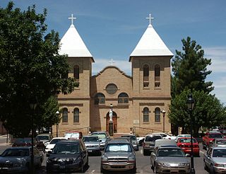
WMesilla is a town in Doña Ana County, New Mexico, United States. The population was 2,196 at the 2010 census. It is part of the Las Cruces Metropolitan Statistical Area.
WMission Camp is a historic locale, site of a later Butterfield Overland Mail stagecoach station, located about four and a half miles (7.2 km) west of Wellton on the south bank of the Gila River, in Yuma County, Arizona. It was located 11.49 miles (18.49 km) miles east of Gila City, Arizona, 4.51 miles (7.26 km) west of the original Butterfield stage station at Filibusters Camp, and 15.14 miles (24.37 km) west of Antelope Peak Station, a later station that with Mission Camp Station replaced Filibusters Camp Station.
WMurderer's Grave Station is a historic locale, later called Kinyon Station and Kenyon Station was a stagecoach station of the Butterfield Overland Mail located along the Gila River in Arizona. The site was located 20 miles east of Oatmans Flat Station and 15 miles west of Gila Ranch Station. It was located along the Gila River near the present site of the Painted Rock Reservoir
WOatman Flat Station, later Fourr's Stage Station, was a stagecoach station of the Butterfield Overland Mail located along the Gila River in Maricopa County, Arizona. The site was located 20 miles (32 km) east of Flap-Jack Ranch and 20 miles (32 km) west of Murderer's Grave Station, near the Gila River at Oatman Flat. It is to the east of the Oatman Grave, where the family of Olive Oatman was buried following their massacre on the Southern Emigrant Trail by Yavapai in 1851.
WPeterman's Station is a historic locale, site of a ranch and stage station located along the Gila River. It was first established by a man named Peterman, in 1857 along the route of the San Antonio-San Diego Mail Line, later a station of its successor, the Butterfield Overland Mail, 19 miles east of Fillibuster Camp, 12 miles west of Griswell's Station.
 W
WPicacho is an unincorporated community and census-designated place in Pinal County, Arizona, United States. The population was 471 at the 2010 census.
 W
WSan Simon is a census-designated place in Cochise County, Arizona, United States. As of the 2010 census it had a population of 165. San Simon is located along Interstate 10 40 miles (64 km) east of Willcox. The community has a ZIP code of 85632.
 W
W'Soldiers Farewell Stage Station was a stagecoach stop of the 1858-1861 Butterfield Overland Mail route before the company moved to the central route. West of "Soldiers Farewell Hill" on the west bank of a drainage arroyo, the stop was on the Butterfield Overland Mail route (1858-1861) in Grant County, New Mexico. According to the Overland Mail Company Through Time Schedule, it was 150 miles west of El Paso, Texas and 184½ miles east of Tucson, Arizona. Located 42 miles east of Stein's Peak Station and 14 miles southwest of Ojo de Vaca Station.
WTexas Hill Station is a site of a later Butterfield Overland Mail stagecoach station. It was one of several built in 1859 to increase the number of water stops and team changes along the drier and hotter sections of the route and was located about 2 miles east of Texas Hill.