 W
WThe Bluff Point Stoneworks are a prehistoric structure located in the town of Jerusalem, New York, at the crux of Keuka Lake in the Finger Lakes region of western New York State. Though they were studied many times throughout the 20th century, the structure has been mostly destroyed, and it is still uncertain who built the structure.
 W
WCrooked Lake Outlet Historic District is a national historic district located near Penn Yan in Yates County, New York. The district is located along a seven-mile recreational trail that parallels the Keuka Lake Outlet. The district includes several mill sites along the gorge. It also includes nine areas that contain surface and subsurface archaeological remains.
 W
WFall Street–Trinity Lane Historic District is a national historic district located at Seneca Falls in Seneca County, New York. The district includes the archaeological remains of 19th century industrial structures located on three islands in the Seneca River. Also included are the limestone Trinity Church (1886) and its associated parish house (1916) and the red brick "The Armitage" historic home built about 1850. Other structures include the board and batten "Cline's Barn" and a rectangular 1920s bandstand.
 W
WThe Finger Lakes National Forest is a United States National Forest that encompasses 16,259 acres (65.80 km2) of Seneca and Schuyler counties, nestled between Seneca Lake and Cayuga Lake in the Finger Lakes Region of the State of New York. It has over 30 miles (50 km) of interconnecting trails that traverse gorges, ravines, pastures, and woodlands.
 W
WForest Home Historic District is a national historic district located at Forest Home in Tompkins County, New York. The district consists of 66 contributing buildings, four contributing sites, and two contributing sites. The historic building stock consists primarily of one- to two-story frame dwellings on relatively small, irregularly shaped lots.
 W
WFort Brewerton is a historic fort site located at Brewerton in Oswego County, New York. It is the site of a fort that originally was in the form of an eight-pointed star with sixteen 30-foot (9.1 m) faces surrounded by a 10-foot (3.0 m) moat. The 480-foot-long (150 m) parapet had earth walls 5 feet (1.5 m) high from which projected log palisades. Within the parapet were four log blockhouses, smaller buildings for munitions and supplies, and wells. It was erected in 1759 to defend the passage from Albany to the port of Oswego.
 W
WFort Corchaug Archeological Site is a prehistoric archaeological site in Cutchogue on eastern Long Island in New York State. It is located west of the North Fork Country Club, on the south side of Main Road. The site shows evidence of 17th century contact between Native Americans and Europeans. Fort Corchaug itself was a log fort built by Native Americans. It may have been to protect the Corchaug tribe from other Indians, built with the help of Europeans. Ralph Solecki, a prominent American archaeologist, grew up nearby and conducted several digs on site.
 W
WThe Fort de La Présentation, a mission fort, was built in 1749 and so named by the French Sulpician priest, Abbé Picquet. It was also sometimes known as Fort La Galette. It was built at the confluence of the Oswegatchie River and the St Lawrence River in present-day New York. The French wanted to strengthen their alliance with the powerful Iroquois, as well as convert them to Catholicism. With increasing tensions with Great Britain, they were concerned about their thinly populated Canadian colony. By 1755 the settlement included 3,000 Iroquois residents loyal to France, in part because of the fur trade, as well as their hostility to encroachment by British colonists in their other territories. By comparison, Montréal had only 4,000 residents.
 W
WFort Massapeag Archeological Site is a historic archaeological site at Sunset Park in Massapequa, New York. It is believed to be the site of a New Netherland trading post built in the mid-17th century to facilitate trade with local Native Americans, and possibly serve as a wampum factory. It was first excavated in the 1930s by a team including Ralph Solecki. It was declared a National Historic Landmark in 1993.
WFort Orange was the first permanent Dutch settlement in New Netherland; the present-day city of Albany, New York developed at this site. It was built in 1624 as a replacement for Fort Nassau, which had been built on nearby Castle Island and served as a trading post until 1617 or 1618, when it was abandoned due to frequent flooding. Both forts were named in honor of the Dutch House of Orange-Nassau. Due to a dispute between the Director-General of New Netherland and the patroonship of Rensselaerswyck regarding jurisdiction over the fort and the surrounding community, the fort and community became an independent municipality, paving the way for the future city of Albany. After the English reconquered the region they soon abandoned Fort Orange in favor of a new fort: Fort Frederick, constructed in 1676.
 W
WFort Salonga, also known as NYSDHP Unique Site No. A103-08-0036, is an archeological site in the vicinity of Fort Salonga, New York that was listed on the National Register of Historic Places in 1982.
 W
WGanondagan State Historic Site, also known as Boughton Hill, is a Native American historic site in Ontario County, New York in the United States. Location of the largest Seneca village of the 17th century, the site is in the present-day Town of Victor, southwest of the Village of Victor. The village was also referred to in various spellings as Gannagaro, Canagora, Gandagora, and Gandagaro.
 W
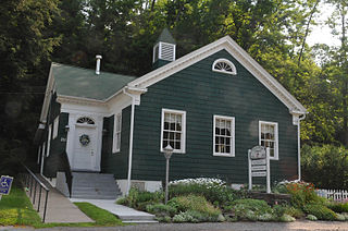
WThe German Reformed Sanctity Church Parsonage, also known as the First Reformed Church Parsonage, is located on Maple Avenue in Germantown, New York, United States. It is a wood, brick and stone building dating to the mid-18th century, the oldest building in the town of Germantown. In 1976 it was listed on the National Register of Historic Places.
 W
WNicoll Halsey House and Halseyville Archeological Sites is a national historic district and archaeological site located at Halseyville in Tompkins County, New York.
 W
WThe Hiscock Site is an archaeological and paleobiological site in Byron, Western New York, United States that has yielded many mastodon and paleo-Indian artifacts, as well as the remains of flora and fauna not previously known to have inhabited Western New York during the late Pleistocene. Now owned by the Buffalo Museum of Science, it has been studied by archeological excavation and analysis since 1983.
 W
WHoman-Gerard House and Mills is a historic home and mill complex located at Yaphank in Suffolk County, New York. It is composed of a large Federal-style residence, four contributing related support buildings, and six contributing related archaeological sites. The house is a 2 1⁄2-story frame residence with a three-bay facade, gambrel roof, center chimney, and kitchen wing. Also on the property are three small sheds and a large 2-story, late-19th-century barn. Archaeological remains include that of the J. P. Mills Store and Homan-Gerard saw mill and grist mill.
 W
WLower Landing Archeological District is a historic archeological site located at Lewiston in Niagara County, New York. The district comprises the area that served as the western end of the portage for goods around Niagara Falls. It is located on east bank of the Niagara River.
 W
WMohawk Upper Castle Historic District is a historic district in Herkimer County, New York that was declared a National Historic Landmark in 1993. Located south of the Mohawk River, it includes the Indian Castle Church, built in 1769 by Sir William Johnson, British Superintendent of Indian Affairs, as a missionary church for the Mohawk in the western part of their territory; the Brant Family Barn, a rare surviving example of Dutch colonial barns in the Mohawk Valley; as well as important archaeological site areas revealing life in Nowadaga, as the western part of the Mohawk village of Canajoharie was known. The fortified village was called the Upper Castle by European colonists.
 W
WMount Sinai is a hamlet and census-designated place (CDP) located within the Town of Brookhaven in Suffolk County, New York, United States. The population was 12,118 at the 2010 census. The hamlet is located on the North Shore of Long Island, and is served by the Mount Sinai School District and the Mount Sinai Fire Department, founded on October 25, 1930. The Mount Sinai Fire District covers approximately 5.5 square miles including the Mount Sinai Harbor and parts of the Long Island Sound. Mount Sinai's ZIP code is 11766.
 W
WThe Boston Post Road Historic District is a 286-acre (116 ha) National Historic Landmark District in Rye, New York, and is composed of five distinct and adjacent properties. Within this landmarked area are three architecturally significant, pre-Civil War mansions and their grounds; a 10,000-year-old Paleo-Indian site and viewshed; a private cemetery, and a nature preserve. It is one of only 11 National Historic Landmark Districts in New York State and the only National Historic Landmark District in Westchester County. It touches on the south side of the nation's oldest road, the Boston Post Road, which extends through Rye. A sandstone Westchester Turnpike marker "24", inspired by Benjamin Franklin's original mile marker system, is set into a wall that denotes the perimeter of three of the contributing properties. The district reaches to Milton Harbor of Long Island Sound. Two of the properties included in the National Park designation are anchored by Greek Revival buildings; the third property is dominated by a Gothic Revival structure that was designed by Alexander Jackson Davis.
 W
WThe Peale's Barber Farm Mastodon Exhumation Site, near Montgomery, New York, is the site of an 1801 exhumation of a mastodon which became "the world's first fully articulated prehistoric skeleton". The exhumation was led by artist/scientist Charles Willson Peale.
WRogers Island is an island on the Hudson River, in Washington County, New York, that once formed part of the third largest "city" in colonial North America, and is considered the "spiritual home" of the United States Special Operations Forces, particularly the United States Army Rangers.
 W
WThe former Saratoga Gas, Electric Light and Power Company Complex is located near the northern boundary of Saratoga Springs, New York, United States. It is a seven-acre parcel with two brick buildings on it. In the 1880s it became the thriving resort city's first power station.
 W
WSchuyler Flatts is an important prehistoric and historic settlement site overlooking the Hudson River in Colonie, New York. The site includes evidence of prehistoric Native American, early Dutch colonial settlement, and 18th and 19th-century American use. Because of this rich confluence of archaeological sites, the area was designated a National Historic Landmark in 1993. It is now owned by the town of Colonie, and is known as Schuyler Flatts Cultural Park.
 W
WTotiakton was a town of the Seneca Nation located in the present-day town of Mendon, New York. It is located "on the northernmost bend of Honeoye outlet" two miles from the current village of Honeoye Falls. The Seneca name for the town was De-yu-di-haak-doh, meaning “the bend," because of its location at a bend of Honeoye Creek. The archaeological remains of the site are listed on the National Register of Historic Places.
 W
WTown Doctors' House and Site is a historic home located at Southold in Suffolk County, New York. The house was built about 1720, and expanded in about 1880, 1930, and 2002–2003. The house is a 2 1⁄2-story, northern-Colonial–style building with a cross-gabled roof and central chimney. The site includes Bilberry Swamp, where the earliest Euro-American occupation occurred around 1664. There is evidence on the site of pre-17th-century occupation by Native Americans.
 W
WThe Trapps Mountain Hamlet Historic District is located on the Shawangunk Ridge in Gardiner, New York, United States. It is a large area that covers the site of a settlement that thrived there from the late 18th to mid-20th centuries. Inhabitants practiced subsistence farming, making it one of the rare such communities in the East to have left any trace remaining. They supplemented that with a variety of other trades, primarily in the forest products industry, with most inhabitants gradually coming to work at nearby mountain resorts in the 20th century. The last resident died in 1956.
WTyrone is a town in Schuyler County, New York, United States. The population was 1,714 at the 2000 census.
WWest Stockholm Historic District is a national historic district located in the town of Stockholm in St. Lawrence County, New York. The district includes 27 contributing buildings and three contributing sites. The district encompasses the archaeological sites of mills and small factories as well as the cluster of extant residences, shops, and public buildings which comprises the village center. The buildings were built between 1815 and about 1900.