 W
WThe practice of preserving the battlefields of the American Civil War for historical and memorial reasons has been developed over more than 150 years in the United States. Even during the American Civil War active duty soldiers on both sides of the conflict began erecting impromptu battlefield monuments to their recently fallen comrades. Since these initial attempts at preservation and commemoration, important Civil War battle sites have been preserved by various groups and many are now in the care of the National Park Service and overseen by the American Battlefield Protection Program (ABPP). Of approximately 10,500 acts of aggression that occurred between the United States and the Confederacy 384 have been identified in a 1993 federal report as being principle to the conflict. From these a select few have been chosen based on their historical significance, accessibility, and preservability to be federally curated. Beyond sites run by the U.S. Federal government many secondary battle sites across the United States are maintained and operated by state governments and private historical groups.
 W
WBattle of Athens State Historic Site is located in Clark County, Missouri, along the banks of the Des Moines River. It is the site of the Battle of Athens. The historic site and open-air museum interpret the battle and its aftermath. It is one of the northernmost places in the state.
 W
WAverasboro Battlefield Historic District is a national historic district located near Erwin, Harnett County, North Carolina. It encompasses four contributing buildings, three contributing sites, three contributing structures, and one contributing object on the battlefield associated with the American Civil War Battle of Averasboro of March 15–16, 1865. They include the separately listed Oak Grove and Lebanon plantations, along with a Commemorative Marker (1872), Chicora Cemetery and over 4,000 acres of rural agricultural land.
 W
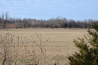
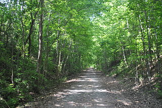
WThe Cane Hill Battlefield is a historic district encompassing the battlefield of the Battle of Cane Hill, fought during the American Civil War on November 28, 1862, in and around the site of present-day Cane Hill, Arkansas. Because the battle was a running battle that extended over many hours and 12 miles (19 km) of roads, the battlefield is more than 5,700 acres (2,300 ha) in size, extending in all directions around Cane Hill. The northern section of the battlefield is an agricultural area that is little-altered except for the introduction of new roadways and rural buildings, and the abandonment of old roadway alignments. The southern section is hillier and more wooded, and is altered in similar ways.
 W
WThe Skirmish at Cedar Creek, also known as Camp Mooney or McGirt's Creek, was a small engagement of the American Civil War fought in present-day Jacksonville, Florida on March 1, 1864. It was fought between a small Confederate States Army outpost and the 40th Massachusetts Volunteer Infantry of the Union Army, and resulted in 29 casualties. It was the last engagement in the Olustee Campaign.
 W
WCool Spring Battlefield is a historic American Civil War battlefield and national historic district located near Berryville, Clarke County, Virginia. It encompasses 17 contributing buildings, 26 contributing sites, and 11 contributing structures. The district includes the terrain and hydrography over which the Battle of Cool Spring, July 16–20, 1864, was fought and which served to shape the tactical progress of the engagement in time and space. The district also includes the archaeological and architectural remnants of plantations, farmsteads, transportation, mining, and industrial centers that were a part of the economically prosperous community over which the conflict was fought. Located in the district is the separately listed Wickliffe Church.
WThe First Battle of Newtonia Historic District, near Newtonia, Missouri, is a National Register of Historic Places (NRHP) site that preserves the location of the First Battle of Newtonia, an 1862 battle during the American Civil War. The battle saw Confederate troops under Colonels Douglas H. Cooper and Joseph O. Shelby defeat a Union force commanded by Brigadier General Frederick C. Salomon. The historic district contains some Civil War-period structures, as well as the Mathew H. Ritchey House, which is listed separately on the NRHP.
 W
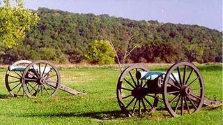
WFort McAllister State Park is a 1,725 acres (698 ha) Georgia state park located near Keller and Richmond Hill in south Bryan County, Georgia and on the south bank of the Ogeechee River. It is roughly ten miles south of Savannah. The park is home to Fort McAllister, the best-preserved earthwork fortification of the Confederacy. Though the earthworks were attacked unsuccessfully seven times by Union soldiers, it did not fall until it was taken by General Sherman in 1864 during his March to the Sea. The park, located on the coast, is nestled among giant live oaks and a large salt marsh. In addition, the park contains a museum specializing in Civil War artifacts. The fort was added to the National Register of Historic Places in 1970.
 W
WGathland State Park is a public recreation area and historic preserve located on South Mountain near Burkittsville, Maryland, in the United States. The state park occupies the former estate of war correspondent George Alfred Townsend (1841-1914), who wrote under the pen name "Gath" during the American Civil War. The estate's few remaining original structures include the War Correspondents Memorial Arch, which sits alongside the Appalachian Trail. The park is operated by the Maryland Department of Natural Resources. The arch is a National Historic Monument maintained by the National Park Service.
 W
WThe Glorieta Pass Battlefield was the site of an American Civil War battle that ended Confederate ambitions to cut off the West from the Union. The Battle of Glorieta Pass took place on March 26–28, 1862, at Glorieta Pass, on the Santa Fe Trail between the Pecos River and Santa Fe, New Mexico. The pass, and the battlefield, are now bisected by Interstate 25. Two portions of the battlefield, now publicly owned and operated by the National Park Service as part of Pecos National Historical Park, were declared a National Historic Landmark in 1961.
 W
WHistoric Blakeley State Park is a park located on the site of the former town of Blakeley in Baldwin County, Alabama on the Tensaw River delta. The park encompasses an area once occupied by settlers in what was a thriving community on the river. Later, Confederate soldiers were garrisoned here and fought in the last major battle of the U.S. Civil War against superior Union forces.
 W
WThe Mine Creek Battlefield State Historic Site, located 2.5 miles (4.0 km) southwest of Pleasanton in eastern Kansas, United States, commemorates the Battle of Mine Creek in the American Civil War. On October 25, 1864, approximately 2,800 Union troops attacked and defeated about 8,000 Confederates along the banks of Mine Creek. It was one of the largest cavalry battles in the Civil War, and the only major battle fought in Kansas. The Union brigades were commanded by Colonels Frederick W. Benteen and John Finis Philips. After this battle, Federal forces pursued and defeated additional Confederates in Missouri as they attempted to return to Arkansas, the Indian Territory (Oklahoma), and Texas.
 W
WNatural Bridge Battlefield State Historic Site is a Florida State Park in Leon County, Florida. It is located roughly between the city of Tallahassee and the town of St. Marks. During the American Civil War, the Battle of Natural Bridge was fought here on March 6, 1865. The site is named for a natural bridge over the St. Marks River. The Civil War Trust, a division of the American Battlefield Trust, and its partners have acquired and preserved 110 acres of the battlefield park.
 W
WNew Bern Battlefield Site is a historic site of the American Civil War Battle of New Bern located near New Bern, Craven County, North Carolina. The battle was fought on 14 March 1862. The New Bern Battlefield Site consists of two discontiguous sites.
 W
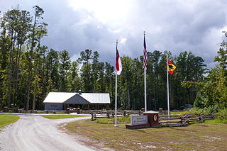
WOlustee Battlefield Historic State Park is a Florida State Park in the Osceola National Forest, near the town of Olustee. The site of Florida's largest Civil War battle, the Battle of Olustee. The park is located 50 miles (80 km) west of Jacksonville and 15 miles (24 km) east of Lake City, on U.S. 90. It also has the distinction of being the first park in the Florida State Park system.
 W
WThe Port Gibson Battlefield is the site near Port Gibson, Mississippi where the 1863 Battle of Port Gibson was fought during the American Civil War. The battlefield covers about 3,400 acres (1,400 ha) of land west of the city, astride Rodney Road, where Union Army forces were establishing a beachhead after crossing the Mississippi River in a bid to take the Confederate fortress of Vicksburg. The Union victory secured that beachhead and paved the way for the eventual fall of Vicksburg. A 2,080-acre (840 ha) area surrounding part of the site was listed on the National Register of Historic Places in 1972, and a larger area was designated a National Historic Landmark in 2005. In 2009, the battlefield was designated by the Civil War Preservation Trust as one of its Top 10 most endangered Civil War battlefields. In 2011, the Civil War Preservation Trust was renamed the Civil War Trust, which in 2018 became a division of the American Battlefield Trust. The Trust and its partners have acquired and preserved 644 acres (2.61 km2) of the Port Gibson battlefield.
 W
WThe Port Hudson State Historic Site is located on the Mississippi River north of Baton Rouge in East Feliciana Parish, Louisiana, just outside the limits of Port Hudson and in the vicinity of Jackson. The site preserves a portion of the fortifications and battle area of the longest siege in American history, during the American Civil War from May 23 through July 9, 1863. The state of Louisiana maintains the site, which includes a museum about the siege, artillery displays, redoubts, and interpretive plaques. Living history re-enactments are held each year. It was designated a National Historic Landmark in 1974, significant as the first place where African-American military units fought for the Union Army under African-American field leadership.
 W
WIn March 2006, the Civil War Preservation Trust (CWPT) - now the Civil War Trust - announced the beginning of a $12 million national campaign to preserve the historic Slaughter Pen Farm, a key part of the Fredericksburg battlefield. The 205-acre (0.83 km2) farm, known locally as the Pierson Tract, was the scene of bloody struggle on December 13, 1862. Over this ground Federal troops under Maj. Gen. George Meade and Brig. Gen. John Gibbon launched their assault against Lt. Gen. Thomas "Stonewall" Jackson's Confederates holding the southern portion of the Army of Northern Virginia's line at Fredericksburg. Despite suffering enormous casualties the Federal troops under Meade were able to temporarily penetrate the Confederate line and for a time represented the North's best chance of winning the Battle of Fredericksburg. The fighting on this southern portion of the battlefield, later named the Slaughter Pen, produced 5,000 casualties and five Medal of Honor winners.
WThe Second Battle of Newtonia Site is a battlefield listed on the National Register of Historic Places (NRHP) near Newtonia and Stark City in Missouri. In late 1864, Major General Sterling Price of the Confederate States Army began a raid into Missouri in hopes of diverting Union troops away from more important theaters of the American Civil War. After a defeat at the Battle of Westport on October 23, Price's Army of Missouri began retreating through Kansas, but suffered three consecutive defeats on October 25. By October 28, the retreating Confederates had reached Newtonia, where the Second Battle of Newtonia broke out when Union pursuers caught up with the Confederates. Confederate cavalry under Brigadier General Joseph O. Shelby was initially successful, but after Union reinforcements under Brigadier General John B. Sanborn counterattacked, the Confederates withdrew. The Union troops did not pursue, and Price's men escaped, eventually reaching Texas by December.
 W
WThe Sulphur Trestle Fort Site is a historic Civil War battle site near Elkmont, Alabama. The fort was the site of the Battle of Sulphur Creek Trestle on September 25, 1864. After defeating Union Army forces and recapturing Athens, Alabama, Confederate General Nathan Bedford Forrest moved north to attempt to destroy a key railroad trestle. The trestle was defended by a fortification manned by 1000 Union soldiers. Forrest's troops easily defeated the Union forces and burned the trestle. Today, about 400 yards of trenches dug around the outside of the fort's parapet remain. The site was listed on the National Register of Historic Places in 1973.
 W
WWilson's Creek National Battlefield, located near Republic, Missouri, preserves the site of the Battle of Wilson's Creek. Fought on August 10, 1861, the battle was the first major American Civil War engagement west of the Mississippi River. In the battle, a Confederate army commanded by Benjamin McCulloch and Sterling Price defeated a smaller Union army commanded by Nathaniel Lyon. However, the Confederates were unable to hold much of Missouri, and a Confederate defeat at the Battle of Pea Ridge effectively solidified Union control of the state. Major features include a five-mile automobile tour loop, the restored 1852 Ray House, and "Bloody Hill," the site of the final stage of the battle. The site is located near Republic in southwestern Missouri just southwest of the city of Springfield. It has been a unit of the National Park Service since 1960, and was listed on the National Register of Historic Places in 1966.