 W
WAlaungdaw Kathapa National Park is a national park in Myanmar covering 1,402.8 km2 (541.6 sq mi). It was established in 1989 and is listed as one of the ASEAN Heritage Parks. It spans an elevation of 135–1,335 m (443–4,380 ft) in the Kani and Mingin Townships in Sagaing Region.
 W
WChatthin Wildlife Sanctuary is a protected area in Myanmar's Sagaing Region that was established in 1941, stretching over an area of 260.07 km2 (100.41 sq mi). It is located in Kanbalu Township.
 W
WThe Gulf of Martaban or the Gulf of Mottama is an arm of the Andaman Sea in the southern part of Burma. The gulf is named after the port city of Mottama. The Sittaung, Salween and Yangon rivers empty into it.
WHkakaborazi National Park is a national park in northern Myanmar with an area of 3,812.46 km2 (1,472.00 sq mi). It was established in 1998. It surrounds Hkakabo Razi, the highest mountain in the country. It ranges in elevation from 900 to 5,710 metres comprising evergreen forest and mixed deciduous forests in Nogmung Township, Kachin State. It is managed by the Nature and Wildlife Conservation Division. It is contiguous with Bumhpa Bum Wildlife Sanctuary and Hukaung Valley Wildlife Sanctuary. These protected areas together with Hponkanrazi Wildlife Sanctuary comprise the largest continuous expanse of natural forest called the Northern Forest Complex stretching over an area of 30,105 km2 (11,624 sq mi). Its objective is to conserve the biodiversity of the Ayeyarwady and Chindwin river basins.
WHponkanrazi Wildlife Sanctuary is a protected area in northern Myanmar, stretching over an area of 2,703.95 km2 (1,044.00 sq mi). It was established in 2003. It encompasses riverine habitats, subtropical moist forest, temperate forest, deciduous forest and alpine forest. It is contiguous with Hkakaborazi National Park, Bumhpa Bum Wildlife Sanctuary and Hukaung Valley Wildlife Sanctuary. Together, they form a 30,269 km2 (11,687 sq mi) large protected area complex of natural forest called the Northern Forest Complex. It is managed by the Forest Department.
 W
WHtamanthi Wildlife Sanctuary is a 2,150.73 km2 (830.40 sq mi) large protected area in northern Myanmar. It was established in 1974 in the Sagaing Region.
 W
WHukaung Valley Wildlife Sanctuary is a protected area in northern Myanmar, covering 17,373.57 km2 (6,707.97 sq mi). It was established in 2004 and extended to its present size in 2010. It was initially gazetted in 2004 with an area of 6,371 km2 (2,460 sq mi) in Tanaing Township and extended to Kamaing, Nayun and Kamti Townships. In elevation, it ranges from 125 to 3,435 m in the Hukawng Valley located in Kachin State and Sagaing Region. It harbours evergreen and mixed deciduous forests.
 W
WIndawgyi Lake is one of the largest inland lakes in Southeast Asia. It is located in Mohnyin Township in the Kachin State of Myanmar. The lake measures 13 kilometres (8.1 mi) east to west, and 24 kilometres (15 mi) north to south. There are over 20 villages around the lake. The predominant ethnic groups living in the surroundings of the lake are the Shan and the Kachin, who mainly practise agriculture. It is 546 feet (166 m) above sea level. The lake is the main feature of the Indawgyi Lake Wildlife Sanctuary.
 W
WIndawgyi Lake Wildlife Sanctuary is a biosphere reserve in Myanmar, covering 814.99 km2 (314.67 sq mi). It ranges in elevation from 105–1,400 m (344–4,593 ft) encompassing the surroundings of Indawgyi Lake in Mohnyin Township, Kachin State. It was gazetted in 2004, is recognized as an Important Bird Area and as one of the ASEAN Heritage Parks. An area of 478.84 km2 (184.88 sq mi) comprising the lake and the surrounding lowland is a Ramsar site since February 2016.
 W
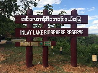
WInlay Lake Wetland Sanctuary is a protected area in Myanmar's Shan State, covering an area of 533.73 km2 (206.07 sq mi) surrounding Inle Lake. It ranges in elevation from 830 to 1,270 m, stretching over Nyaungshwe, Pinlaung and Pekon Townships. It was gazetted in 1985 to protect habitats for migratory birds. In 2003, it was designated as one of the ASEAN Heritage Parks, and in 2015 as the first Biosphere Reserve in the country.
 W
WThe Lampi Island Marine National Park is a marine national park in Myanmar covering 204.48 km2 (78.95 sq mi). It was established in 1996. It encompasses Lanbi Island and several smaller islands in the Mergui Archipelago, comprising coral reefs, seagrass beds, mangroves, sand dunes and tropical evergreen forest up to an elevation of 455 m (1,493 ft). The national park is an Important Bird Area and one of the ASEAN Heritage Parks. Access is restricted to day-time visits.
WLenya National Park is a proposed national park in Myanmar. It has been proposed since 2002 to be established in the Tenasserim Hills over an area of 1,761 km2 (680 sq mi) and extended by 1,399 km2 (540 sq mi) in 2004. The area comprises evergreen forest at elevations from 15 to 1,240 m, which is governed by Myanmar's Forest Department. By 2011, the national park was not yet gazetted and its boundaries still not demarcated.
WMahamyaing Wildlife Sanctuary is a protected area in Myanmar's Sagaing Region, covering an area of 1,181 km2 (456 sq mi). It ranges in elevation from 145 to 590 m and was established in 2002 in Kalay and Mawlaik Townships.
 W
WMeinmahla Kyun Wildlife Sanctuary is a protected area in Myanmar with an extent of 500 km2 (190 sq mi) and one of the ASEAN Heritage Parks. Meinmahla Kyun is an island in the Ayeyarwady Delta ranging in elevation from 0 to 30 m and covered by mangrove forest. It was declared a Ramsar site in 2017.
WMoeyungyi Wetland Wildlife Sanctuary is a protected area in Myanmar's Bago Division, covering an area of 103.6 km2 (40.0 sq mi). It was established in 1988 and gained the status of an Important Bird Area in 2003.
WNatmataung National Park is a national park in Myanmar covering 713.06 km2 (275.31 sq mi). It was established in 2010 and is listed as one of the ASEAN Heritage Parks. In elevation, it ranges from 740 to 3,070 m surrounding Nat Ma Taung in Mindat and Kanpetlet Townships, Chin State. It was designated an Important Bird Area in 2004.
 W
WShwesettaw Wildlife Sanctuary is a protected area in Myanmar, covering 464.09 km2 (179.19 sq mi). It was established in 1985. In elevation, it ranges from 55 to 555 m and harbours mixed deciduous forest in the Minbu, Pwintphyu, Saytotetaya and Ngape Townships in the Magway Region.
WTanintharyi National Park is a proposed national park in Myanmar's Tanintharyi Region that was supposed to cover an area of 2,072 km2 (800 sq mi) of mangrove and evergreen forests at an elevation from sea level to 1,490 m (4,890 ft). It was proposed in 2002. Wildlife species in this area include Asian elephant, sambar deer, Malayan tapir, Indian muntjac, and leopard.
 W
WTanintharyi Nature Reserve is a strict nature reserve in Myanmar's Tenasserim Hills, covering 1,699.99 km2 (656.37 sq mi). In elevation, it ranges from at an elevation of 20–130 m (66–427 ft). Most of the tropical rain forest is evergreen, interspersed with some grassland. The reserve provides habitat to Asian elephant and Gurney's pitta. It was gazetted in 2005 for the maintenance of natural resources, scientific research and education of local people in surrounding communities.