 W
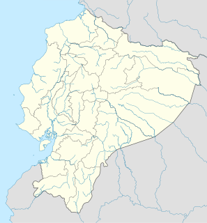
WThe Inca Empire, also known as the Incan Empire and the Inka Empire, was the largest empire in pre-Columbian America. The administrative, political and military center of the empire was in the city of Cusco. The Inca civilization arose from the Peruvian highlands sometime in the early 13th century. Its last stronghold was conquered by the Spanish in 1572.
 W
WAyahuasca is a South American entheogenic brew commonly made out of the Banisteriopsis caapi vine, and the Psychotria viridis shrub or a substitute, and possibly other ingredients; although, a chemically similar preparation also known and sold as ayahuasca, but occasionally also known as "pharmahuasca", can be prepared using illicitly manufactured N,N-Dimethyltryptamine (DMT) and a pharmaceutical monoamine oxidase inhibitor (MAOI) such as isocarboxazid. The brew is used as a traditional spiritual medicine in ceremonies among the indigenous peoples of the Amazon basin.
 W
WThe ceque system was a series of ritual pathways leading outward from Cusco into the rest of the Inca Empire. The empire was divided into four sections called suyus. In fact, the local name for the empire was "Tawantinsuyu," meaning "four parts together." Cusco, the capital, was the center and meeting point of these four sections, which converged at Qurikancha, the temple of the sun. Cusco was split in half, Hanansaya to the north and Hurinsaya to the south, with each half containing two of the four suyus. Hanansaya contained Chinchaysuyu in the northwest and Antisuyu in the northeast while Hurinsaya contained Qullasuyu in the southeast and Kuntisuyu in the southwest. Each region contained 9 lines, except for the Kuntisuyu, which had 14 or 15. Thus a total of 41 or 42 known pathways radiated out from the Qurikancha or sun temple in Cusco, leading to shrines or wak'as of religious and ceremonial significance.
 W
WCochasquí is the "most extensive and most important complex" of pre-Columbian and pre-Inca Empire ruins in northern Ecuador. The site lies some 30 kilometres (19 mi) in straight-line distance northeast of Quito in Pedro Moncayo Canton in Pichincha Province at 3,040 metres (9,970 ft) above sea level.
 W
WEl Quinche is a city of Ecuador, in the Pichincha Province, about 22 km (14 mi) in a straight line distance northeast of the city of Quito. The city, administratively a rural parish of the canton of Quito, is located in the valley of the headwaters of the Guayllabamba River, to the west of Pambamarca. It borders Cayambe Canton to the northeast.
 W
WHuánuco Pampa, Huánuco Marka or Huánuco Viejo, is an archaeological site in Peru in the Huánuco Region, Dos de Mayo Province, La Unión District. The site lies on a plain above the Urqumayu or Vizcarra River in the north central Andes. Wanuku Pampa is one of the many administrative centers which is built along the highland Inca highway between Cusco and Quito. The land administrated at least five, and perhaps many more, ethnic groups. The city is situated on an important commercial trade route and sits on top of a plateau with ravines on all sides in order to allow easy defense of the city. Wanuku Pampa was briefly occupied by the spanish led by Gomez de Alvarado, who founded a city there but it was quickly moved because of the harsh climate and constant Inca raids of Illa Tupac, one of the captains of Manco Inca.
 W
WThe Inca army was the multi-ethnic armed forces used by the Tawantin Suyu to expand its empire and defend the sovereignty of the Sapa Inca in its territory.
 W
WThe Inca Civil War, also known as the Inca Dynastic War, the Inca War of Succession, or, sometimes, the War of the Two Brothers, was fought between half-brothers Huáscar and Atahualpa, sons of Huayna Capac, over succession to the throne of the Inca Empire. The war followed Huayna Capac's death in 1527.
WThe Inca-Caranqui archaeological site is located in the village of Caranqui on the southern outskirts of the city of Ibarra, Ecuador. The ruin is located in a fertile valley at an elevation of 2,299 metres (7,543 ft). The region around Caranqui, extending into the present day country of Colombia, was the northernmost outpost of the Inca Empire and the last to be added to the empire before the Spanish conquest of 1533. The archaeological region is also called the Pais Caranqui.
 W
WIntihuatana is a ritual stone in South America associated with the astronomic clock or calendar of the Inca. Its name is derived from the local Quechua language. The most notable Intihuatana is an archaeological site located at Machu Picchu in the Sacred Valley near Machu Picchu, Peru. The name of the stone is derived from Quechua: inti means "sun", and wata- is the verb root "to tie, hitch (up)". The Quechua -na suffix derives nouns for tools or places. Hence inti watana is literally an instrument or place to "tie up the sun", often expressed in English as "The Hitching Post of the Sun".
 W
WIntihuatana at the archaeological site of Machu Picchu is a notable ritual stone associated with the astronomic clock or calendar of the Inca in South America. Machu Picchu was thought to have been built c. 1450 by the Sapa Inca Pachacuti as a country estate, although it is equally likely that the Inca discovered much older ruins and opted to build this majestic estate on older foundations.. In the late 16th century, the Viceroy Francisco de Toledo and the clergy destroyed those Intihuatana which they could find. They did so as they believed that the Incas' religion was a blasphemy and the religious significance of the Intihuatana could be a political liability. The Intihuatana of Machu Picchu was found intact by Bingham in 1911, indicating that the Spanish conquerors had not found it.
 W
WA kuraka or curaca was an official of the Inca Empire who held the role of magistrate, about four levels down from the Sapa Inca, the head of the Empire. The kurakas were the heads of the ayllus. They served as tax collector, and held religious authority, in that they mediated between the supernatural sphere and the mortal realm. They were responsible for making sure the spirit world blessed the mortal one with prosperity, and were held accountable should disaster strike, such as a drought.
 W
WThe Lupaca, Lupaka, or Lupaqa people were one of the divisions of the ancestral Aymaras. The Lupaca lived for many centuries near Lake Titicaca in Peru and their lands possibly extended into Bolivia. The Lupacas and other Aymara peoples formed powerful kingdoms after the collapse of the Tiwanaku Empire in the 11th century. In the mid 15th century they were conquered by the Inca Empire and in the 1530s came under the control of the Spanish Empire.
 W
WMachu Colca, Machuqolqa or Machu Qollqa is an archaeological site in Peru. It lies in the Cusco Region, Urubamba Province, Huayllabamba District, a few minutes outside of Chinchero. Machu Colca is situated at about 3,850 metres (12,631 ft) of elevation, above the left bank of the Urubamba River, near the village of Raqch'i (Raqchi).
 W
WThe Mascapaicha or Maskaypacha was the royal crown of the Emperor of the Tahuantinsuyo, more commonly known as the Inca Empire.
 W
WMawk'allaqta, also Mawk'a Llaqta, the architectural Inca complex, is located above the contemporary village of San Antonio, 3,700 meters above sea level, and overlooks the neighbouring valley. The nearest bigger town, Pampacolca, is located approximately 170 kilometers north-west of the city Arequipa in the southern highlands of Peru.
 W
WNevado de Acay is a 5,950-metre-high (19,520 ft) mountain in Argentina. It is a volcanic intrusion that formed during the Miocene and was later exposed. The intrusion is formed by monzonite and is associated with a fault system that also connects to neighbouring volcanoes.
WThe Pambamarca Fortress Complex consists of the ruins of a large number of pukaras and other constructions of the Inca Empire. The fortresses were constructed in the late 15th century by the Incas to overcome the opposition of the people of the Cayambe chiefdom to the expansion of the Incas in the Andes highlands of present-day northern Ecuador. The Pambamarca fortresses are located in Cayambe Canton in Pichincha Province about 32 kilometres (20 mi) in a straight-line distance northeast of the city of Quito.
 W
WA qiru is an ancient Andean drinking vessel used to drink liquids like alcohol, or more specifically, chicha. They can be made from wood, ceramics, silver, or gold. They were traditionally used in Andean feasts.
 W
WA qullqa (Quechua pronunciation: [ˈqʊʎˌqa] "deposit, storehouse"; was a storage building found along roads and near the cities and political centers of the Inca Empire. To a "prodigious [extent] unprecedented in the annals of world prehistory" the Incas stored food and other commodities which could be distributed to their armies, officials, conscripted laborers, and, in times of need, to the populace. The uncertainty of agriculture at the high altitudes which comprised most of the Inca Empire was among the factors which probably stimulated the construction of large numbers of qullqas.
 W
WThe Ransom Room is a small building located in Cajamarca, Peru. It is considered to be the place where the Inca Empire came to an end with the capture and eventual execution of the Inca Emperor Atahualpa.
 W
WThe Rumichaca Bridge is the principal highway passage between Colombia and Ecuador. The bridge is located 3 kilometres (1.9 mi) from the city of Ipiales, Colombia and 7 kilometres (4.3 mi) from the city of Tulcán, Ecuador. The bridge is located in the Andes at an elevation of 2,763 metres (9,065 ft). The Pan-American Highway crosses the bridge.
WRumicucho or Pucara de Rumicucho is an archaeological site of the Inca Empire in the parroquia of San Antonio de Pichincha, in Quito Canton, Pichincha Province. Ecuador. Rumicucho is a pucara located 23 kilometres (14 mi) in a straight-line distance north of the city of Quito at an elevation of 2,401 metres (7,877 ft). Rumicucho in the Quechua language means "stone corner", perhaps referring to its strategic location between the territory of the Yumbo people to the east and the chiefdoms of the Pais Caranqui to the north.
WThe Saraguro is a people of the Kichwa nation most of whom live in Saraguro Canton in the Loja Province of Ecuador. Although most now speak Spanish, Runashimi or Kichwa, a Quechua dialect, is also spoken and language revitalization efforts are being implemented. Likewise, the Saraguro have retained much of their land, customs and traditional dress. According to the INEC's 2010 population census, the total population of Saraguro canton is 30,183, but that total includes both the Indigenous and non-Indigenous people living in Saraguro.
 W
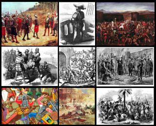
WThe Spanish conquest of the Inca Empire, also known as the Conquest of Peru, was one of the most important campaigns in the Spanish colonization of the Americas. After years of preliminary exploration and military skirmishes, 168 Spanish soldiers under conquistador Francisco Pizarro, his brothers, and their native allies captured the Sapa Inca Atahualpa in the 1532 Battle of Cajamarca. It was the first step in a long campaign that took decades of fighting but ended in Spanish victory in 1572 and colonization of the region as the Viceroyalty of Peru. The conquest of the Inca Empire, led to spin-off campaigns into present-day Chile and Colombia, as well as expeditions towards the Amazon Basin.
 W
WAn ushnu or usnu is a pyramid-shaped, terraced structure that was used by the Inca to preside at the most important ceremonies of the Tawantinsuyu, or Inca Empire.
 W
WVilcashuamán or Vilcasguaman is the capital of Vilcas Huamán Province, Ayacucho region, Peru. It is located at an altitude of 3,490 m on the eastern slopes of the Andes. It is located on an ancient archaeological site.