 W
WThe Finland–Sweden border is the border between the countries of Finland and Sweden. Almost the entire border runs through water: along the Tornio River and its tributaries, and in the Gulf of Bothnia. Only a few kilometres of the border are on dry land. Because of the Schengen treaty and the Nordic Passport Union, the border can be crossed mostly freely.
 W
WThe Gulf of Bothnia is the northernmost arm of the Baltic Sea. It is situated between Finland's west coast (Ostrobothnia) and Sweden's east coast. In the south of the gulf lie the Åland Islands, between the Sea of Åland and the Archipelago Sea.
 W
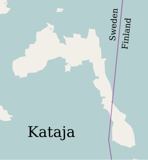
WKataja, the easternmost point of Sweden, is an islet south of Haparanda in Norrbotten. It is part of the Haparanda archipelago. The islet has an area of 71 hectares. It is about 2 kilometres (1.2 mi) long and 200 to 500 metres wide.
 W
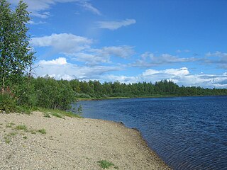
WKilpisjärvi is a medium-sized lake located at the north-western tip of Finland and northernmost Sweden. Treriksröset, the point where the borders of Finland, Sweden and Norway join is located some 2.5 kilometres (1.6 mi) northwest from the lake.
 W
WKönkämäeno is a river in Finland and Sweden in Finnish and Swedish Lapland. It forms the upper course of the Muonionjoki river, which begins where the Könkämäeno river meets the Lätäseno river. The river begins from Lake Kilpisjärvi and forms together with Muonionjoki and the lower course of Torne River the border between Sweden and Finland.
 W
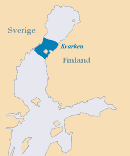
WKvarken is the narrow region in the Gulf of Bothnia separating the Bothnian Bay from the Bothnian Sea. The distance from Swedish mainland to Finnish mainland is around 80 km (50 mi) while the distance between the outmost islands is only 25 km (16 mi). The water depth in the Kvarken region is only around 25 metres (82 ft). The region also has an unusual rate of land rising at about 10 mm a year.
 W
WMärket is a small 3.3-hectare (8.2-acre) uninhabited skerry in the Baltic Sea between Sweden and Finland, with a lighthouse as its salient manmade feature. Märket has been divided between the two countries since the Treaty of Fredrikshamn of 1809 defined the border between Sweden and the Russian Empire as going through the middle of the island. The Finnish side of the island is part of the Municipality of Hammarland and is the westernmost land point of Finland. The Swedish part of the island is itself divided by two counties of Sweden: Uppsala County and Stockholm County.
 W
WThe Muonio is a river in northern Finland and Sweden. It is a tributary of the Tornio. Together the two rivers form the national border between Finland and Sweden. The river is 230 kilometres long.
 W
WThe Torne, also known as the Tornio, is a river in northern Sweden and Finland. For approximately half of its length it defines the border between these two countries. It rises at Lake Torne near the border with Norway and flows generally southeast for a distance of 522 kilometres (324 mi) into the Gulf of Bothnia. It is the largest river in Norrbotten both by length and by watershed area.
 W
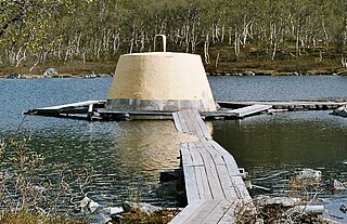
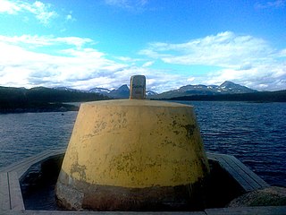
WThree-Country Cairn is the point at which the international borders of Sweden, Norway and Finland meet, and the name of the monument that marks the point. It is an example of a geographical feature known as a tripoint. It is the northernmost international tripoint in the world.