 W
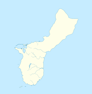
WThis article describes the geography of the United States territory of Guam.LocationOceania, island in the North Pacific Ocean, about a quarter of the way from the Philippines to Hawaii, United States Geographic coordinates13°26′31″N 144°46′35″ECoastline125.5 km (78.0 mi) Maritime claims Territorial sea: 12 nmi (22 km) Exclusive economic zone: 200 nautical miles The southern maritime boundary of Guam forms a border with the Federated States of Micronesia, and the northern maritime boundary forms a border with the Commonwealth of the Northern Marianas Islands. Climate Tropical marine; generally warm and humid, moderated by northeast trade winds; dry season from January to June, wet season from July to December; little seasonal temperature variation. Terrain Volcanic origin, surrounded by coral reefs; relatively flat coralline limestone plateau, with steep coastal cliffs and narrow coastal plains in north, low-rising hills in center, mountains in south. Soils are mostly silty clay or clay and may be gray, black, brown or reddish brown; acidity and depth vary.Elevation extremes Lowest point: Pacific Ocean, 0 metres Highest points: Mount Lamlam, 406 meters (1,332 ft) Mount Jumullong Manglo, 391 meters (1,283 ft) Mount Bolanos, 368 meters (1,207 ft)Natural resources Commercial fishing, recreational fishing of Indo-Pacific Blue Marlin, Wahoo, Mahi-mahi, Yellowfin tuna, and deepwater reef fish, tourism. Land use Arable land: 1.85% Permanent crops: 16.67% Other: 81.48% Irrigated land 2 km2 Natural hazards Frequent squalls during wet season; relatively rare, but potentially very destructive typhoons Environment - current issues Extirpation of native bird population by the rapid proliferation of the Brown tree snake, an exotic species. Island also supports feral populations of introduced deer, Pigs and Carabao. Geography - note Largest and southernmost island in the Mariana Islands archipelago; strategic location in western North Pacific Ocean.
 W
WApra Harbor, also called Port Apra, is a deep-water port on the western side of the United States territory of Guam. The harbor is formed by Orote Peninsula in the south and Cabras Island in the north. To the south, the harbor narrows and then widens again to form an inner harbor. The southern end of the harbor is the location of Naval Base Guam. The northern end is the commercial port, which handles about 2 million tons of cargo a year. It is considered one of the best natural ports in the Pacific and attracts many tourists.
WCabras Island is a long finger of low-lying reef and land which forms the northern shore of Apra Harbor, Guam. Tourists come to the island for snorkeling and hiking.
 W
WCocos Island is an island 1 mile (1.6 km) off the southern tip of the United States territory of Guam, located within the Merizo Barrier Reef, part of the municipality of Merizo. The island is uninhabited, 1,600 meters (5,200 ft) long in a southwest-northeast direction, between 200 m (660 ft) and 300 m (980 ft) wide, and has an area of 386,303 m2. It sits atop the southwestern coral reef rim of Cocos Lagoon.
 W
WCocos Lagoon appears as a small incomplete coral atoll attached to the south-western coast of Guam near the area of the village of Merizo. It stretches about 5.5 km (3.4 mi) east-west and 3.5 km (2.2 mi) north-south, covering an area of more than 10 km2 (3.9 sq mi).
WFena Lake (Reservoir) is the largest lake in the United States territory of Guam and it is a man made reservoir. It is located in the south of the island, and is overlooked by the nearby peaks of Mounts Lamlam, Alifan and Jumullong Manglo. The lake's outflow is to the north-west, its waters eventually reaching the Pacific Ocean at Talofofo Bay.
 W
WHill 40 is a militarily historic landform on the island of Guam. It is located about 325 metres (1,066 ft) east of Bangi Point, south of Agat on the island's west coast, rising to a height of 40 to 60 feet above the coastal plain, with a strategically significant view of the Agat Invasion Beach. This hill was the scene of some of the most intense fighting during the landing phase of the 1944 Battle of Guam as Allied forces sought to establish their beachhead against the defending Japanese forces. The American 4th Marine Regiment of the 1st Provisional Marine Brigade captured Hill 40 on June 21, 1944, the day of the landing. That night the Japanese launched a counteroffensive that successfully retook the hill on three occasions. The Marines regrouped and regained the hill each time. The final push came in the early morning hours of July 22nd. The Japanese 38th Regiment was wiped out during this military action, with 345 killed on the Bangi Point plain, immediately west of Hill 40 near the beach.
 W
WThe Mariana Islands are a crescent-shaped archipelago comprising the summits of fifteen mostly dormant volcanic mountains in the western North Pacific Ocean, between the 12th and 21st parallels north and along the 145th meridian east. They lie south-southeast of Japan, west-southwest of Hawaii, north of New Guinea and east of the Philippines, demarcating the Philippine Sea's eastern limit. They are found in the northern part of the western Oceanic sub-region of Micronesia, and are politically divided into two jurisdictions of the United States: the Commonwealth of the Northern Mariana Islands and, at the southern end of the chain, the territory of Guam. The islands were named after the influential Spanish queen Mariana of Austria following their colonization in the 17th century.
 W
WRitidian Point is the northernmost point of the island of Guam. It is owned by the US Fish and Wildlife Service which administers the area as part of the Guam National Wildlife Refuge.
WUruno Beach is in the north of Guam. Access to Uruno Beach from land is difficult as it lies beyond Andersen Air Force Base and non-military personnel require a pass to travel through the base. Access is easier via boat.