 W
WGeography of West Bengal, a state in eastern India, is diverse, of high peaks of Himalaya in the northern extremes to where Himalayas are in the north and sea is at the south, with both plains and plateaus covering the remaining region.
 W
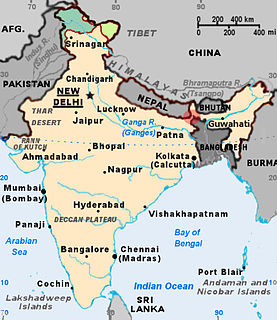
WThe Bangladesh–India border, known locally as the International Border (IB), is an international border running between Bangladesh and India that demarcates the eight divisions of Bangladesh and the Indian states.
 W
WBaurisole is a village in Simlapal, Bankura, West Bengal, India.
 W
WThe climate of West Bengal varies from tropical savannah in the southern portions to humid subtropical in the north.
 W
WDahala Khagrabari (#51) was an Indian enclave belonging to the District of Cooch Behar in the State of West Bengal. This was a piece of India within a piece of Bangladesh within a piece of India within Bangladesh, making it the only third-order enclave in the world until 1 August 2015, when it was ceded to Bangladesh.
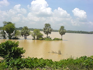
WGongoni Danga is a natural canyon situated near the town of Garbeta, in the Paschim Medinipur district of West Bengal, India.
 W
WThe India–Bangladesh enclaves, also known as the chiṭmahals and sometimes called pasha enclaves, were the enclaves along the Bangladesh–India border, in Bangladesh and the Indian states of West Bengal, Tripura, Assam and Meghalaya. Within the main body of Bangladesh were 102 enclaves of Indian territory, which in turn contained 21 Bangladeshi counter-enclaves, one of which contained an Indian counter-counter-enclave – the world's only third-order enclave. Within the Indian mainland were 71 Bangladeshi enclaves, containing 3 Indian counter-enclaves. A joint census in 2010 found 51,549 people residing in these enclaves: 37,334 in Indian enclaves within Bangladesh and 14,215 in Bangladeshi enclaves within India.
 W
WKhoai in Bengali refers to a geological formation specifically in Birbhum, Bardhaman, and Bankura districts of West Bengal, India and some parts of Jharkhand, India that is made up of laterite soil rich in iron oxide, often in the shapes of tiny hills. This is like natural canyon caused by the effect of wind and water erosion on red laterite soil. Khoai is called part of the India's natural heritage.
 W
WNorth Bengal is a term used for the north-western part of Bangladesh and northern part of West Bengal. The Bangladesh part denotes the Rajshahi Division and Rangpur Division. Generally it is the area lying west of Jamuna River and north of Padma River, and includes the Barind Tract. The West Bengal part denotes Jalpaiguri Division and Malda division together. The Bihar parts include Kishanganj district. It also includes parts of Darjeeling Hills. Traditionally, the Ganga River divides West Bengal into South Bengal and North Bengal, divided again into Terai and Dooars regions. Jalpesh and jatileswar are one of the most popular sacred places.
 W
WRarh region is a toponym for an area in the Indian subcontinent that lies between the Chota Nagpur Plateau on the West and the Ganges Delta on the East. Although the boundaries of the region have been defined differently according to various sources throughout history, it is mainly coextensive with the state of West Bengal, also comprising parts of the state of Jharkhand in India. Linguistically, the region is defined with population speaking the Rahr Bangla local dialect.
 W
WSouth Bengal is a term used for the southern parts of Bengal including Southern Bangladesh and Southern West Bengal.
 W
WThe Tin Bigha Corridor is a strip of land belonging to India on the West Bengal–Bangladesh border which, in September 2011, was leased to Bangladesh so the country could access its Dahagram–Angarpota enclave from the mainland. The enclave remains the only one still in existence after the 2015 resolution of the India-Bangladesh enclaves issue. It is situated in the town of Patgram Upazila.