 W
WSt. Louis is located at 38°38′53″N 90°12′44″W.
 W
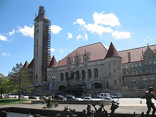
WAloe Plaza is part of the Terminus section of the St. Louis Gateway Mall. It is two blocks in size and sits directly in front of Union Station. It is bounded by Market, Chestnut, 18th, and 20th streets.
 W
WThe Caves of St. Louis have been important in the economic development of St. Louis, Missouri, United States. The city was built upon a complex of natural caves which were once used for the lagering of beer by early German immigrant brewers. Caves are naturally cool, which was especially attractive to brewers before the advent of refrigeration.
 W
WDeer Creek is a stream in the U.S. state of Missouri. It is a tributary of the River des Peres.
 W
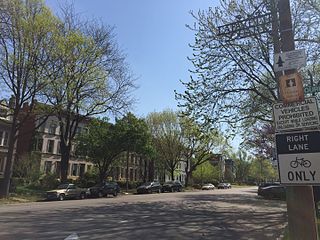
WThe Delmar Divide refers to Delmar Boulevard as a socioeconomic and racial dividing line in St. Louis, Missouri. The term was popularized outside Greater St. Louis by a four-minute documentary from the BBC. Delmar Blvd. is an east–west street with its western terminus in the municipality of Olivette, Missouri extending into the City of St. Louis. There is a dense concentration of eclectic commerce on Delmar Blvd. near the municipal borders of University City and St. Louis. This area is known as the Delmar Loop. Delmar Blvd. is referred to as a “divide” in reference to the dramatic difference in racial populations in the neighborhoods to its immediate north and south: as of 2012, residents south of Delmar are 73% white, while residents north of Delmar are 98% black, and because of corresponding distinct socioeconomic, cultural, and public policy differences.
 W
WHoly Corners Historic District, so named because of its concentration of early 20th-century churches, temples and other large buildings of public assembly, is located on both sides of North Kingshighway Boulevard between and including Westminster Place and Washington Avenue in St. Louis, Missouri. On December 29, 1975, the district was added to the National Register of Historic Places.
 W
WLaclede's Landing, colloquially "the Landing", is a small urban historic district in St. Louis, Missouri, United States. It marks the northern part of the original settlement founded by the Frenchman Pierre Laclède, whose landing on the riverside the placename commemorates. The buildings in the area date from later periods, however.
 W
WLafayette Square Historic District is a historic district roughly bounded by Hickory and 18th Sts., Jefferson and Lafayette Aves. in St. Louis, Missouri. Buildings in the district include a department store, a single dwelling, a public park, and a specialty store. The district was added to the National Register of Historic Places in 1972. A boundary increase in 1986 added an area roughly bounded by Chouteau Ave., Dolman, Lafayette Ave., and S. Eighteenth St. and Vail Pl. and MacKay Pl. Buildings in the boundary increase include single and multiple dwellings, a manufacturing facility and a specialty store.
 W
WMaline Creek is a stream in St. Louis County in the U.S. state of Missouri. It is a tributary of the Mississippi River
 W
WThe Missouri Botanical Garden is a botanical garden located at 4344 Shaw Boulevard in St. Louis, Missouri. It is also known informally as Shaw's Garden for founder and philanthropist Henry Shaw. Its herbarium, with more than 6.6 million specimens, is the second largest in North America, behind that of the New York Botanical Garden.
 W
WThe River des Peres is a 9.3-mile (15.0 km) metropolitan river in St. Louis, Missouri. It is the backbone of sanitary and storm water systems in the city of St. Louis and portions of St. Louis County. Its largest tributaries are Deer Creek and Gravois Creek. At St. Louis, the river has a mean annual discharge of 79 cubic feet per second.
 W
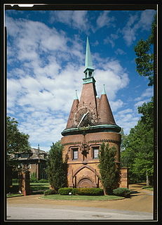
WWashington Terrace is a residential private place in St. Louis, Missouri, laid out circa 1892. The gate is south of Union and Delmar, within the bounds of the Central West End.
 W
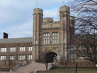
WThe Washington University Hilltop Campus Historic District was the site of the 1904 Louisiana Purchase Exposition and the 1904 Summer Olympics. Many of the exposition buildings were temporary in nature, but a number of permanent structures were built and are used by Washington University, which calls this area the Danforth Campus. The district includes more than fifty structures, of which twenty are in the Collegiate Gothic style.