 W
WThe geography of Chile is extremely diverse as the country extends from a latitude of 17° South to Cape Horn at 56° and from the ocean on the west to Andes on the east. Chile is situated in southern South America, bordering the South Pacific Ocean and a small part of the South Atlantic Ocean. Chile's territorial shape is among the world's most unusual. From north to south, Chile extends 4,270 km (2,653 mi), and yet it only averages 177 km (110 mi) east to west. Chile reaches from the middle of South America's west coast straight down to the southern tip of the continent, where it curves slightly eastward. Diego Ramírez Islands and Cape Horn, the southernmost points in the Americas, where the Pacific and Atlantic oceans meet, are Chilean territory. Chile's northern neighbors are Peru and Bolivia, and its border with Argentina to the east, at 5,150 km (3,200 mi), is the world's third-longest. The total land size is 756,102 km2 (291,933 sq mi). The very long coastline of 6,435 km (3,999 mi) gives it the 11th largest exclusive economic zone of 3,648,532 km2 (1,408,706 sq mi).
 W
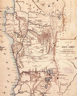
WAraucanía or Araucana was the Spanish name given to the region of Chile inhabited by the Mapuche peoples known as the Moluche in the 18th century. Prior to the Spanish conquest of Chile, the lands of the Moluche lay between the Itata River and Toltén River.
 W
WThe landmass known as Patagonia hosts a series of archipelagoes, all of them located on its western and southern coast. These archipelagoes, with the exception of Tierra del Fuego and some islands in Argentina's Atlantic Ocean, lie mainly in Chile and in the Pacific Ocean, covering about one third of Chile's coast.
 W
WCentral Chile is one of the five natural regions into which CORFO divided continental Chile in 1950. It is home to a majority of the Chilean population and includes the three largest metropolitan areas—Santiago, Valparaíso, and Concepción. It extends from 32° south latitude to 37° south latitude.
 W
WThe Chilean Lake District is a zone in Southern Chile defined by its many lakes in the Andean foothills. The term is primarily used in tourism literature and advertising, in Chile Zona Sur is preferred as a geographical concept. The Chilean Lake District includes the cities of Temuco, Villarrica, Pucón, Valdivia, Osorno, Entre Lagos (Puyehue), Puerto Octay, Frutillar, Puerto Varas and Puerto Montt.
 W
WThe coastal plains of Chile are a series of coastal plains found over much of Chile. Together with the Chilean Coast Range, the Chilean Central Valley and the Andes proper the coastal plains are one of the main landscape units of Chile. In Coquimbo and Valparaíso regions these plains are of fluvial or marine origine, and sometimes of combined fluvial and marine origin.
 W
WContinental Chile is the name given to the Chilean territory located on the continental shelf of South America. This term serves to distinguish the South American area from the insular territories, known as Insular Chile, as from the Antarctic Chile. The existence of this three areas of effective or claimed Chilean sovereignty is what supports the existing tricontinental principle in this country.
 W
WGarúa is a Spanish word meaning drizzle or mist. Although used in other contexts in the Spanish-speaking world, garúa most importantly refers to the moist cold fog that blankets the coasts of Peru, southern Ecuador, and northern Chile, especially during the southern hemisphere winter. Garúa is called Camanchaca in Chile. Garúa brings mild temperatures and high humidity to a tropical coastal desert. It also provides moisture from fog and mist to a nearly-rainless region and permits the existence of vegetated fog oases, called lomas.
 W
WÑadi is a type of soil and a phytogeographic zone of Southern Chile. Ñadi soils are located in the Chilean Central Valley of Los Lagos Region, specifically between the moraines left by the region's most recent glaciation and those of the penultimate glaciation. Ñadis have an impermeable layer, usually called fierrillo.
 W
WThe Norte Chico is one of the five natural regions into which CORFO divided continental Chile in 1950. Its northern border is formed by the limit with the Far North, to the west lies the Pacific Ocean, to the east the Andes mountains and Argentina, and to the south the Zona Central natural region. Although from a strictly geographic point of view, this natural region corresponds to the Chilean territory between the rivers Copiapó and Aconcagua, traditionally the Norte Chico refers to the zone comprising the regions of Atacama and Coquimbo. This region was home to the Diaguita people.
 W
WThe Norte Grande is one of the five natural regions into which CORFO divided continental Chile in 1950. It borders Peru to the north, the Pacific Ocean to the west, the Altiplano, Bolivia and Argentina to the east, and the Copiapó River to the south, beyond which lies the Norte Chico natural region.
 W
WSouthern Chile is an informal geographic term for any place south of the capital city, Santiago, or south of Biobío River, the mouth of which is Concepción, about 300 kilometres (200 mi) south of Santiago. Generally cities like Temuco are considered to be located in the south despite being relatively close to the geographical center of Chile. This is mainly because mainland Chile ended in La Frontera until the occupation of Araucanía (1861–1883). Similarly, the Southern Chile wine region is close to the geographic center of the country, encompassing wine-growing areas in the Bío Bío Region and Araucanía Region.
 W
WTricontinental Chile is a geopolitical concept denoting Chile's unique position with its mainland in South America, Easter Island in Oceania (Polynesia) and the Chilean Antarctic Territory in Antarctica.
 W
WThe Zona Austral is one of the five natural regions into which CORFO divided continental Chile in 1950 corresponding to the Chilean portion of Patagonia. It is surrounded by the Zona Sur and the Chacao Channel to the north, the Pacific Ocean and Drake's Passage to the south and west, and the Andean mountains and Argentina to the east. If excluding Chiloé Archipelago Zona Austral covers all of Chilean Patagonia.
 W
WThe Zona Sur is one of the five natural regions on which CORFO divided continental Chile in 1950. Its northern border is formed by the Bío-Bío River, the limit with the Central Chile Zone. By west with the Pacific Ocean, by the east with the Andean mountains and Argentina. Its southern border is the Chacao Channel, beyond it lies the Austral Zone. While Chiloé Archipelago belongs geographically to Zona Austral in terms of culture and history it lies closer to Zona Sur.