 W
WAlgie Glacier is a 25-nautical-mile (46 km) long glacier which flows southeast into Nimrod Glacier just west of the Nash Range of Antarctica. It was named by the New Zealand Ross Sea Committee for R.M. Algie who, as Minister in Charge of Scientific and Industrial Research, gave his strong support to the New Zealand party of the Commonwealth Trans-Antarctic Expedition, 1956–58.
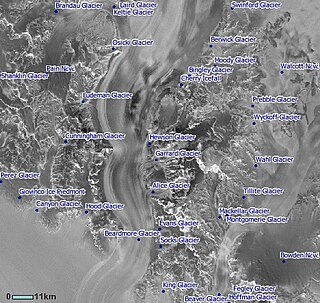
WAlice Glacier is a 13-nautical-mile (24 km) long tributary glacier in East Antarctica. It flows east from the Queen Alexandra Range to enter Beardmore Glacier at Sirohi Point. It was discovered by the British Antarctic Expedition, 1907–09, under Ernest Shackleton, and was named for the mother of Eric Marshall, a member of Shackleton's South Polar Party.
WThe Beardmore Glacier in Antarctica is one of the largest valley glaciers in the world, being 200 km (125 mi) long and having a width of 40 km (25 mi). It descends about 2,200 m (7,200 ft) from the Antarctic Plateau to the Ross Ice Shelf and is bordered by the Commonwealth Range of the Queen Maud Mountains on the eastern side and the Queen Alexandra Range of the Central Transantarctic Mountains on the western.
 W
WBeaumont Bay is an ice-filled reentrant on the west side of the Ross Ice Shelf between Young Head and Harris Point, into which Dickey Glacier flows. It was discovered by the British National Antarctic Expedition (1901–04) and named for Admiral Sir Lewis Beaumont, Royal Navy, an Arctic explorer who took a special interest in this expedition.
WBeaver Glacier is a glacier, 15 miles (24 km) long, draining the coastal mountains of the Queen Alexandra Range just northwest of Mount Fox and entering the Ross Ice Shelf at McCann Point. It was named by the New Zealand Geological Survey Antarctic Expedition (1959–60) after the Beaver aircraft City of Auckland, which crashed in this area in January 1960.
 W
WBingley Glacier is a glacier 8 nautical miles (15 km) long in the Queen Alexandra Range, draining south from the slopes of Mount Kirkpatrick, Mount Dickerson and Barnes Peak and entering Beardmore Glacier just north of the Adams Mountains. It was named by Ernest Shackleton of the British Antarctic Expedition, 1907–09, after Bingley, England, the ancestral home of the Shackleton family.
WDeverall Island is a small ice-covered island, rising above the Ross Ice Shelf just northeast of Beaumont Bay. It was named by the New Zealand Geological Survey Antarctic Expedition (1960–61) for William H. Deverall, a radio operator at Scott Base, 1961. It is considered to be the southernmost island in the world.
WMount Elizabeth is a massive ice-free mountain, 4,480 metres (14,700 ft) high, standing 6 nautical miles (11 km) south of Mount Anne in the Queen Alexandra Range, Antarctica. It was discovered by the British Antarctic Expedition, 1907–09, and named for Elizabeth Dawson-Lambton, a supporter of the expedition.
WFegley Glacier is a tributary glacier in the Holland Range of Antarctica, flowing east into Lennox-King Glacier, 5 nautical miles (9 km) northeast of Mount Allen Young. It was named by the Advisory Committee on Antarctic Names for Lieutenant Charles E. Fegley, III, of the Civil Engineer Corps, U.S. Navy, officer in charge of the nuclear power unit at McMurdo Station during Operation Deep Freeze, 1964.
WMount Katsufrakis is a projecting-type mountain on the east side of Markham Plateau in the Queen Elizabeth Range, Antarctica. It was mapped by the United States Geological Survey from tellurometer surveys and Navy air photos, 1960–62, and was named by the Advisory Committee on Antarctic Names for John P. Katsufrakis, a United States Antarctic Research Program radio scientist at McMurdo Station, 1963–64, and Byrd Station, 1964–65 and 1965–66.
WMount Kirkpatrick is a lofty, generally ice-free mountain in Antarctica's Queen Alexandra Range. Located 8 km (5 mi) west of Mount Dickerson, Mt. Kirkpatrick is the highest point in the Queen Alexandra Range, as well as in its parent range, the Transantarctic Mountains. Discovered and named by the British Antarctic Expedition (1907–09), the mountain was named for a Glasgow businessman, who was one of the original supporters of the expedition. Mount Kilpatrick is an alternate name for this mountain.
WMount Markham is a twin-peaked massif surmounting the north end of Antarctica's Markham Plateau. The main peak has an elevation of 4,350 metres (14,272 ft) and the lower sub-peak is 4,280 metres (14,042 ft) high. Discovered by the British National Antarctic Expedition of 1901–1904), it is named for Sir Clements Markham, who, as President of the Royal Geographical Society, planned the expedition and chose Robert Falcon Scott as its leader. Mount Markham is the fourth-highest ultra prominent peak in Antarctica.
WMount Price is the eastern of two peaks, rising to 3,030 m at the north end of the Adams Mountains, Queen Alexandra Range in Antarctica. It was named by the Advisory Committee on Antarctic Names (US-ACAN) for Rayburn Price, United States Antarctic Research Program (USARP) meteorologist at Hallett Station, 1963.
 W
WThe Nimrod Glacier is a major glacier about 135 km (85 mi) long, flowing from the polar plateau in a northerly direction through the Transantarctic Mountains between the Geologists and Miller Ranges, then northeasterly between the Churchill Mountains and Queen Elizabeth Range, and finally spilling into Shackleton Inlet and the Ross Ice Shelf between Capes Wilson and Lyttelton.
 W
WShackleton Coast is that portion of the coast along the west side of the Ross Ice Shelf between Cape Selborne and Airdrop Peak at the east side of Beardmore Glacier in Antarctica. Named by New Zealand Antarctic Place-Names Committee (NZ-APC) in 1961 after Sir Ernest Shackleton. He accompanied Scott on the southern journey during the Discovery expedition (1901–04) and subsequently led three Antarctic expeditions. On the British Antarctic Expedition (1907–09), Shackleton discovered the area beyond Shackleton Inlet to the Beardmore Glacier, and was the first to find a practicable route to the South Pole. Lack of food stopped him 97 miles (180 km) from his goal.