 W
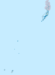
WPalau is divided into sixteen administrative regions, called states. Palau is the most over-governed place on earth, with 16 states and both a tribal chiefdom and elected legislature in each state, for 20,000 people.
 W
WAimeliik is an administrative division of the island country of Palau. It is one of the Republic of Palau's 16 states. It has an area of 52 km² and a population of 334. State capital is the village of Mongami. Following the four other villages which are: Medorm, Imul, Elechui and Ngmechiangel.
 W
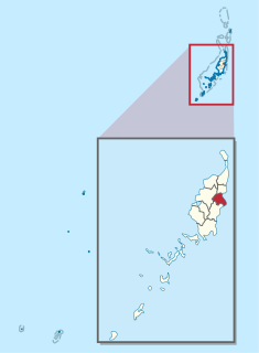
WAirai, located on the southern coast of Babeldaob island, is the second-most populous state of Palau. It contains the country's chief airport, Roman Tmetuchl International Airport, and is connected by the Koror-Babeldaob Bridge to nearby Koror Island.
 W
WAngaur or Ngeaur is an island in the island nation of Palau. The island, which forms its own state, has an area of 8 km² (3 mi²). Its population was 130 in 2012. The state capital is the village of Ngeremasch on the western side. A second village, Rois, is immediately east of Ngeremasch.
 W
WTobi, or Hatohobei (Tobian), also ハトホベイ州 (Japanese), is the southernmost of Palau's sixteen states, consisting of Tobi Island and Helen Reef. The total land area is about 0.88 km². The population was 80 in 1962, 51 in 1995, 23 in 2000, and 25 in 2015. Tobian, English and Sonsorolese are the official languages of Hatohobei State.
 W
WKayangel is the northernmost state of Palau 24 km (15 mi) north of Koror. The land area is about 1.4 km2 (0.54 sq mi). The population is 54.
 W
WKoror is the state comprising the main commercial centre of the Republic of Palau. It consists of several islands, the most prominent being Koror Island.
 W
WMelekeok is a state of the Republic of Palau located on the central east coast of Babeldaob Island. The seat of government of the country, Ngerulmud, is located in the state. The state consists of long beaches, hills, steep ridges, rivers, and the largest and only natural freshwater lake in the Republic of Palau and Micronesia, Lake Ngardok.
 W
WNgaraard is the eighth state of the Republic of Palau, and was originally named Kerradel. Ngaraard is located on the northern tip of Babeldaob directly adjacent to Ngarchelong state. There are five hamlets in Ngaraard, including Choll, Elab, Ngebuked, Ngkeklau and the state capital, Ulimang, located on the eastern shore of the state. Previously, the capital of Ngaraard was the village of Ngebuked, where the traditional leader of the state, Maderangebuked, lived and reigned. There is a saying in Ngaraard, A rengud a dokngei, meaning "everyone works together as one in spirit and in the heart."
 W
WNgarchelong is a state in Palau. Ngarchelong is at the northernmost tip of the island of Babeldaob. Only the state of Kayangel is farther north. Ngarchelong is an important historical site and has undergone archeological excavation.
 W
WNgardmau is one of Palau's sixteen states and is located on the west side of Babeldaob between the states of Ngaraard and Ngeremlengui. Its total area is 20.5 square miles (53 km2). According to the last census, 185 persons live in Ngardmau. Their 46 households are situated in three hamlets: Ngetbong, Ngerutoi and Urdmau. The hamlets have no visible boundaries, but form one settlement.
 W
WNgatpang is one of Palau's sixteen states. It comprises an area of around 47 square kilometers in the west of Palau's largest island, Babeldaob, facing onto Ngeremeduu Bay. The state capital is Ngerdubech. It has a population of 282, making it Palau's 9th largest state in population.
 W
WNgchesar also known as Oldiais is one of the sixteen states of the nation of Palau. There are 291 inhabitants, and its capital is Ngersuul. It is the sixth largest state in terms of land, with an area of roughly 40 square kilometers, and it is located on the eastern side of the island of Babeldaob, northwest of Airai State, and southeast of Melekeok State, where the Palauan government is situated. The sacred totem of Ngchesar is the Stingray. Ngchesar is famous for its war canoe "kabekel" named Bisbush which means Lightning.
 W
WNgeremlengui is one of Palau's sixteen states. It has a population of 350, and is just west of the capital in Melekeok state. The capital of the state of Ngeremlengui is Imeong. Ngeremlengui is on the western side of Babeldaob, which is the largest island in Palau. Ngarelemgui is the largest of Palau's sixteen states in terms of land, and has an area of roughly 65 km2.
 W
WNgiwal is one of the sixteen states of Palau. It has a population of 282 and an area of 26 km². The administrative center is Ngerkeai.
 W
WPeleliu is an island in the island nation of Palau. Peleliu, along with two small islands to its northeast, forms one of the sixteen states of Palau. The island is notable as the location of the Battle of Peleliu in World War II.
 W
WSonsorol is one of the sixteen states of Palau. The administrative center, and only village, is Dongosaru on Sonsorol island. The inhabitants speak Sonsorolese, a local Trukic language, and Palauan.