 W
WThe northern Indian state of Uttar Pradesh, which borders Nepal, comprises 18 administrative divisions. Within these 18 divisions, there are a total of 75 districts. The following table shows the name of each division, its administrative capital city, its constituent districts, and a map of its location.
 W
WAgra Division is one of the divisions of Uttar Pradesh, India. It contains Agra, Firozabad, Mainpuri and Mathura districts. The Population of Agra Division was 11,304,646 as of 2011.The headquarter of the division is in Agra City.
 W
WAligarh division, also known as Aligarh-city and Kol, is one of the administrative divisions of the Indian state of Uttar Pradesh
 W
WAllahabad division, officially known as Prayagraj division, is an administrative unit of Indian state of Uttar Pradesh.
 W
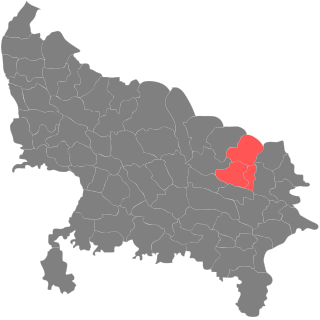
WAzamgarh division is an administrative unit of Indian state of Uttar Pradesh. Azamgarh division consists of:-Azamgarh District Ballia District Mau District
 W
WBareilly division is an administrative geographical unit of Uttar Pradesh state of India. Bareilly is the administrative headquarters of the division. Part of the Rohilkhand region, Bareilly division has three major cities in west Uttar Pradesh - Bareilly, Badaun, Pilibhit and Shahjahanpur.
 W
WBasti Division is an administrative geographical unit of Uttar Pradesh state of India. Basti is the administrative headquarters of the division. Currently (2005), the division consists following districts: Basti district and Basti division carved out from Gorakhpur district.Basti, Sidharthanagar Sant Kabir Nagar.
 W
WChitrakoot Division is an administrative division of Uttar Pradesh state in northern India. Historically part of Bundelkhand region, it includes the districts of:Banda, Chitrakoot, Hamirpur, and Mahoba.
 W
WDevipatan division is an administrative geographical unit of Uttar Pradesh state of India. Currently (2005), the division consists of districts of:Gonda, Bahraich, Shravasti, and Balarampur. Barabanki.
 W
WFaizabad division is an administrative geographical unit of Uttar Pradesh state in India. Faizabad is the administrative headquarters of the division. The government of Uttar Pradesh approved the renaming of the Faizabad division to Ayodhya division in November 2018.
 W
WGorakhpur division is an administrative geographical unit of Uttar Pradesh state in northern India. Gorakhpur is the administrative headquarters of the division. Currently (2017), the division consists of four districts:
 W
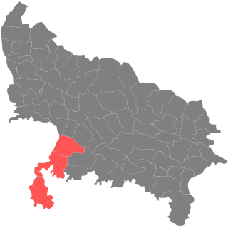
WJhansi Division is one of 17 divisions of Uttar Pradesh state in northern India. The city of Jhansi is the administrative center. The division is part of the historic Bundelkhand region, which includes a portion of southern Uttar Pradesh and extends into neighboring Madhya Pradesh state.
 W
WKanpur division is an administrative geographical unit of Uttar Pradesh state of India. Kanpur is the administrative headquarters of the division. Kanpur was formerly spelled Cawnpore. The division consists of six districts:Auraiya District Etawah Farrukhabad Kanpur Dehat Kanpur Nagar Kannauj
 W
WLucknow division is an administrative geographical unit of Uttar Pradesh state of India. Lucknow is the administrative headquarters of the division. The division consists of Lucknow, Hardoi, Lakhimpur Kheri, Raebareli, Sitapur, and Unnao.
 W
WMeerut division is one of the 18 administrative division of Uttar Pradesh state in India. Meerut city is the administrative headquarters of the division. It consists of six districts namely Baghpat, Bulandshahr, Gautam Buddha Nagar, Ghaziabad, Hapur and Meerut.
 W
WMirzapur division is a division of Uttar Pradesh state of India. Mirzapur is the administrative headquarters. Currently (2018), the division consists of districts of:Mirzapur, Bhadohi, Bhadohi district Sonbhadra.
 W
WMoradabad division is an administrative geographical unit of Uttar Pradesh state of India. Moradabad is the administrative headquarters of the division. It forms a part of the Rohilkhand region. Currently (2005), the division consists of districts of Moradabad, Bijnor, Rampur, Amroha and Sambhal.
 W
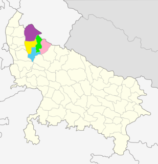
WSaharanpur division is an administrative geographical unit of Uttar Pradesh state of India. The city of Saharanpur is the administrative headquarters of the division.
 W
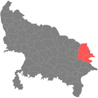
WVaranasi division is an administrative geographical unit of Uttar Pradesh state of India. Varanasi is the administrative headquarters of the division. Currently (2018), the division consists of districts of Varanasi, Chandauli, Ghazipur, and Jaunpur and is loosely equivalent to the Benares State.