 W
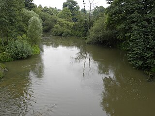
WThe Aire is a river of northern France, crossing the departments of Meuse and Ardennes. It is a right tributary of the Aisne. It is 124.8 km (77.5 mi) long. Its source is near Saint-Aubin-sur-Aire in Meuse. It flows through the towns of Pierrefitte-sur-Aire, Clermont-en-Argonne, Varennes-en-Argonne and Grandpré, finally flowing into the Aisne in Termes.
 W
WThe Alzette is a river with a length of 73 kilometres (45 mi) in France and Luxembourg. It is a right tributary of the Sauer.
 W
WThe Aube is a river in France, a right tributary of the Seine. It is 248.9 kilometres (154.7 mi) long. The river gives its name to the Aube department.
 W
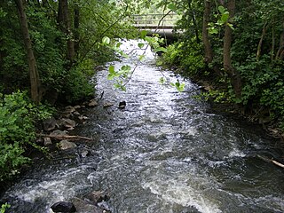
WThe Bist is a river in France and in Germany, and a 26.3-kilometre-long (16.3 mi) left tributary of the Saar. It is 26.3 km (16.3 mi) long, of which 15.8 km (9.8 mi) within France and on the French-German border.
 W
WThe Blies is a right tributary of the Saar in southwestern Germany (Saarland) and northeastern France (Moselle). The Blies flows from three springs in the Hunsrück near Selbach, Germany. It is roughly 100 km long, ending in the French city of Sarreguemines. It flows through Sankt Wendel, Ottweiler, Neunkirchen, Bexbach, Homburg and Blieskastel. Its lower extent demarcates part of the Franco–German border. The section within France and on the French-German border is 19.7 km (12.2 mi) long.
 W
WChampagne was a province in the northeast of the Kingdom of France, now best known as the Champagne wine region for the sparkling white wine that bears its name in modern-day France. The County of Champagne, descended from the early medieval kingdom of Austrasia, passed to the French crown in 1314.
 W
WThe Chiers is a river in Luxembourg, Belgium and France. It is a right tributary of the Meuse. Its total length is about 140 kilometres (87 mi), of which 127 km (79 mi) in France.
 W
WThe County of Brienne was a medieval county in France centered on Brienne-le-Château.
 W
WThe Forest of Argonne is a long strip of mountainous and wild woodland in northeastern France, approximately 200 km (120 mi) east of Paris, France. In 1792 Charles François Dumouriez outmaneuvered the invading forces of the Duke of Brunswick in the forest before the Battle of Valmy.
 W
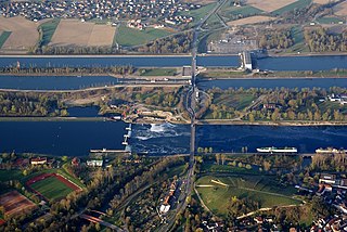
WThe Grand Canal of Alsace is a canal in eastern France, channeling the Upper Rhine river. It is 50 kilometers long between Kembs and Vogelgrun, and provides access to the region from the Rhine River, Basel in Switzerland, and the North Sea for barges of up to about 5000 metric tons. The Grand Canal permits the navigation of more than 30,000 boats a year between Basel and Strasbourg.
 W
WThe Grand Morin is a 118-kilometre (73 mi) long river in France, left tributary of the Marne. Its source is near the village of Lachy. Its course crosses the departments of Marne and Seine-et-Marne. It flows westwards through the towns of Esternay, La Ferté-Gaucher, Coulommiers and Crécy-la-Chapelle, finally flowing into the Marne in Esbly.
 W
WThe Longeau is a 37.5-kilometre (23.3 mi) long river in the Grand Est of northeastern France. It rises in Hannonville-sous-les-Côtes and runs generally northeast to join the river Yron at Jarny.
 W
WThe Meurthe is a river in north-eastern France, right tributary to the river Moselle. It is 161 km (100 mi) long. Its source is in the Vosges mountains, near the Col de la Schlucht in the Vosges département, from where it flows in an overall north-westerly direction. Its name gave rise to the naming of the present French département Meurthe-et-Moselle and the former département Meurthe.
 W
WThe Petit Morin is an 86 km-long (53 mi) river in France, a left tributary of the Marne. Its source is in the commune Val-des-Marais. Its course crosses the departments of Marne, Aisne and Seine-et-Marne. It flows westwards through the towns of Montmirail, Villeneuve-sur-Bellot, Saint-Cyr-sur-Morin and Jouarre, finally flowing into the Marne in La Ferté-sous-Jouarre.
 W
WSaar-Warndt coal mining basin is an area of Germany and France which has been shaped by two centuries of coal extraction from the start of the 19th century to the start of 21st century; and it represents a significant period in the history of European industrialisation.
 W
WThe Saulx is a 115 km long river in France, right tributary of the Marne. Its source is near the village Germisay. It flows generally northwest, through the following départements and towns:Haute-Marne: Effincourt Meuse: Montiers-sur-Saulx, Stainville Marne: Sermaize-les-Bains, Pargny-sur-Saulx, Vitry-le-François
 W
WThe Vezouze is a river in north-eastern France, right tributary to the river Meurthe. Its source is on Mont Donon in the Vosges département. It is 75 km (47 mi) long.
 W
WThe Voire is a small river in France, in the drainage basin of the Seine. It is 56.2 km (34.9 mi) long. Its source is in Mertrud, in the Haute-Marne department. It flows through Montier-en-Der and Puellemontier, and empties into the river Aube at Chalette-sur-Voire, in the Aube department.
 W
WThe Vosges and Jura coal mining basins are an area of France located between two mountain ranges, that has been shaped by four centuries of coal extraction from the 16th Century to the 20th Century. It includes four coal basins in three geographic locations.
 W
WThe Warndt is an extensive forest area of approximately 5,000 hectares (19 sq mi) including parts of the German Saarland and the French region Grand Est west of Saarbrücken. The geology of the Warndt is composed of Buntsandstein permeated by veins of iron ore and deposits of hard coal. Today it is a popular recreational area.
 W
WThe Woëvre is a natural region of Lorraine in northeastern France. It forms part of Lorraine plateau and lies largely in the department of Meuse. Along with the Côtes de Moselle, the Woëvre is one of the areas in Lorraine that receives the least rainfall; nonetheless, its river system is very important and feeds into the Lac de Madine.