 W
WNortheast India is the easternmost region of India representing both a geographic and political administrative division of the country. It comprises eight states – Arunachal Pradesh, Assam, Manipur, Meghalaya, Mizoram, Nagaland, Sikkim and Tripura. The region shares an international border of 5,182 kilometres (3,220 mi) with several neighbouring countries – 1,395 kilometres (867 mi) with Tibet Autonomous Region, China in the north, 1,640 kilometres (1,020 mi) with Myanmar in the east, 1,596 kilometres (992 mi) with Bangladesh in the south-west, 97 kilometres (60 mi) with Nepal in the west, and 455 kilometres (283 mi) with Bhutan in the north-west. It comprises an area of 262,230 square kilometres (101,250 sq mi), almost 8 percent of that of India
 W
WArunachal Pradesh is a state in Northeast India. It borders the states of Assam and Nagaland to the south. It shares international borders with Bhutan in the west, Myanmar in the east, and a disputed border with China in the north at the McMahon Line. Itanagar is the state capital of Arunachal Pradesh. Arunachal Pradesh is the largest of the Seven Sister States of Northeast India by area.
 W
WAssam is a state in northeastern India, situated south of the eastern Himalayas along the Brahmaputra and Barak River valleys. Assam covers an area of 78,438 km2 (30,285 sq mi). The state is bordered by Bhutan and Arunachal Pradesh to the north; Nagaland and Manipur to the east; Meghalaya, Tripura, Mizoram and Bangladesh to the south; and West Bengal to the west via the Siliguri Corridor, a 22 kilometres (14 mi) wide strip of land that connects the state to the rest of India. It is also one of the world's most populous subdivisions. Assamese is the official and most commonly spoken language of the state, followed by Bengali, which is official in the Barak Valley and Bodo which is official in Bodoland Territorial Region.
 W
WThe Eastern Bengal and Assam Legislative Council was the legislative council of Eastern Bengal and Assam, a province of the British India covering Bangladesh and Northeast India. It would meet in the Government House of Dacca, the provincial capital. Its ex-officio head was the Lieutenant Governor of Eastern Bengal and Assam.
 W
WChristoph von Fürer-Haimendorf or Christopher von Fürer-Haimendorf was an Austrian ethnologist and professor at the School of Oriental and African Studies at London. He spent forty years studying tribal cultures in Northeast India, in the central region of what is now the state of Telangana and in Nepal.
 W
WThe Ganga basin is a part of the Ganges-Brahmaputra basin draining 1,086,000 square kilometres in Tibet, Nepal, India and Bangladesh. To the north, the Himalaya or lower parallel ranges beyond form the Ganges-Brahmaputra divide. On the west the Ganges Basin borders the Indus basin and then the Aravalli ridge. Southern limits are the Vindhyas and Chota Nagpur Plateau. On the east the Ganges merges with the Brahmaputra through a complex system of common distributaries into the Bay of Bengal. Its catchment lies in the states of Uttar Pradesh (294,364 km²), Madhya Pradesh (198,962 km²), Bihar (143,961 km²), Rajasthan (112,490 km²), West Bengal (71,485 km²), Haryana (34,341 km²), Himachal Pradesh (4,317 km²), Delhi, Arunachal pradesh(1,484 km²), the whole of Bangladesh, Nepal and Bhutan. Several tributaries rise inside Tibet before flowing south through Nepal. The basin has a population of more than 500 million, making it the most populated river basin in the world.
 W
WThe Insurgency in Arunachal Pradesh is a part of the larger Northeast India insurgency involving multiple groups trying to separate from or destabilize the province. Because of Arunachal Pradesh's close proximity to the border, many groups are able to use border crossings to promote their terrorist activity. Since Arunachal Pradesh's recapture in the 1962 War, there has been incursions from the Chinese Army in the region further escalating the conflict. The conflict has slowed since the early 2000s due to police arrest of major insurgent leaders. The highly diverse ethnic and religious population of the province has also influenced various groups.
 W
WInsurgency in Northeast India involves multiple armed separatist factions operating in India's northeastern states, which are connected to the rest of India by the Siliguri Corridor, a strip of land as narrow as 14.29 miles (23.00 km) wide. Most factions favour a separate nation while others seek regional autonomy. Some groups demand complete independence. Others wanted religious law.
 W
WKamtapur was a Koch Rajbanshi kingdom in present India, Bangladesh and Nepal. The medieval Kamatapur, or Kamata kingdom, grew before the emergence of the Koch dynasty under the leadership of Viswa Singha.
 W
WThe Bengal slow loris or northern slow loris is a strepsirrhine primate and a species of slow loris native to the Indian subcontinent and Indochina. Its geographic range is larger than that of any other slow loris species. Considered a subspecies of the Sunda slow loris (N. coucang) until 2001, phylogenetic analysis suggests that the Bengal slow loris is most closely related to the Sunda slow loris. However, some individuals in both species have mitochondrial DNA sequences that resemble those of the other species, due to introgressive hybridization. It is the largest species of slow loris, measuring 26 to 38 cm from head to tail and weighing between 1 and 2.1 kg. Like other slow lorises, it has a wet nose (rhinarium), a round head, flat face, large eyes, small ears, a vestigial tail, and dense, woolly fur. The toxin it secretes from its brachial gland differs chemically from that of other slow loris species and may be used to communicate information about sex, age, health, and social status.
 W
WManipur is a state in northeastern India, with the city of Imphal as its capital. It is bounded by the Indian states of Nagaland to the north, Mizoram to the south and Assam to the west. It also borders two regions of Myanmar, Sagaing Region to the east and Chin State to the south. The state covers an area of 22,327 square kilometres (8,621 sq mi) and has a population of almost 3 million, including the Meitei, who are the majority group in the state, the Meitei Pangals, Naga tribes, Kuki/Zo tribes and other communities, who speak a variety of Sino-Tibetan languages. Manipur has been at the crossroads of Asian economic and cultural exchange for more than 2,500 years. It has long connected the Indian subcontinent and Central Asia to Southeast Asia, China, Siberia (Russia), Micronesia and Polynesia, enabling migration of people, cultures and religions.
 W
WMeghalaya ; is a state in northeastern India. Meghalaya was formed by carving out two districts from the state of Assam: the United Khasi Hills and Jaintia Hills, and the Garo Hills on 21 January 1972. The population of Meghalaya as of 2016 is estimated to be 3,211,474. Meghalaya covers an area of approximately 22,430 square kilometres, with a length to breadth ratio of about 3:1.
 W
WMizoram is a state in northeastern India, with Aizawl as its capital city. The name is derived from "Mizo", the name of the native inhabitants, and "Ram", which means land, and thus Mizoram means "land of the Mizos". Within the northeast region, it is the southernmost landlocked state, sharing borders with three of the Seven Sister States, namely Tripura, Assam and Manipur. The state also shares a 722-kilometre border with the neighbouring countries of Bangladesh and Myanmar.
 W
WNagaland is a state in north-eastern India. It is bordered by the state of Arunachal Pradesh to the north, Assam to the west, Manipur to the south and the Sagaing Region of Myanmar to the east. Nagaland's capital city is Kohima and its largest city is Dimapur. It has an area of 16,579 square kilometres (6,401 sq mi) with a population of 1,980,602 per the 2011 Census of India, making it one of the smallest states of India.
 W
WNorth Eastern Council (NEC) is a statutory advisory body constituted under the NEC Act 1971 and came into being on 7 November 1972 at Shillong. The eight States of Northeast India viz. Arunachal Pradesh, Assam, Manipur, Meghalaya, Mizoram, Nagaland, Tripura and Sikkim, are members of the council, with their respective Chief Ministers and Governors representing them. Sikkim was added to the council in the year 2002. The headquarters of the council is situated in Shillong and functions under the Ministry of Development of North Eastern Region (DONER) of the Government of India.
 W
WThe Northeastern Himalayan subalpine conifer forests are a temperate coniferous forests ecoregion of the middle to upper elevations of the eastern Himalayas and southeast Tibetan Plateau. The ecoregion occurs in southeastern Tibet Autonomous Region, China, in northern and eastern Arunachal Pradesh, India, and extreme eastern Bhutan.
 W
WPahukata(পহুকটা) is a village located in the Kalabari Area of Sonitpur District in Assam. It falls under the Gohpur Sub-Division. The village is divided into two parts by the river Mornoi. The northern part is named Uttar-Pahukata (North-Pahukata), and the southern part is called the Dakshin-Pahukata (Southern-Pahukata). Due to the increase in population, both parts of Pahukata now introduce themselves as different villages.
 W
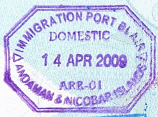
WThe Foreigners Order 1958 states that a Protected Area Permit (PAP) is required for non-Indian citizens to visit certain areas in India. Certain requirements have to be fulfilled in order to get this permit. Indian citizens who are not resident in these areas need an Inner Line Permit (ILP) to enter these places. The Inner Line Permit is significantly easier to get.
WNortheast India is the easternmost region of India representing both a geographic and political administrative division of the country. It comprises eight states – Arunachal Pradesh, Assam, Manipur, Meghalaya, Mizoram, Nagaland, Sikkim and Tripura. The region shares an international border of 5,182 kilometres (3,220 mi) with several neighbouring countries – 1,395 kilometres (867 mi) with Tibet Autonomous Region, China in the north, 1,640 kilometres (1,020 mi) with Myanmar in the east, 1,596 kilometres (992 mi) with Bangladesh in the south-west, 97 kilometres (60 mi) with Nepal in the west, and 455 kilometres (283 mi) with Bhutan in the north-west. It comprises an area of 262,230 square kilometres (101,250 sq mi), almost 8 percent of that of India
 W
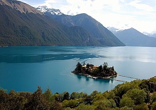
WSikkim is a state in northeastern India. It borders the Tibet Autonomous Region of China in the north and northeast, Bhutan in the east, Nepal in the west, and West Bengal in the south. Sikkim is also close to India's Siliguri Corridor near Bangladesh. Sikkim is the least populous and second smallest among the Indian states. A part of the Eastern Himalaya, Sikkim is notable for its biodiversity, including alpine and subtropical climates, as well as being a host to Kangchenjunga, the highest peak in India and third highest on Earth. Sikkim's capital and largest city is Gangtok. Almost 35% of the state is covered by the Khangchendzonga National Park - a UNESCO World Heritage Site.
 W
WTripura is a state in northeastern India. The third-smallest state in the country, it covers 10,491 km2 (4,051 sq mi) and is bordered by Bangladesh to the north, south, and west, and the Indian states of Assam and Mizoram to the east. In 2011 the state had 3,671,032 residents, constituting 0.3% of the country's population.
 W
WUndivided Assam refers to the then undivided greater state of Assam in India soon after the Indian Independence in 1947 until 1963. In addition to the present-day Assam, it included the current states of Arunachal Pradesh, Meghalaya, Nagaland and Mizoram. The capital of this state was Shillong, currently the capital of Meghalaya.