 W
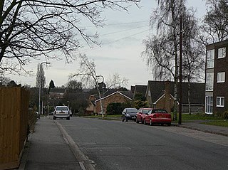
WAbington Vale is an area of Northampton in Northamptonshire, England. Abington Vale lies just to the north of the A45 road and the River Nene; Abington Vale is about 2 miles (3.2 km) north-east from the centre of Northampton.
 W
WAbington is a district of the town of Northampton, Northamptonshire, England, situated about 2 miles (3.2 km) east of the town centre. The population of the ward of Northampton Borough Council at the 2011 census was 9,668.
 W
WBilling is a civil parish in eastern Northampton in England, covering the Great Billing, Little Billing, Ecton Brook and Bellinge areas. It is geographically the largest area of Northampton. According to the 2001 census the parish had a population of 8,642, decreasing at the 2011 census to 8,457. Billing consists of four estates, with each estate constituting a ward of the parish. Great Billing and Little Billing were developed around the existing villages; Bellinge and Ecton Brook were created as new communities. Billing is accessible by the A45 westward to Northampton which runs along the south side of Billing and is accessed through the Lumbertubs Way Interchange.
 W
WCollingtree is a village in the Borough of Northampton and a civil parish in Northamptonshire, England. It is part of the Northampton built-up area.
 W
WCollingtree Park is a district in the Borough of Northampton in the East Midlands of England.
WCotton End is a small district of the town of Northampton, England, about half a mile south of the town centre, north of the area known as Far Cotton and west of the road from South Bridge to Ransome Road known as Cotton End. The district population is included in the Delapre and Briar Hill Ward of Northampton Council.
 W
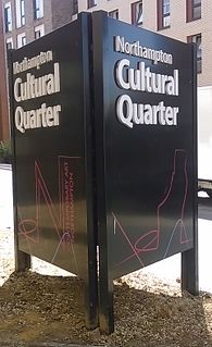
WThe Cultural Quarter of the town Northampton, England, is a Northampton Borough Council initiative to promote the depressed centre of the town. Part of it was referred to as Derngate, the name of a gate in the old town walls.
 W
WDallington is a former village about 1.5 miles (2.4 km) northwest of the centre of Northampton, the county town of Northamptonshire, England. Dallington is now a suburb of Northampton. At the 2011 census the population was listed in the Spencer ward of Northampton Council.
 W
WDuston is a suburb of and civil parish in the borough of Northampton, Northamptonshire, England.
 W
WEast Hunsbury is a large residential area in the south of the town of Northampton, England, 3 miles (5 km) from the town centre and 1 mile (2 km) from the M1 motorway, junction 15. For administrative purposes it is part of the Borough of Northampton. It is part of the Hunsbury residential area, which also includes West Hunsbury on the west side of Towcester Road. Shelfleys is the original name for the area of Northampton currently referred to as West Hunsbury. The name of West Hunsbury still appears on maps for the district as Shelfleys. Merefield is the corresponding name for East Hunsbury, together with the name "Blackymore" for the eastern part of East Hunsbury. All three names are still on local direction signs in Northampton, although older references are no longer in use by the local people living there. The areas developed in the 1980s and 1990s as part of the expansion of Northampton. The Northampton loop of the West Coast Main Line railway running between Northampton and London Euston runs under East and West Hunsbury via the Hunsbury Hill Tunnel emerging near Hill Farm Rise which follows the original course of Towcester Road prior to the 1980s. Ventilation shafts are visible in the housing estate in Yeoman Meadow.
WFar Cotton is a district in the civil parish of Far Cotton and Delapre, in the town of Northampton, in the county of Northamptonshire, England and many years ago a village in its own right. The population is included in the Delapre and Briar Hill Ward of Northampton Borough Council.
 W
WHardingstone is a village in Northamptonshire, England. It is on the southern edge of Northampton, and now forms a suburb of the town within the Northampton Borough Council area. It is about 1 mile (2 km) from the town centre. The Newport Pagnell road separates the village from the nearby village of Wootton, which has also been absorbed into the urban area.
 W
WKingsthorpe is a northern suburb and civil parish of the county town of Northampton, England. The 2011 Census recorded the population of the district council ward as 4,477.
WQueen's Park is a district of the town of Northampton, England.
WRound Spinney is a locality in the north-east of the English town of Northampton.
 W
WSixfields is an area of Northampton, Northamptonshire, England about 1 mile (1.6 km) west of the town centre along the A4500 St James Road and Weedon Road towards M1 junction 16 about 2 miles (3.2 km) further west. It is close to the Duston, Upton and St James areas of the town. Located next to The River Nene and The Grand Union Canal, Sixfields is often called "The Starcity of Northamptonshire".
WSpinney Hill is an area of Northampton, England, to the north of the town, in the Parklands ward. It is bordered by a semi-wild park area called Bradlaugh Fields, another more traditional park, allotments and a residential area.
 W
WSt. James End also known as simply St. James and historically St James's End is a district west of the town centre in Northampton, England. The area developed from the mid to late 19th century particularly with the expansion of the shoe manufacturing and engineering industries, and also the extension of the railway from London in June 1882.
 W
WUpton is a civil parish north-east of Kislingbury and south-west of Dallington, in Northamptonshire, England about 3.5 miles (6 km) west of Northampton town centre along the A4500 road. Formerly a scattered hamlet, it is now part of the town. The area west of Northampton is now a major area of expansion of the town and named Upton after the parish.
 W
WVictoria Park is a public green space in St. James End, Northampton, England, south of Spencer Bridge Road. The park has open grass areas and lines and belts of trees. A stream, a tributary of the River Nene flows from north to south through the park on the east side next to the railway line. A small stream, Dallington Brook, also flows through the park from the north-west joining the Nene tributary. The park has an area of about 6.5 hectares.
WWest Hunsbury is a large housing estate in the south of the town of Northampton, 2 miles (3 km) from the town centre, 0 miles (0 km) from the M1 motorway, junction 15A and 2 miles (3 km) from junction 15. The motorway can be seen and heard as most of the area is elevated and the wind's prevailing direction is westerly. It is part of the Hunsbury residential area, which also constitutes East Hunsbury east of Towcester Road. Shelfleys is an earlier name for the area and still appears on signs, maps and bus destination indicators. However Hunsbury is an old name. Iron ore was formerly quarried in the area.This had begun by 1873 and an ironworks called Hunsbury Ironworks was in the course of being built in that year. The quarries were worked by several companies and individual owners, two of which companies used the name "Hunsbury" in their titles. The area is part of the Borough of Northampton. The area was developed in the 1970s, 1980s, 1990s and 2000s as part of the expansion of Northampton.
 W
WWeston Favell is an area near the eastern end of Northampton, and is part of Park ward of the Borough of Northampton.
WWootton is a former village about 3 miles (4.8 km) south of Northampton town centre that is now part of the Northampton Borough Council area.