 W
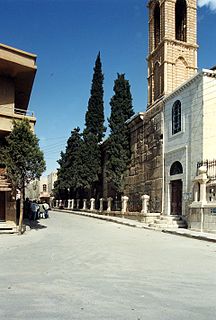
WAl-Jdayde is a historic predominantly Christian neighbourhood of Aleppo. It is noted for its winding narrow alleys, richly decorated mansions and churches. It was an area of significant cultural and historical interest. Much of Al-Jdayde suffered catastrophic damage during the Syrian civil war.
 W
WAl-Qassaa is a neighborhood and district of the Sarouja municipality in Damascus, Syria. Qassaa is situated in the northeastern part of the city and borders the Old City neighborhood of Bab Tuma. It had a population of 11,467 in the 2004 census. Al-Qassaa's inhabitants are predominantly upper class Christians.
W'Amar al-Husn is a village in northern Syria located west of Homs in the Homs Governorate. According to the Syria Central Bureau of Statistics, Amar al-Husn had a population of 373 in the 2004 census. Its inhabitants are predominantly Christians.
WAutan is a village in northern Syria located northwest of Homs in the Homs Governorate. According to the Syria Central Bureau of Statistics, Autan had a population of 583 in the 2004 census. Its inhabitants are predominantly Maronites.
WBahzinah is a village in northern Syria located west of Homs in the Homs Governorate. According to the Syria Central Bureau of Statistics, Bahzinah had a population of 586 in the 2004 census. Its inhabitants are predominantly Christians.
WAl-Bayyadiyah is a village in northern Syria, administratively part of the Hama Governorate, located southwest of Hama. Nearby localities include al-Bayda and district center Masyaf to the northwest, Ayn Halaqim to the southwest, Baarin and Nisaf to the south, Aqrab to the southeast and al-Muah to the east. According to the Syria Central Bureau of Statistics (CBS), al-Bayyadiyah had a population of 2,701 in the 2004 census. Its inhabitants are predominantly Alawites and Christians.
WDeir Atiyah or Dayr Atiyah is a city in Syria, located between the Qalamoun Mountains and the Eastern Lebanon Mountains Series, 88 kilometres (55 mi) north of the capital Damascus and on the road to the city of Homs. According to the Syria Central Bureau of Statistics (CBS), Deir Atiyah had a population of 10,984 in the 2004 census.
WAl-Hamah is a village on the Barada river in the Qudsaya District of Rif Dimashq in southern Syria. It is west of the Syrian capital of Damascus city, beyond Mount Qasioun, and is now an outlying suburb of greater Damascus. It is between Qudsaya to the south and Jamraya to the north.
WHisyah is a town in central Syria, administratively part of the Homs Governorate, located about 35 kilometers south of Homs. Situated on the M5 Highway between Homs and Damascus, nearby localities include al-Qusayr and Rableh to the northwest, Shamsin and Jandar to the north, Dardaghan to the northeast, Sadad to the southeast and Bureij to the south. According to the Central Bureau of Statistics (CBS), Hisyah had a population of 5,425 in the 2004 census. Its inhabitants are mostly Sunni Muslims and Catholics.
WKafr Buhum is a town in central Syria, administratively part of the Hama Governorate, located 9 km southwest of Hama, 210 km (130 mi) north Damascus and 160 km (99 mi) south of Aleppo. Nearby localities include al-Rabiaa and Matnin to the northwest, Tayzin to the north, al-Khalidiyah to the east, Tell Qartal to the southeast, Birin to the south and al-Muah to the southwest. According to the Syria Central Bureau of Statistics (CBS), Kafr Buhum had a population of 12,194 in the 2004 census. Its inhabitants are predominantly Christian. It is 330 meters (1082 ft) above the sea level.
WAl-Khreibat is a village and suburb in northwestern Syria, administratively part of the Tartus Governorate, located southeast of Tartus. Nearby localities include Beit Kammun to the south, Dibbash to the southeast, Tayshur to the east, and al-Shaykh Saad to the north.
WKinsabba is a town in northwestern Syria administratively belonging to the Latakia Governorate, located northeast of Latakia. Nearby localities include Slinfah to the south, al-Haffah to the southwest, Balloran and Umm al-Tuyour to the west, Qastal Ma'af to the northwest, al-Najiyah to the northeast, Qarqur to the east and Sirmaniyah to the southeast. According to the Syria Central Bureau of Statistics (CBS), Kinsabba had a population was 514 in 2004. It is the administrative center, but 16th largest locality, of the Kinsabba nahiyah ("subdistrict") which contains 35 localities with a collective population of 17,615. Its inhabitants are predominantly Christians.
 W
WMaarat Saidnaya, or Maaret Saidnaya is a mountainous village in Al-Tall District of Damascus's Countryside Rif Dimashq Governorate, Syria. It sets on the plains of the Qalamun Mountains that are overlooked by nearby city of Saidnaya at 1,200 metres above sea level, 28 kilometres (17 mi) north of the city of Damascus. According to the Syria Central Bureau of Statistics (CBS), Maarat Saidnaya had a population of 3,084 in the 2004 census. In 1838, its inhabitants were Sunni Muslim, Greek Orthodox Christians and Catholic Christians.
 W
WMahardah, also spelled Mhardeh or Muhardah, is a city in northern Syria, administratively part of the Hama Governorate, located about 23 kilometers northwest of Hama. It is situated along the Orontes River, near the Ghab plain. Nearby localities include Halfaya and Taybat al-Imam to the east, Khitab to the southeast, Maarzaf to the south, Asilah and Jubb Ramlah to the southwest, Shaizar, Safsafiyah, Tremseh and Kafr Hud to the west and Kafr Zita and al-Lataminah to the north.
WAl-Mushrifah is a village in central Syria, administratively part of the Homs Governorate, located northeast of Homs, with a population of 14,868 in 2004. Nearby localities include Ayn al-Niser, Umm al-Amad and al-Mukharram to the east, and Talbiseh, al-Ghantu and Teir Maalah to the west. Outside the modern town is Tell el-Mishrife, the site of the ancient city-state of Qatna. It has a religiously mixed population of Sunni Muslims, Alawites and Christians. The village contains several mosques and two churches.
WMuzayraa is a town in northwestern Syria administratively part of the Latakia Governorate, located east of Latakia. Nearby localities include Difa and Hanadi to the west, al-Jandiriyah to the northwest, al-Haffah and Ayn al-Tineh to the north, Slinfah to the northeast, Shathah to the east and Qardaha to the south. According to the Syria Central Bureau of Statistics (CBS), Muzayraa had a population was 834 in the 2004 census. It is the administrative center and the fourth largest locality of the Muzayraa nahiyah ("subdistrict") which contained 27 localities with a collective population of 13,908 in 2004. Its inhabitants predominantly Christians.
 W
WAn-Nabek or Al-Nabek is a Syrian city administratively belonging to Rif Dimashq and the capital of the Qalamoun. Located 81 kilometers (50 mi) north of Damascus and south of Homs. It has an altitude of 1255 meters. According to the Syria Central Bureau of Statistics (CBS), An-Nabek had a population of 32,548 in the 2004 census. The Monastery of Saint Moses the Abyssinian is located along the Anti-Lebanon Mountains near Nabek and dates back to at least the 6th century.
WQatana is a city in southern Syria, administratively part of the Qatana District of Rif Dimashq Governorate. Qatana has an altitude of 879 meters. According to the Syria Central Bureau of Statistics, the city had a population of 33,996 in the 2004 census. It is the administrative center of the Qatana Subdistrict, which contained 20 localities with a collective population of 147,451 in 2004.
WAl-Qunaya is a village in northwestern Syria, administratively belonging to the Idlib Governorate, located northwest of Idlib, 35 km north of Jisr ash-Shugur, and is in between Lattakia and Aleppo. Al-Qunaya is situated 450 meters (1476 ft) above sea level. According to the Syria Central Bureau of Statistics, al-Qunaya had a population of 587 in the 2004 census. Its inhabitants are predominantly Christians.
WAl-Qusayr is a city in western Syria, administratively part of the Homs Governorate. It is located about 35 kilometers (22 mi) south of Homs and is situated in a mountainous area overlooking Syria's border with Lebanon which lies 15 kilometres to the southwest. Nearby localities include Rablah and Zira'a to the south, Jandar further to the east, al-Dabaah to the northeast, Arjoun to the northwest and Aqrabiyah to the west. Al-Qusayr has an altitude of 540 meters (1,770 ft).
WAl-Rawda is a small town in northwestern Syria, administratively part of the Tartus Governorate. It is situated along the Mediterranean coast and just west of the Syrian Coastal Mountains in between Tartus and Baniyas. According to the Syria Central Bureau of Statistics (CBS), al-Rawda had a population of 3,131 in the 2004 census. It is the administrative center of the Rawda Subdistrict (nahiyah) which consisted of nine localities with a collective population of 11,688. Its inhabitants are predominantly Christians, from various denominations.
 W
WSaidnaya is a city located in the mountains, 1,500 m (4,900 ft) above sea level, 27 km (17 mi) north of the city of Damascus in Syria. It is the home of a Greek Orthodox monastery traditionally held to have been founded by Byzantine emperor Justinian I, and where a renowned icon of the Virgin Mary is revered by both Christians and Muslims to this day. The town is noted for the large number of Aramaic speakers, along with nearby Maaloula and few smaller towns nearby such as Maarat Saidnaya. According to the Syria Central Bureau of Statistics (CBS), Saidnaya had a population of 25,194 in the 2004 census.
WAl-Samaqiyat, also spelled al-Summaqiyat or Smaqiyat, is a village in southern Syria, administratively part of the Daraa Governorate, located east of Daraa and south of Bosra. Other nearby localities include al-Mataaiya to the west and Samad to the northeast. According to the Syria Central Bureau of Statistics (CBS), Samaqiyat had a population of 511 in the 2004 census.
 W
WYabroud or Yabrud is a city in Syria, located in the Rif Dimashq governorate about 80 kilometres (50 mi) north of the capital Damascus. According to the Syria Central Bureau of Statistics (CBS), Yabroud had a population of 25,891 in the 2004 census.