 W
WAvenue Campus is a campus of the University of Southampton and is located in Southampton, England. It currently houses most of the University's Faculty of Humanities. It is located off The Avenue, borders Southampton Common and is less than a mile from the University's main Highfield Campus.
 W
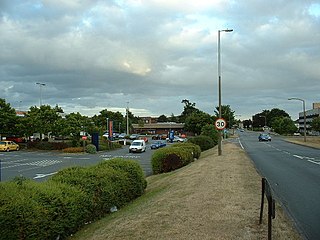
WBassett Green is a suburb of Southampton, which has grown from the original small village of Basset. It remains part of the electoral ward of Bassett(q.v. for population). The area is mainly residential, with a mixture of Herbert Collins-designed houses and council built estates known as the Flowers Estate and the Leaside Way Estate. Within Bassett Green are a community centre, Bassett Green Primary School and Southampton Crematorium, as well as several of the University of Southampton's halls of residence.
 W
WBevois Valley is an inner city area of Southampton, England, within Bevois Electoral Ward, and includes areas called Bevois Town and Bevois Mount. The area lies south of and adjoins Portswood and is within easy walking distance of the city centre. It follows the line of the original valley of the River Itchen and as such the land is primarily clays and shingles.
 W
WBitterne Manor is a suburb of Southampton surrounding the manor house of the same name. It is located on the eastern bank of the River Itchen, across Cobden Bridge from St Denys.
 W
WBoldrewood Innovation Campus is one of the University of Southampton’s campuses, located in Bassett, Southampton. The newly built campus is a centre where business, research and education coexist in engineering sciences, maritime engineering and other maritime disciplines. The state-of-the-art campus is also home to the University’s strategic partner Lloyd’s Register. Also based at the campus are the Southampton Marine and Maritime Institute, the Transportation Research Group, the Airbus Noise Technology Centre and the Rolls Royce University Technology Centre for Computational Engineering.
 W
WHighfield Campus is the main campus of the University of Southampton and is located in Southampton, southern England. It is the largest of the University's campuses with most of the students studying there. The campus is also the location of the main university library, the students' union as well as sports facilities.
 W
WHighfield is a suburb of Southampton, England. The suburb is situated to the north of the city centre, and is bounded by Southampton Common, Bassett, Swaythling and Portswood. Highfield is home to the main campus of the University of Southampton, which is built on a former brickfield.
 W
WItchen Ferry village was a small hamlet on the East bank of the River Itchen in Hampshire. The village took its name from the small fishing boats that were also used to ferry foot passengers across the river. An Ordnance Survey map of 1911 (NC/03/17894) shows the village to be situated in the area roughly bounded by Sea Road, Oakbank Road, the River Itchen and the railway line in modern Woolston, but also extending along Sea Road towards Peartree Green on the other side of the railway, which cut the village in half in 1866. Neighbouring streets on that same map, Defender Road, Britannia Road and Shamrock Road have a more structured layout and are clearly part of the Victorian enlargement of Woolston. The same map clearly shows the housing in Itchen Ferry village to have a more random layout. An even older map, of 1842 pins Itchen Ferry village more tightly to the area between Sea Road and Vicarage Road.
 W
WLordshill is a district in Southampton, England. It is situated in the northern part of the city.
 W
WLordswood is a district in Hampshire, England. It is situated in the northern quarter of greater Southampton bordering the areas of Lordshill, Chilworth, Aldermoor and Bassett.
 W
WMansbridge is a suburb on the northern perimeter of Southampton, England. The area is named after the Mans Bridge which spans the River Itchen. For a considerable time, this was the southernmost crossing point of the river, before the construction of Woodmill in Swaythling. The bridge itself still stands and is a Grade II listed structure but is closed to road traffic, having been replaced by a larger and more modern road bridge to carry the A27.
 W
WMidanbury is a small suburb of Southampton, England, bordering Bitterne, Bitterne Park and Townhill Park.
 W
WNicholstown-Newtown is a small area to the north-east of Southampton's city centre. To the north is Bevois Valley, to the east Northam and to the west and south is St Mary's. In the north of Newtown is the Mount Pleasant area, which spills over into the north of Northam. Black signs saying "Welcome to Nicholstown-Newtown" demarcate the district on the roads running east from St. Mary's Rd – hence the district is bordered on the west by St. Mary's Road, the south by Six Dials road, and the east by the railway lines.
 W
WNortham is a suburb of Southampton in Hampshire. On the West bank of the River Itchen, it shares borders with St Mary's, Bitterne and Bevois Valley. Beside the border with St Mary's is the Chapel area, which has been home to some recent apartment building developments in Northam. The A3024 road runs through the suburb and crosses the Northam Bridge, which links Northam with Bitterne via Bitterne Manor. Although St Mary's Stadium takes its name from the neighbouring St Mary's, the stadium itself is in Northam, and home to Southampton F.C..
 W
WOcean Village is a mixed-use marina, residential, business and leisure development on the mouth of the River Itchen in Southampton, on the south coast of England. Originally the site of Southampton's first working docks, the "Outer Dock" which opened in 1842, the area was redeveloped in 1986 and became the leisure marina it is today. After experiencing a period of stalled development with the late-2000s recession, Ocean Village underwent another series of major, multimillion-pound redevelopment projects. Current recreational facilities include a cinema, cafes, wine bars and restaurants.
 W
WPeartree Green is an open space on high ground on the east bank of the River Itchen in Southampton. A 16/17th century building, Peartree House, still stands, though is today concealed by private housing. The house and the green take their name from a pear tree that grew near the parish church. Some of the original open space has been built on, but a large proportion remains as a recreational area. It contains a church and the remains of a boarding school. It overlooks the River Itchen to St Mary's Church in Southampton.
 W
WThe Polygon is an area in the city of Southampton, England.
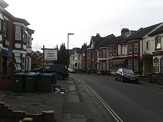
WRegents Park is a suburb of Southampton in England. A large house and grounds, after which the area is named, formerly occupied the land with the current Regents Park Road following the route of the Carriage Drive. A former gatehouse or lodge which once guarded the entrance to this still stands at the junction Bard of Regents Park Road, Waterhouse Lane and St Edmunds Road. Victorian "villa" style houses occupying the Northern part of Regents Park Road represent the initial phase of redevelopment following demolition of the large house. Later Victorian and then Edwardian properties followed before much of the Southern part of the road was given over to 1930's style semi-detached and detached housing. This phase of development eventually extended West to King George's Avenue and North to Oakley Road and South to what is now the main Millbrook Road. It is this area which is now generally known as Regents Park, although the description is a loose one and is also taken to include the housing between Oakley Road and Shirley High Street / Romsey Road, which is also the location of the former Regents Park girls school, now Regents Park Community College. The area now consists mainly of private housing, and it is sometimes seen as being part of neighbouring Millbrook or Shirley. Millbrook neighbours Regents Park to the west, with Shirley to the north and Freemantle to the east. Southampton's container port and Southampton Water are to the south.
WSt Denys is a partially riverside district of Southampton, England, centred 1.5 miles (2.4 km) north north-east of the city centre facing variously Bitterne Park and quay across the River Itchen estuary. The river is here spanned in the mid-east extreme of the district by Cobden Bridge, one of five within the city's broad boundaries, six including the railway bridge 100 m south. It is separated from the city centre by the districts sometimes known as Bevois Valley and New Town, in turn.
 W
WSt Mary's is an inner city area of Southampton in England. It consists of two areas separated by Six Dials junction. The northern section of the district is bounded by St Mary's Road and some streets to the west and the area to the east is Nicholstown-Newtown. The northern section is home to the fire station.
 W
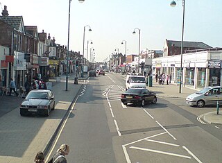
WShirley is a broad district and a former village on the western side of Southampton, England. Shirley's main roles are retailing and residential. It is the most important suburban shopping area in the west of the city. Housing is a mixture of council houses in the centre of the district surrounded by private housing, with larger suburban houses concentrated in Upper Shirley. Shirley is separated from Highfield by Southampton Common, a large green public space.
WSouthampton City Centre is the commercial and organisational centre of the City of Southampton, and the transport hub of the city. Because Southampton is on the South Coast of England, the city centre is not at the geometric centre of the city, but at the southern extremity.
 W
WThornhill is a suburb of Southampton, United Kingdom, situated on the eastern border of the city and bounded by three major roads. According to the 2001 census the population was 11,460. The under 16s represent 23.4% of the population, 5% more than the city figure of 18.2%; the over 65s represent 17.4%, again, higher than the city average of 14.5%.
 W
WTownhill Park is a suburb of Southampton, England, bordering Swaythling, Bitterne Park and West End. It is built on land which once belonged to the house which carries the same name.
WWeston is a small suburb on the south-eastern side of Southampton, UK, predominantly built on the Weston Grove Estate formerly owned by the Chamberlayne family. It also includes the area that was previously the Barnfield Estate. Weston includes part of Mayfield Park, which was previously the Mayfield Estate. Weston is bounded by Woolston, Sholing, Netley and Southampton Water.