 W
WThe geology of Norway encompasses the history of earth that can be interpreted by rock types found in Norway, and the associated sedimentological history of soils and rock types.
 W
WThe Baltic Shield is a segment of the Earth's crust belonging to the East European Craton, representing a large part of Fennoscandia, northwestern Russia and the northern Baltic Sea. It is composed mostly of Archean and Proterozoic gneisses and greenstone which have undergone numerous deformations through tectonic activity. It contains the oldest rocks of the European continent with a thickness of 250-300 km.
 W
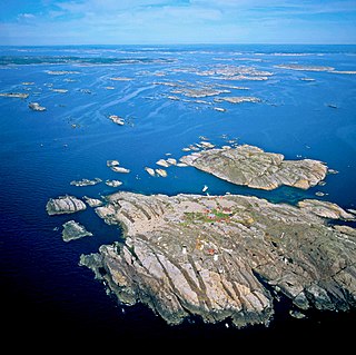
WThe Bohus granite is a type of granite that crops out along the Swedish West Coast in Bohuslän. In Norway the same granites are termed Iddefjord granite, Østfold granite and Halden granite. A large quarrying industry has developed around the granites, mainly producing blocks. Large scale extraction begun in the 1840s and employment in the quarries peaked in the 1920s with over 7,000 people working in the industry. The rock is valued for its durability. In the first half of the 20th century the transport of quarried Bohus granite was done with the aid of by the Lysekil Line. In Norway Iddefjord granite has been a relatively common rock in architecture, further many of the renown statues of Frogner Park in Oslo are made of Iddefjord granite. Iddefjord granite is the official county rock of Østfold in Norway.
 W
WThe Caledonian orogeny was a mountain-building era recorded in the northern parts of Ireland and Britain, the Scandinavian Mountains, Svalbard, eastern Greenland and parts of north-central Europe. The Caledonian orogeny encompasses events that occurred from the Ordovician to Early Devonian, roughly 490–390 million years ago (Ma). It was caused by the closure of the Iapetus Ocean when the continents and terranes of Laurentia, Baltica and Avalonia collided.
 W
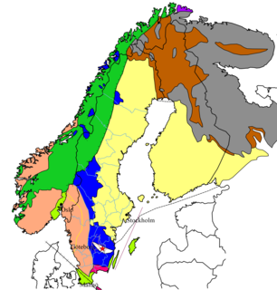
WFennoscandia or the Fennoscandian Peninsula is the geographical peninsula comprising the Scandinavian and Kola Peninsulas, mainland Finland, and Karelia. Administratively this roughly encompasses the mainlands of Finland, Norway and Sweden, as well as Murmansk Oblast, much of the Republic of Karelia, and parts of northern Leningrad Oblast in Russia.
 W
W W
WThe Hornelen Basin is a sedimentary basin in Vestland, Norway, containing an estimated 25 km stratigraphic thickness of coarse clastic sedimentary rocks of Devonian age. It forms part of a group of basins of similar age along the west coast of Norway between Sognefjord and Nordfjord, related to movement on the Nordfjord-Sogn Detachment. It formed as a result of extensional tectonics as part of the post-orogenic collapse of crust that was thickened during the Caledonian Orogeny towards the end of the Silurian period. It is named for the mountain Hornelen on the northern margin of the basin.
 W
WThe Jan Mayen hotspot is a proposed volcanic hotspot responsible for the volcanic activity that has formed the island of Jan Mayen in the northern Atlantic Ocean.
 W
WJutulhogget is a 2.4 kilometres long canyon in the municipalities of Alvdal and Rendalen in Innlandet, Norway, created by the rupture of the dam of a proglacial lake.
 W
WJutulhogget is a small canyon close to the cabin Rondvassbu by Rondvatnet in Rondane National Park, Norway. Its highest walls are approximately 20–30 meters high.
 W
WThe Kattsund-Koster dyke swarm is a collection of dykes of Mesoproterozoic age in southeastern Norway and the West Coast of Sweden. The most prominent outcrops are in the Koster Islands in Sweden and Kattsund in Norway, hence the name. The dykes are made up of tholeiitic diabase and some dykes of intermediate composition. Some dykes are deformed and metamorphosed into amphibolite. Radiometric dating has shown that the dyke swarm is about 1421 million years old. Geologists have suggested that the dyke swarm is related to extensional tectonics.
 W
WThe Kola Province is an area of the Fennoscandian Shield spanning an area near the borders of Russia, Finland and Norway including the bulk of its namesake Kola Peninsula. The continental crust that makes up the province is a collage of Mesoarchean and Neoarchean age with some lesser amounts being of Paleoproterozoic age.
 W
WThe Kvamshesten Basin is a sedimentary basin containing coarse continental clastic rocks of Devonian age. It is one of a series of basins of similar age in southwestern Norway found between Sognefjord and Nordfjord, developed in the hanging-wall of the Nordfjord-Sogn Detachment. It is named for the mountain of Kvamshesten.
 W
WThe Lapland Granulite Belt is an elongate and arcuate zone of granulite rock in the Cap of the North spanning areas within Norway, Finland and Murmansk Oblast in Russia. At most the belt is 80 km broad. The main rocks of the belt are migmatized greywacke and argillites. Studies of detrital zircon show that the sedimentary protolith of the metamorphic rocks of the belt could not be older than 2900–1940 million years. The belt has norite and enderbite intrusions of calc-alkaline chemistry.
 W
WLarvikite is an igneous rock, specifically a variety of monzonite, notable for the presence of thumbnail-sized crystals of feldspar. These feldspars are known as ternary because they contain significant components of all three endmember feldspars. The feldspar has partly unmixed on the micro-scale to form a perthite, and the presence of the alternating alkali feldspar and plagioclase layers give its characteristic silver blue sheen on polished surfaces. Olivine can be present along with apatite, and locally quartz. Larvikite is usually rich in titanium, with titanaugite and/or titanomagnetite present.
WThe Nordfjord—Sogn Detachment (NSD) is a major extensional shear zone up to 6 km in thickness, which extends about 120 km along strike from Nordfjord to Sognefjord, bringing Devonian continental coarse clastic sedimentary rocks into close contact with eclogite facies metamorphic rocks of the Western Gneiss Region. It formed towards the end of the Caledonian Orogeny and was mainly active during the Devonian. It has an estimated displacement of at least 70 km and possibly as much as 110 km. It was reactivated during the Mesozoic and may have influenced the development of fault structures in the North Sea rift basin.
WThe Protogine Zone is a geological boundary zone in western Sweden. There are two slightly different definitions of the Protogine Zone. In the lithological definition it forms the limit between the gneisses of western Sweden and the relatively underformed eastern granites. As such it makes up the limit of deformation and metamorphism attributed to the Sveconorwegian orogeny. In the tectonic definition it is a zone of strong deformation that follows roughly the same course as the lithological Protogine Zone. In the two definitions of the Protogine Zone it runs from Scania across Lake Vättern into the upper course of Klarälven and then into Norway. The tectonic Protogine Zone has anastomosing branches and splits south of Lake Vättern into various diverging arms. The two westernmost of these arms follow the valleys of the Nissan and Lagan rivers. A more eastern branch is reflected in the alignment of the lakes Rusken, Rymmen and Möckeln.
WThe Scandinavian Caledonides are the vestiges of an ancient, today deeply eroded orogenic belt formed during the Silurian–Devonian continental collision of Baltica and Laurentia, which is referred to as the Scandian phase of the Caledonian orogeny. The size of the Scandinavian Caledonides at the time of their formation can be compared with the size of the Himalayas. The area east of the Scandinavian Caledonides, including parts of Finland, developed into a foreland basin where old rocks and surfaces were covered by sediments. Today, the Scandinavian Caledonides underlay most of the western and northern Scandinavian Peninsula, whereas other parts of the Caledonides can be traced into West and Central Europe as well as parts of Greenland and eastern North America.
 W
WThe Solund Basin is a sedimentary basin containing at least 6 km of mainly coarse conglomerates of Devonian age. It is the southernmost of a group of basins of similar age found along the southwest coast of Norway between Sognefjord and Nordfjord, developed in the hanging-wall of the Nordfjord-Sogn Detachment. It was formed as a result of extensional tectonics during the post-orogenic collapse of crust thickened during the Caledonian orogeny, towards the end of the Silurian period. It is named for the municipality of Solund in Vestland.
 W
WThe three Storegga Slides are considered to be amongst the largest known submarine landslides. They occurred under water, at the edge of Norway's continental shelf in the Norwegian Sea, approximately 6225–6170 BCE. The collapse involved an estimated 290 km (180 mi) length of coastal shelf, with a total volume of 3,500 km3 (840 cu mi) of debris, which caused a megatsunami in the North Atlantic Ocean.
 W
WThe sub-Cambrian peneplain is an ancient, extremely flat, erosion surface (peneplain) that has been exhumed and exposed by erosion from under Cambrian strata over large swathes of Fennoscandia. Eastward, where this peneplain dips below Cambrian and other Lower Paleozoic cover rocks. The exposed parts of this peneplain are extraordinarily flat with relief of less than 20 m. The overlying cover rocks demonstrate that the peneplain was flooded by shallow seas during the Early Paleozoic. Being the oldest identifiable peneplain in its area the Sub-Cambrian peneplain qualifies as a primary peneplain.
 W
WThe geology of Svalbard encompasses the geological description of rock types found in Svalbard, and the associated tectonics and sedimentological history of soils and rocks. The geological exploration of Svalbard is an ongoing activity, and recent understandings may differ from earlier interpretations.
WThe Sveconorwegian orogeny was an orogenic system active 1140 to 960 million years ago and currently exposed as the Sveconorwegian orogenic belt in southwestern Sweden and southern Norway. In Norway the orogenic belt is exposed southeast of the front of the Caledonian nappe system and in nappe windows. The Sveconorwegian orogen is commonly grouped within the Grenvillian Mesoproterozoic orogens. Contrary to many other known orogenic belts the Sveconorwegian orogens eastern border does not have any known suture zone with ophiolites.
 W
WThe Timanide Orogen is a pre-Uralian orogen that formed in northeastern Baltica during the Neoproterozoic in the Timanide orogeny. The orogen is about 3000 km long. Its extreme points include the southern Urals in the south and the Polar Urals, the Kanin and Varanger peninsulas in the north. The Timan Ridge is the type area of the orogen. To the west, at the Varanger Peninsula, the north-west oriented Timanide Orogen is truncated by the younger Scandinavian Caledonide Orogen that has an oblique disposition. The northeastern parts of the orogen are made up of volcanic and sedimentary rocks, granitoids and few ophiolites. In contrast the southwestern part of the orogen is made up mostly of sedimentary rocks. I and A type granitoids and volcanic rocks are common in the orogen.
WThe Transscandinavian Igneous Belt, abbreviated TIB, is one of the major lithological units of the Baltic Shield. It consists of a series of batholiths in Sweden and Norway forming a ca. 1400 km long belt running from Lofoten, Norway, in the north to Blekinge, Sweden, in the south. The Transscandinavian Igneous Belt and its rocks solidified from magma between 1810 and 1650 million years ago during the Mesoproterozoic. The Transscandinavian Igneous Belt was likely formed in an Andean-type geological environment, implying it was once parallel to a destructive plate boundary. The belt was first identified in the 1980s and was referred as the "Transscandinavian Granite-Porphyry Belt". The current name was first applied in 1987.