 W
WBačka is a geographical and historical area within the Pannonian Plain bordered by the river Danube to the west and south, and by the river Tisza to the east. It is divided between Serbia and Hungary. Most of the area is located within the Vojvodina region in Serbia and Novi Sad, the capital of Vojvodina, lies on the border between Bačka and Syrmia. The smaller northern part of the geographical area is located within Bács-Kiskun County, in Hungary.
 W
WThe Banat is a geographical and historical region straddling between Central and Eastern Europe that is currently divided among three countries: the eastern part lies in western Romania ; the western part in northeastern Serbia ; and a small northern part lies within southeastern Hungary.
 W
WDeliblato Sands is a large sand area covering around 300 km2 (120 sq mi) of ground in Vojvodina province, Serbia. It is located in southern Banat, situated between the river Danube and the southwestern slopes of the Carpathian Mountains. The sands are named after the village of Deliblato, in the municipality of Kovin. Its main masses are elliptical shaped hills with steppe grassland plains and steppe forests.
 W
WHomolje is a small geographical region in east Serbia south of the Danube river. It is centered on the town of Žagubica, with smaller parts belonging to municipalities of Kučevo, Majdanpek and Petrovac. In the narrow sense, the term "Homolje" is applied only to the Homolje valley around Mlava river, but it is usually applied to the low Homolje mountains (940 m) north of the valley and Beljanica and Crni Vrh mountains at the south. It is sparsely populated, and renowned for its unspoiled nature.
 W
WLužnica is a region in southeastern Serbia, comprising the Lužnica river basin. It includes parts of the Babušnica municipality and two villages in Bela Palanka.
 W
WMačva is a geographical and historical region in the northwest of Central Serbia, on a fertile plain between the Sava and Drina rivers. The chief town is Šabac. The modern Mačva District of Serbia is named after the region, although the region of Mačva includes only the northern part of this district. A small northern part of Mačva region is in the Autonomous Province of Vojvodina, in the Syrmia District.
 W
WThe Morava Valley, is a general term which in its widest sense marks valleys of any of three Morava rivers in Serbia: the West Morava, the South Morava and the Great Morava. In the narrow sense, the term is applied only to the Great Morava Valley. The Serbian term follows the general manner of coining river valley names in Serbian using the prefix po- and suffix -je, meaning literally "(land) along the Morava". Morava valley lies in the central Balkans, at the crossroads which lead eastwards, towards the Black sea and Asia Minor, and further south, down the Vardar river into the Aegean sea.
 W
WThe Negotin Valley is a region in northeastern Serbia. It is isolated and distanced from other parts of Central Serbia. The Negotin Valley has unusual climatic features and hydropotential and geomorphologic sites.
 W
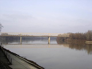
WPančevački Rit is a small geographical area in south-western Banat, Serbia. It is situated between the rivers Danube and Tamiš, in Belgrade's municipality of Palilula.
 W
WThe Pešter plateau (Serbian: Пештерска висораван, romanized: Pešterska visoravan, or simply Pešter (Serbian Cyrillic: Пештер, pronounced [pɛ̌ʃtɛr], is a karst plateau in southwestern Serbia, in the Raška region. It lies at the altitude of 1150–1492 m, at 1492 meters. The territory of the plateau is mostly located in the municipality of Sjenica, with parts belonging to Novi Pazar and Tutin.
 W
WPocerina is a region of western Serbia, and includes hills and plains on the north of the mountain Cer. It covers the area to Mačva and Posavina. Pocerina got its name from the mountain Cer. According to folk legends, the mythical Serbian hero Miloš Obilić hailed from this area.
 W
WPodrinje is the Slavic name of the Drina river basin, known in English as the Drina Valley, located in Bosnia and Herzegovina and Serbia.
 W
WPomorišje is a historical geographical region on the banks of the river Mureş that in the past has had a sizable ethnic Serb population. The region is mostly divided between Romania and Hungary, with small part of it in northern Serbia. Today, a Serb minority is present in parts of the region that are part of Romania and Hungary.
 W
WPosavina is a geographical region that stretches along the Sava river, encompassing only the inner areas of the Sava river basin, that are adjacent or near to the Sava river itself, in Croatia, Bosnia and Herzegovina, and Serbia.
 W
WPotisje is the name of the Tisa river basin parts located in Serbia, in the autonomous province of Vojvodina. The river Tisa flow between Banat and Bačka regions.
 W
WRaška is a geographical and historical region, covering the south-western parts of modern Serbia, and historically also including north-eastern parts of modern Montenegro, and some of the most eastern parts of modern Bosnia and Herzegovina. In the Middle Ages, the region was a center of the Serbian Principality and of the Serbian Kingdom, one central settlement of which was the city of Ras in the late 12th century. Its southern part corresponds to the region of Sandžak
 W
WRavna Gora is a highland in central Serbia, at the mountain of Suvobor. It is renowned as the birthplace of the modern Chetnik movement under the leadership of Dragoljub Mihailović in 1941.
 W
WŠajkaška (Шајкашка) is a historical region in northern Serbia. It is southeastern part of Bačka, located in the Autonomous Province of Vojvodina. Territory of Šajkaška is divided among four municipalities: Titel, Žabalj, Novi Sad, and Srbobran. Historical center of Šajkaška is Titel.
 W
WSerbian Carpathians is a mountain range in eastern Central Serbia. It presents an extension of proper Carpathian Mountains across the Danube, connecting them with the Balkan Mountains in the southeast. They stretch in north-south direction in eastern Serbia, east of the Great Morava valley and west of the White Timok Valley and north of the Nišava Valley. The mountains are 800–1500 m high, and dominated by karst limestone geologic features, the highest one being Rtanj Mountain.
 W
WSpačva basin is a geographic microregion in Croatia. It is located in the south-western part of Syrmia—the latter being divided by Croatia and Serbia—and the southeastern part of Slavonia macroregion of Croatia, around Spačva river and river Studva. The region's 40.000 hectares of oak forests makes Spačva basin one of the largest continuous lowland oak forests in Europe. In addition, the region forms an organic continuum with the Bosutska šuma literally Bosut Forest in Vojvodina in Serbia. Bosutska šuma is one of two strict nature reserves in Vojvodina. Spačva basin and Bosutska šuma forms the northern section of forest and swampland complex spreding south of Sava river as the Donje Podrinje into Bosnia and Herzegovina and Central Serbia. Wood industry based in Spačva basin is important in the economical life of Vukovar-Srijem County. The major settlement in the region is the town of Otok.
WRaška is a geographical and historical region, covering the south-western parts of modern Serbia, and historically also including north-eastern parts of modern Montenegro, and some of the most eastern parts of modern Bosnia and Herzegovina. In the Middle Ages, the region was a center of the Serbian Principality and of the Serbian Kingdom, one central settlement of which was the city of Ras in the late 12th century. Its southern part corresponds to the region of Sandžak
 W
WŠumadija is a geographical region in the central part of Serbia. The area used to be heavily covered with forests, hence the name. The city of Kragujevac is the administrative center of the Šumadija District in the Šumadija and Western Serbia statistical region.
 W
WSyrmia is a region of the southern Pannonian Plain, which lies between the Danube and Sava rivers. It is divided between Serbia and Croatia. Most of the region is flat, with the exception of the low Fruška gora mountain stretching along the Danube in its northern part.
 W
WThe Timok Valley is a geographical region in east-central Serbia around the Timok River. The Timok Valley corresponds to parts of two Serbian districts, with a total 2002 census population of 284,112.
 W
WVisok is a region in eastern Serbia and westernmost Bulgaria that lies between the main ranges of the Balkan Mountains and Vidlič Mountain. It is located 35 km (22 mi) from Pirot, and about 350 km (220 mi) from Belgrade.
 W
WVlasina is a mountainous region of southeastern Serbia. It is a border area to Bulgaria, a region of the Rhodopian Serbia, with old rocks and mountains. Its most prominent landforms are eponymous Vlasina River and Vlasina Lake. It corresponds to the territories of municipalities of Crna Trava, Vlasotince and Surdulica.