 W
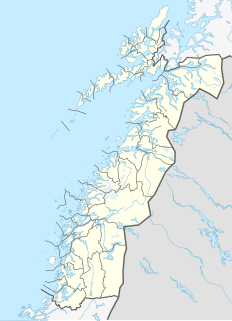
WThe Norway–Sweden border is a 1,630-kilometre (1,010 mi) long land national border, and the longest border for both Norway and Sweden.
 W
WBåvrojávrre is a lake that lies on the border between Norway and Sweden. Most of the 6.08-square-kilometre (2.35 sq mi) lake lies in Norway in Narvik Municipality in Nordland county. Only 0.61 square kilometres (0.24 sq mi) of the lake lies in Sweden in Gällivare Municipality in Norrbotten County. The lake Baugevatnet lies just to the north. The ending -jávrre is the Lule Sami word for lake.
WGautelisvatnet (Norwegian) or Guovdelisjávri (Northern Sami) is a lake that is located on the border of Norway and Sweden, about 50 kilometres (31 mi) southeast of the town of Narvik. The Norwegian side lies in Narvik Municipality in Nordland county and the Swedish side lies in Gällivare Municipality in Norrbotten County. The 17.67-square-kilometre (6.82 sq mi) lake has a dam on the northern end and the water is used for hydropower. After the dam was built, the lake grew and merged with the lake Vannaksvatnet to the south. The lake Unna Guovdelisjávri lies just to the east of this lake.
 W
WGresvatnet (Norwegian) or Gräsvattnet (Swedish) or Graesiejaevrie (Southern Sami) is a lake on the border between Norway and Sweden. Most of the lake lies in Hemnes Municipality in Nordland county (Norway) and then a small portion crosses the border into Storuman Municipality in Västerbotten County (Sweden). The lake lies about 25 kilometres (16 mi) east of the village of Korgen, and just a few kilometres northeast of the mountain Oksskolten and the Okstindbreen glacier. The lake is one of the upper reservoirs for the Bjerka Hydroelectric Power Station.
 W
WHolderen is a lake on the border between Sweden and Norway. The 1.83-square-kilometre (0.71 sq mi) Norwegian part is located inside Blåfjella–Skjækerfjella National Park in the municipality of Snåsa in Trøndelag county. The 6.44-square-kilometre (2.49 sq mi) Swedish part is located in the municipality of Åre in Jämtland County. The lake lies about 3 kilometres (2 mi) south of the lake Grøningen.
 W
WIddefjord ; Swedish: Idefjorden) is a classic fjord with a narrow watercourse and steep natural formations on both sides. It runs along the Norwegian-Swedish border from the Singlefjord. The Iddefjord separates the province of Bohuslän in the county of Västra Götaland in Sweden from the municipality of Halden in the county of Østfold in Norway. It opens to the Skagerrak via the Svinesund and Hvaler archipelago. The outermost stretch is called the Ringdalsfjord, but from the point where it makes a sharp bend and further south, it is called the Iddefjord. Like several other fjords, it was named after a part of its coast, in this case the parish of Idd.
WKingen is a lake on the border between Sweden and Norway. The Norwegian part is located in the municipality of Lierne in Trøndelag county, and the Swedish part is located in the municipality of Krokom in Jämtland County. It lies south of the larger lake Rengen.
WTjårdavatnet or Kjårdavatnet (Norwegian) or Čoađgejávri (Northern Sami) is a lake that is located on the border of Norway and Sweden, about 15 kilometres (9.3 mi) south of the village of Elvegård in Norway. The Norwegian side lies in Narvik Municipality in Nordland county and the Swedish side lies in Gällivare Municipality in Norrbotten County. The lake has an area of about 3.63 square kilometres (1.40 sq mi), with 3.5 square kilometres (1.4 sq mi) being in Norway, the tiny remainder is in Sweden.
WLangvatnet (Norwegian) or Tjoaddnejávrre (Lule Sami) is a lake that lies on the border between Norway and Sweden. Almost all of the lake is located in Hamarøy Municipality in Nordland county, Norway with a very small part of the lake in Jokkmokk Municipality in Norrbotten County, Sweden. The 5.46-square-kilometre (2.11 sq mi) lake is located about 20 kilometres (12 mi) southeast of the village of Kjøpsvik in Tysfjord.
 W
WLeinavatn (Norwegian) or Lenesjávri (Northern Sami) is a lake on the border between Norway and Sweden. It is almost entirely located in Bardu Municipality in Troms og Finnmark county in Norway, but a very small area crosses over into Kiruna Municipality in Norrbotten County in Sweden. The lake's area is 28.32 square kilometres (10.93 sq mi) and it sits at an elevation of 491 metres (1,611 ft) above sea level. Its shoreline measures 62.83 kilometres (39.04 mi).
WLeirvatnet is a lake located on the border between Norway and Sweden. The majority of the 2.57-square-kilometre (0.99 sq mi) lake lies in Sørfold Municipality in Nordland county, Norway, and the remaining 0.06 square kilometres of the lake are located in Jokkmokk Municipality in Norrbotten County, Sweden. The lake lies at one end of the large Blåmannsisen glacier.
WLitlumvatnet (Norwegian), Lill-Uman (Swedish), or Jovsjaevrie (Southern Sami) is a lake on the border of Norway and Sweden. The Norwegian side lies in Rana Municipality in Nordland county and the Swedish side lies in Storuman Municipality in Västerbotten County. The lake lies about 40 kilometres (25 mi) southeast of the town of Mo i Rana. The lake is 5.24 square kilometres (2.02 sq mi) and about 1.8 square kilometres (0.69 sq mi) lies inside Norway and the rest lies in Sweden.
WNasa Mountain is a 1,211-metre (3,973 ft) tall mountain that is situated on the border of Sweden and Norway. It is located near Arjeplog in Arjeplog Municipality in western Norrbotten County in Sweden and near Dunderland in the municipality of Rana in Nordland county, Norway. There is a marker at the summit of the mountain denoting the border between the two countries. The mountain is best known for the Nasa silver mine. The mining area still has a number of old quarries, some ruins, and a cemetery. There is also a restored miners cottage from 1889 located on the site.
 W
WØst-Trøndelag is an unofficial and polemic name for the Swedish regions Jämtland and Härjedalen which until 1645 belonged to Norway. As the name suggests, the region lies to the east of the Norwegian region of Trøndelag.
 W
WÖveruman or Uman is a lake on the border between Norway and Sweden. Most of the 52.49-square-kilometre (20.27 sq mi) lake is located in Storuman Municipality in Västerbotten County in Sweden. A small 3.17-square-kilometre (1.22 sq mi) part of the lake, known as Umbukta, is located in Rana Municipality in Nordland County in Norway. The European route E12 highway runs along the eastern side of the lake. The lake lies just southeast of the large lake Storakersvatnet.
WRanseren (Norwegian), also known as Bije-Ransarn (Swedish) or Bijjie Raentsere (Southern Sami), is a lake on the border between Norway and Sweden. The Norwegian side lies in Hattfjelldal Municipality in Nordland county. The Swedish side of the lake is called Bije-Ransaren, which means "the upper Ransaren" and this part lies in Vilhelmina Municipality in Västerbotten County.
WRengen is a lake on the border between Sweden and Norway. The 21.49-square-kilometre (8.30 sq mi) lake covers 15.72 square kilometres (6.07 sq mi) in Norway and 5.77 square kilometres (2.23 sq mi) in Sweden. The Norwegian part is located in the municipality of Lierne in Trøndelag county, and the Swedish part is located in the municipality of Krokom in Jämtland County. Water flows into Rengen from the lake Ulen to the north.
WThe Norway–Sweden border is a 1,630-kilometre (1,010 mi) long land national border, and the longest border for both Norway and Sweden.
WRogen or Rovje is a lake on the border of Sweden and Norway. The lake is mostly located in Härjedalen Municipality in Jämtland county in Sweden with a small portion crossing the Norwegian border in the municipalities of Røros and Engerdal. The 35.12-square-kilometre (13.56 sq mi) lake is the source of Sweden's longest river, Klarälven.
WRostojávri (Northern Sami), Råstojaure (Swedish), or Store Rostavatn (Norwegian) is a lake on the border between Norway and Sweden. The Norwegian side of the lake is located in Målselv Municipality in Troms og Finnmark county and the Swedish side of the lake is located in Kiruna Municipality in Norrbotten County. The Norwegian part of the lake lies inside Øvre Dividal National Park. The lake lies at an elevation of 680 metres (2,230 ft) and covers a total area of 34.24 square kilometres (13.22 sq mi); with 3.67 square kilometres (1.42 sq mi) located in Norway and the remaining 30.57 square kilometres (11.80 sq mi) are located in Sweden.
WSiiddašjávri (Northern Sami) or Sijdasjávrre (Lule Sami) or Sitasjaure (Swedish) is a lake on the border between Norway and Sweden. Only 0.96 square kilometres (0.37 sq mi) of the 71.91-square-kilometre (27.76 sq mi) lake lies in Norway and the vast majority of the lake lies in Sweden. The Norwegian side is located in Narvik Municipality in Nordland county. The Swedish side is located in Gällivare Municipality in Norrbotten County. The name of the lake comes from the Sami languages, with the ending -jávri or -jávrre being the word for "lake".
 W
WThe Skagerrak is a strait running between the southeast coast of Norway, the west coast of Sweden, and the Jutland peninsula of Denmark, connecting the North Sea and the Kattegat sea area, which leads to the Baltic Sea.
 W
WSulitjelma is a mountain massif on the Norway-Sweden border in the municipality of Fauske in Nordland, Norway and the municipality of Arjeplog in Norrbotten, Sweden. The massif lies east of the village of Sulitjelma, which takes its name from the mountain. The massif is bordered by Låmivatnet and Muorkkejávrre to the south, and by Bajep Sårjåsjávrre and Vuolep Sårjåsjávrre to the north. About two-thirds of the mountain is in Norway. The Langvann Valley extends toward the massif along a northwest-southeast axis, through which the Sjønstå River flows, forming the Sulitjelma watercourse. The valley starts at the village of Sjønstå on Øvervatnet, which lies about 17 kilometers (11 mi) east of the village of Sulitjelma itself.
 W
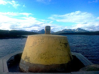
WThree-Country Cairn is the point at which the international borders of Sweden, Norway and Finland meet, and the name of the monument that marks the point. It is an example of a geographical feature known as a tripoint. It is the northernmost international tripoint in the world.
WUnna Guovdelisjávri or Vuolip Čoarvejávri is a lake that is located on the border of Norway and Sweden. The Norwegian side lies in Narvik Municipality in Nordland county and the Swedish side lies in Kiruna Municipality in Norrbotten County. The lake lies just east of the lake Gautelisvatnet, about 35 kilometres (22 mi) southeast of the village of Elvegård in Norway. The ending -jávri is the word for "lake" in the Northern Sami language.
WVuolep Sårjåsjávrre is a lake which lies on the border between Norway and Sweden. The western part lies in Fauske Municipality in Nordland county, Norway, and the eastern part lies in Jokkmokk Municipality in Norrbotten County, Sweden. The 7.17-square-kilometre (2.77 sq mi) lake lies just to the east of the large Blåmannsisen glacier and smaller neighboring lake Bajep Sårjåsjávrre.