 W
WBaldoyle Bay is a sea inlet on the east coast of Fingal in Ireland, in the historic County Dublin. It is situated between Portmarnock and Baldoyle. The bay is an important natural feature with protected status, which once held a Viking longphort.
 W
WBallyalla Lake, also known as Ballyallia Lough, is a small lake on the River Fergus, north of the town of Ennis in County Clare, Ireland. Covering an area of 308 hectares, it is an important site for waterbirds, and has been recognised as a wetland of international importance under the Ramsar Convention. It is protected by the Irish National Parks and Wildlife Service as a wildfowl sanctuary, meaning that shooting game birds is not allowed at the lake.
 W
WBlacksod Bay is a bay of the Atlantic Ocean in Erris, North County Mayo, Ireland. The 16 km (9.9 mi) long and 8 km (5.0 mi) wide bay is bounded on its western side by the Mullet Peninsula. Its eastern side includes Kiltane Parish, which extends southwards from Belmullet towards Gweesalia and Doohoma.
 W
WThe Blackwater or Munster Blackwater is a river which flows through counties Kerry, Cork, and Waterford in Ireland. It rises in the Mullaghareirk Mountains in County Kerry and then flows in an easterly direction through County Cork, through Mallow and Fermoy. It then enters County Waterford where it flows through Lismore, before abruptly turning south at Cappoquin, and finally draining into the Celtic Sea at Youghal Harbour. In total, the Blackwater is 169 km long. The total catchment area of the River Blackwater is 3,324 km2. The long term average flow rate of the River Blackwater is 89.1 cubic metres per second (m3/s) The Blackwater is notable for being one of the best salmon fishing rivers in the country. Like many Irish and British rivers, salmon stocks declined in recent years, but the Irish government banned commercial netting of salmon off the coast of Ireland in November 2006.
 W
WBroadhaven Bay is a natural bay of the Atlantic Ocean situated on the northwestern coast of County Mayo, Ireland. The opening of the bay faces northward, stretching 8.6 km between Erris Head in the west and Kid Island/Oileán Mionnán in the east.
 W
WBull Island, more properly North Bull Island, is an island located in Dublin Bay in Ireland, about 5 km long and 800 m wide, lying roughly parallel to the shore off Clontarf, Raheny, Kilbarrack, and facing Sutton. The island, with a sandy beach known as Dollymount Strand running its entire length, is a relatively recent, and inadvertent, result of human intervention in the bay. The island lies within the jurisdiction of, and is mostly owned by, Dublin City Council, and is managed by the Council's Parks and Landscape Division.
 W
WCastlemaine Harbour is a Ramsar site, Special Area of Conservation, Special Protection Area and national nature reserve of approximately 2,281 acres (9.23 km2) located in County Kerry, Ireland.
 W
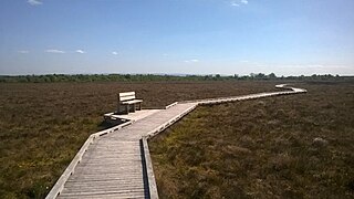
WClara Bog is one of the largest relatively intact raised bogs remaining in Ireland. It lies southeast of the R436 regional road between the village of Ballycumber and the town of Clara, in County Offaly. Much of the bog is state-owned and managed as a nature reserve covering some 460 ha. A Special Area of Conservation covers 836 ha.
 W
WCoole Park is a nature reserve of approximately 1,000 acres (4 km2) located a few miles west of Gort, County Galway, Ireland. It is managed by the Irish National Parks & Wildlife Service, part of the Department of Arts, Heritage and the Gaeltacht. The park is in a low–lying karstic limestone area characterised by seasonal lakes, known as turloughs, which are almost unique to Ireland. It has extensive woodlands. There are 6 kilometres of signposted nature trails plus a formal late 18th century walled garden.
 W
WCork Harbour is a natural harbour and river estuary at the mouth of the River Lee in County Cork, Ireland. It is one of several which lay claim to the title of "second largest natural harbour in the world by navigational area". Other contenders include Halifax Harbour in Canada, Trincomalee Harbour in Sri Lanka and Poole Harbour in England.
 W
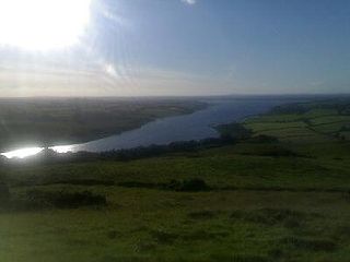
WLough Corrib is a lake in the west of Ireland. The River Corrib or Galway River connects the lake to the sea at Galway. It is the largest lake within the Republic of Ireland and the second largest on the island of Ireland. It covers 176 km² and lies mostly in County Galway with a small area of its northeast corner in County Mayo.
 W
WDundalk Bay is a large (33 km2), exposed estuary on the east coast of Ireland. The inner bay is shallow, sandy and intertidal, though it slopes into a deeper area 2 km from the transitional water boundary. It is predominantly influenced by the sea, though several rivers drain into the bay from the west. In the northwest corner of the bay, the Castletown River cuts through the intertidal zone and the smaller River Fane flows into the southeast corner. While the shores of the bay are largely made up of intertidal flats, there is a significant area of salt marsh on the western shore. The catchment around the bay is of mixed agriculture and urban land use.
 W
WThe Gearagh is a submerged glacial woodland and nature reserve two kilometres southwest of Macroom, County Cork, Ireland. It is located at the point where the River Lee descends from the mountains and widens at an alluvial plain, and stretches for roughly five kilometres, bounded by the townlands of Toonsbridge, Illaunmore and Anahala.
 W
WKillala Bay is a bay on the west coast of Ireland between County Mayo and County Sligo. It is situated between Kilcummin Head to the west and Lenadoon Point to the east. and is the estuary for the River Moy. The village of Killala is situated at the southwest corner of the bay.
 W
WLough Derravaragh is a lake in County Westmeath, Ireland, north of Mullingar between Castlepollard, Crookedwood and Multyfarnham.
 W
WLough Ennell is a lake near the town of Mullingar, County Westmeath, Ireland. It is situated beside the N52 road, off the Mullingar/Kilbeggan road. The lake is part of the Lough Ennell Special Protection Area. It is 6.5 km (4.0 mi) long by 2 km (1.2 mi) wide, with an area of about 12 km2 (4.6 sq mi). Lough Ennell has a large area of shallow water with nearly two-thirds of its area being less than 25 feet and almost half of it being under 10 ft (3.0 m) deep. The lake produced Ireland's largest ever lake brown trout at 26 lbs (11.8 kg). Lough Ennell is dotted with islands, many of which have now become attached to the shoreline as the levels of the lake have changed.
 W
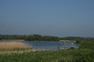
WLough Gara is a lake in Counties Sligo and Roscommon, Ireland. It is an Important Bird Area protecting 1,788 ha of which most is covered by a Ramsar Site.
 W
WLough Owel is a mesotrophic lough in the Midlands of Ireland, situated north of Mullingar, the county town of Westmeath. It has a maximum depth of 21 metres (69 ft). Water from Lough Owel feeds the Royal Canal, a canal crossing Ireland from Dublin to the River Shannon. The lake is close to the N4 primary road.
 W
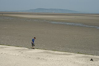
WThe North Slob is an area of mud-flats at the estuary of the River Slaney at Wexford Harbour, Ireland. The North Slob is an area of 10 km2 that was reclaimed in the mid-19th century by the building of a sea wall. It is the lowest geographical point in the Republic of Ireland
 W
WLough Oughter is a lake, or complex of lakes, in County Cavan covering more than 8,900 hectares. The complex of lakes lies on the River Erne, and forms the southern part of the Lough Erne complex. The lakes are bounded roughly by Belturbet in the north, Cavan town to the east, Crossdoney to the south and Killeshandra to the west.
 W
WPollardstown Fen is Ireland's largest extant calcareous spring-fed fen, a national nature reserve, Special Area of Conservation, and Ramsar site of approximately 321 acres (1.30 km2) in County Kildare.
 W
WThe River Owenabue, also spelled "Owenboy", is a river in County Cork, Ireland. It rises just north of Crossbarry and flows east towards the sea for roughly 20 miles (32 km). It flows through Crossbarry and on to the small village of Halfway. It then reaches Ballinhassig where it widens into Ballygarvan. It then meanders through Ballea Woods into Carrigaline, and onto Crosshaven where it enters Cork Harbour. The area is known as the Owenabue Valley. Otters and herons are seen on the river, and the heron has become a symbol of the area. 10 bridges cross the river.
 W
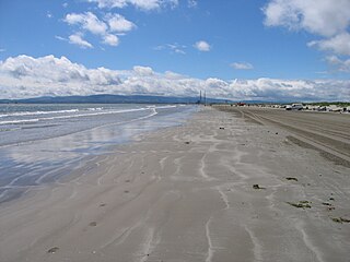
WSandymount Strand is a large strand on the east coast of Ireland, adjacent to the village and suburb of Sandymount in Dublin. It is part of South Bull - a major component of the south side of Dublin Bay, and part of the Dublin Bay Biosphere Reserve. South Bull is a mirror to the North Bull sandbank, which grew into North Bull Island.
 W
WThe Slieve Bloom Mountains is a mountain range in Ireland. They rise from the central plain of Ireland to a height of 527 metres. While not very high, they are extensive by local standards. The highest points are Arderin at the southwestern end of the range and Baunreaghcong at the end of the Ridge of Capard.
 W
WThe Raven Nature Reserve is a Ramsar site and national nature reserve of approximately 1,455.5 acres (5.890 km2) located in County Wexford, Ireland. It is managed by the Irish National Parks & Wildlife Service.
 W
WTralee Bay is located in on the west coast of County Kerry, Ireland. It is situated between Kerry Head on the north side and the Maharees on the west and extends eastwards as far as the bridge at Blennerville. Several small rivers feed into the bay through the town of Tralee. Villages around the bay include; Ballyheigue, Fenit, Kilfinora, Spa, Blennerville, Camp and Castlegregory.