 W
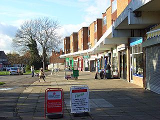
WBeansheaf Farm is a suburb of the town of Reading, in the English county of Berkshire. It lies south of the A4 and is approximately 3.5 miles (5.6 km) south-west of the centre of Reading.
 W
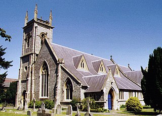
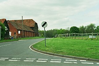
WCalcot, or Calcot Row, is a suburb west of Reading in the English county of Berkshire. Calcot straddles the historic A4 Bath Road and is between ex-hamlet Horncastle and Junction 12 of the M4 motorway. The suburb of Tilehurst is to the north, taking up the hills above the place; the populous village of Theale is west, across the motorway. Its named neighbourhoods include Beansheaf Farm and Fords Farm mainly of the early 21st century in its south.
 W
WCaversham Heights is a residential area within Caversham in the English Royal County of Berkshire. Today Caversham is a northern suburb of the larger town of Reading. Caversham Heights has no formal boundaries, but the name usually refers to that part of Caversham situated on higher ground to the west of central Caversham, straddling the Woodcote Road (A4074). House prices in Caversham Heights are among the highest in Reading.
 W
WCaversham Park Village is a suburb of Reading, England.
 W
WCaversham is a suburb of Reading, England. Originally a village founded in the Middle Ages, it lies on the north bank of the River Thames, opposite the rest of Reading. Caversham Bridge, Reading Bridge, Christchurch Bridge, and Caversham Lock provide crossing points, with Sonning Bridge also available a few miles east of Caversham.
 W
WColey Park is a suburb of the town of Reading in the English county of Berkshire. It is largely built on the country estate of the same name, surrounding Coley House. It is primarily a residential area, although it is also home to the Berkshire Independent Hospital and has previously been the site of government offices.
 W
WColey is an inner-town district near the centre of the town of Reading, in the English county of Berkshire. It is often referred to as Old Coley, to distinguish it from the adjacent, and much more recent, suburb of Coley Park.
 W
WEarley is a town and civil parish in the English non-administrative county of Berkshire. Along with neighbouring Woodley, it forms part of the extensive eastern suburbs of Reading. The Office for National Statistics places Earley within the Reading/Wokingham Urban Area; for the purposes of local government it falls within the Borough of Wokingham, outside the area of Reading Borough Council. The name is sometimes spelt Erleigh or Erlegh.
 W
WEast Reading is a main locality of the town of Reading in the English county of Berkshire. Its centre is known as Cemetery Junction, after Reading Old Cemetery.
 W
WEmmer Green is the northernmost suburb of Reading in the English county of Berkshire within the unitary authority, centred 2 miles (3.2 km) north of the town. Having most of its own commerce, sport and other amenities, Emmer Green has an arbitrary divide with larger Caversham and a border with Oxfordshire, the county in which both places formerly stood.
 W
WFords Farm is a suburb west in West Berkshire west of Reading. Overall, it is in the Royal County of Berkshire in England. Fords Farm lies south of the Bath Road 3-4 miles west of the centre of Reading.
 W
WHolybrook is a civil parish, forming a contiguous part of Reading in West Berkshire and is a mixture of urban, suburban land with watercourses and flood meadows in Berkshire, England. The parish takes its name from the Holy Brook, a watercourse which forms its southern boundary and which is a corollary of the River Kennet. Its main settlements are part of Calcot those commonly known as Beansheaf Farm and Fords Farm, Holybrook and occasionally considered part of Calcot or Southcote which overlaps with this area.
 W
WKatesgrove is an inner-town district near the centre of the town of Reading in the English county of Berkshire and ward of the Borough of Reading, in the English county of Berkshire. It is bounded on the north by the Inner Distribution Road and Reading town centre, on the east by Sidmouth Street, London Road, Kendrick Road and Northumberland Avenue, on the west Coley Park and Southcote, on the south by Long Barn Lane and Rose Kiln Lane and on the west by the River Kennet.
 W
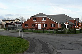
WKennet Island is a large neighbourhood of over 1,350 new homes and apartments in Reading, Berkshire, England. It has been constructed on open fields, commencing in 2005 by The Berkeley Homes Group with completion in 2019. Located halfway between Reading town centre and the M4 motorway. It incorporated watercourses for aesthetics by engineering new channels for the canalised Kennet which has its catchment in rural south-west Berkshire and east Wiltshire.
 W
WLittle Heath is a suburb of the town of Reading, in the county of Berkshire, England. It is part of the larger suburb of Tilehurst, forming the south western flank of that suburb and bordering on open countryside to its west.
 W
WLower Caversham is an area of the former town of Caversham, in the English county of Berkshire. Today this is itself a suburb of the larger town of Reading. Lower Caversham has no formal boundaries, but the name usually refers to that part of Caversham situated on lower ground to the east of central Caversham, close to the River Thames.
 W
WLower Earley is the southern portion of Earley civil parish and a large suburb of Reading, within the English county of Berkshire. It forms part of a large suburban conurbation of over 85,000 inhabitants adjoining east and south-east Reading. Lower Earley and Earley have a combined population of around 32,000 and Lower Earley itself has developed since the late 1970s. By the mid 1980s it was considered to be the largest private housing development in the UK. Lower Earley forms a major part of Wokingham Borough. In 2014, the RG6 postcode area was rated one of the most desirable postcode areas to live in England.
 W
WNewtown, Reading is a suburb of the town of Reading in Berkshire, England. It is situated in East Reading between the Cemetery Junction and the River Kennet. The population is a socially and ethnically diverse mix of families, professionals and Reading University students.
 W
WNorcot is an area of the suburb of Tilehurst in the town of Reading, in the English county of Berkshire. It is also an electoral ward of the Borough of Reading.
 W
WPurley on Thames is a village and civil parish in Berkshire, England. Purley is centred 3 miles (4.8 km) north-west of Reading, 1 mile (1.6 km) east of Pangbourne, and 22 miles (35 km) south-east of Oxford. Consequently, the Reading urban area is the principal social, economic and cultural centre for the people of Purley. Historically, Purley comprised three separate manors and associated settlements, these being Purley Magna to the east, Purley Parva to the north-west, and La Hyde, to the west. In the centre there is an historic area named variously Lething or Burley (Domesday) which accommodated traders and craftsmen alongside the main Reading to Oxford road.
 W
WSouthcote is a suburb of Reading in the English county of Berkshire. Located to the south-west of Reading town centre, Southcote has a population of about 8,500. The settlement lies primarily between the London-to-Bath road and the River Kennet.
 W
WTilehurst is a suburb of the town of Reading in the English county of Berkshire. It lies to the west of the centre of Reading, and extends from the River Thames in the north to the A4 road in the south. The suburb is partly within the boundaries of the Borough of Reading and partly in the district of West Berkshire. The part within West Berkshire forms part of the civil parish of Tilehurst, which also includes the northern part of Calcot and a small rural area west of the suburb. The part within the Borough of Reading includes the Reading electoral ward of Tilehurst, together with parts of Kentwood and Norcot wards.
 W
WWest Reading is a locality or informal subdivision of the town of Reading in the English county of Berkshire, with its own railway station which opened in 1906, by which time its main roads were an established housing area. It is a really conjoined community. There are other subdivisions like tilhurst and Whitley. These are also located in reading.
 W
WWhitley Wood is a suburb to the south of Reading in the English county of Berkshire.
 W
WWhitley is a suburb of the town of Reading, in the English county of Berkshire. It is also an electoral ward of the Borough of Reading.
 W
WWoodley is a town and civil parish in Berkshire, England. It is the largest suburb of Reading, four miles (6.4 km) east of the town centre and joined to the neighbouring large suburb of Earley, two miles (3.2 km) to the west, and five miles (8 km) from the historic market town of Wokingham. Nearby are the villages of Sonning, Twyford, Winnersh, Hurst and Charvil.