 W
WThe following communities were founded by The Church of Jesus Christ of Latter-day Saints in Alberta:1887 — Cardston 1888 — Aeran 1890 — Mountain View 1891 — Beazer 1893 — Leavitt 1897 — Kimball 1898 — Caldwell, Magrath, Stirling, Taylorville 1901 — Orton, Raymond 1902 — Frankburg, Taber 1908 — Glenwood 1910 — Hillspring
 W
WCanada's Mormon Trail has a variety of National Historic Sites, Provincial Historic Sites and many points of interest that display the unique cultural heritage the Mormons have had in the settling of Southern Alberta.
 W
WBarnwell is a village in southern Alberta, Canada. It is located 10 km (6.2 mi) west of Taber and 43 km (27 mi) east of Lethbridge on Highway 3, in the Municipal District of Taber.
WBeazer is a hamlet in southern Alberta, Canada within Cardston County, located 6 kilometres (3.7 mi) south of Highway 5, approximately 80 kilometres (50 mi) southwest of Lethbridge. It is named in 1900 after Mark Beazer who organized the first congregation of The Church of Jesus Christ of Latter-day Saints there.
 W
WBow Island is a town in Alberta, Canada. It is located on Highway 3 in southern Alberta, approximately 100 km (62 mi) from the United States border and 320 km (200 mi) southeast of Calgary.
 W
WCardston County is a municipal district in southern Alberta, Canada. It is located in Census Division 3 around the Town of Cardston.
 W
WCardston is a town in Alberta, Canada. The land on which Cardston was founded was originally inhabited by the Niitsitapi (Blackfoot) people of Kainai but was not considered part of Blackfoot Territory by the Government of Canada in the Treaty 7 agreement of 1877.
 W
WDel Bonita is a hamlet in southern Alberta, Canada within Cardston County. It is located approximately 49 km (30 mi) south of Magrath at the junction of Highway 62 and Highway 501. Due to its location near the Canada–United States border, it serves as a port of entry into the U.S. state of Montana at the nearby Del Bonita Border Crossing which is located 3 km (1.9 mi) to the south. Del Bonita is a name derived from Spanish meaning "of the pretty".
WEnsign is a hamlet in southern Alberta, Canada within Vulcan County. It is located approximately 11 kilometres (6.8 mi) south of Highway 23 and 78 kilometres (48 mi) southeast of Calgary.
WGlenwood is a village in southern Alberta, Canada. It is located north of the town of Cardston, in Cardston County. The village was named for a man named Glen Edward Wood. The founder of the village was Edward J. Wood, successor to Mormon leader Charles Ora Card, the founder of Cardston. Both Glen and Edward Wood were from Salt Lake City, Utah, and are buried in Cardston. The old name for the village was Glenwoodville until 1979.
WHill Spring is a village in southern Alberta, Canada. It is located 32 km (20 mi) west of Cardston and 43 km (27 mi) southeast of Pincher Creek, in the foothills of the Canadian Rockies.
 W
WJefferson is an unincorporated community within Cardston County, Alberta, Canada. It community is located approximately 16 km (9.9 mi) southeast of Cardston, which is home to Cardston County's municipal office.
WKimball is a hamlet in southern Alberta, Canada within Cardston County. It is located on Highway 501, approximately 16 kilometres (9.9 mi) southeast of Cardston between the St. Mary River and the Milk River Ridge. The community is named after the Mormon ward which was named after the descendants of Heber C Kimball.
 W
WLundbreck is a hamlet in southern Alberta, Canada within the Municipal District of Pincher Creek No. 9. It is located on the south side of Highway 3, approximately 3 kilometres (1.9 mi) east of the southern terminus of Highway 22, 16 km (9.9 mi) east of the Municipality of Crowsnest Pass, 4 km (2.5 mi) west of the Village of Cowley and 16 km (9.9 mi) west of the Town of Pincher Creek. It has an elevation of 1,200 m (3,900 ft).
 W
WMagrath is a town in Cardston County, Alberta, Canada. Its population was 2,217 in 2011. Magrath is 32 km (20 mi) south of Lethbridge and 242 km (150 mi) south of Calgary.
 W
WMaybutt, also known as "New Stirling" or "New Town", is a former locality in the County of Warner No. 5, Alberta, Canada. The community is situated 1 km north of the Village of Stirling just off the CANAMEX Corridor between Lethbridge and the Canada–US border. The community has become a bedroom community to Lethbridge, with many newer acreages being developed in the area. The footprint of Maybutt is defined by its historic boundary roads, Young St., Sunnyside Ave., Front St. & Lorne Ave, and Etzikom Ave. York St., First Ave. and Second Ave. are the only interior streets left of the original street grid of Maybutt.
WMountain View is a hamlet in Alberta, Canada within Cardston County. It is located along Highway 5 approximately 25 kilometres (16 mi) west of Cardston and 20 kilometres (12 mi) east of Waterton Lakes National Park near the United States border. It is also a kickoff point for visitors to Police Outpost Provincial Park, 18 kilometers to the south.
WOrton is a hamlet in southern Alberta, Canada within the Municipal District of Willow Creek No. 26. It is located 6 kilometres (3.7 mi) south of Highway 3, approximately 31 kilometres (19 mi) west of Lethbridge.
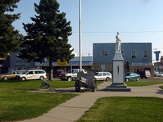
Pincher Creek is a town in the southwest of Alberta, Canada. It is located immediately east of the Canadian Rockies, 101 km (63 mi) west of Lethbridge and 210 km (130 mi) south of Calgary.
WRaley, Alberta is an unincorporated community in Cardston County, Alberta, Canada. The population of Raley was 5 in 1966. The community is located about 4 km north of Highway 3, and about 15 km east of the Town of Cardston. Raley is named after C. Raley, of Lethbridge.
 W
WRaymond is a town in the County of Warner No. 5, Alberta, Canada. It is located in southern Alberta south of Lethbridge on Highway 52. Raymond is known for its annual rodeo during the first week of July and the large population of members of The Church of Jesus Christ of Latter-Day Saints. The town has a rich history in high school sports, basketball, Canadian football, and women's rugby. Raymond was recently mentioned as one of the first communities in Alberta to become a net-zero solar-powered community, after having installed solar panels on most town building.
 W
WSeven Persons is a hamlet in Alberta, Canada within Cypress County. It is located approximately 20 kilometres (12 mi) southwest of Medicine Hat on Highway 3 and has an elevation of 755 metres (2,477 ft).
 W
WStirling is a village in the County of Warner No. 5, Alberta, Canada. The village is located on Highway 4, approximately 31 km (19 mi) southeast of Lethbridge and 72 km (45 mi) northwest of the Canada–US border.
 W
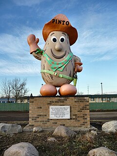
WTaber is a town in southern Alberta, Canada within the Municipal District of Taber. It is located approximately 51 km (32 mi) east of the City of Lethbridge at the intersection of Highway 3 and Highway 36.
WTaylorville is an unincorporated community in Cardston County, Alberta, Canada. It is located on Highway 501 ten miles southeast of Cardston. The first school opened May 17, 1900 and then later served as a chapel for The Church of Jesus Christ of Latter-day Saints.
WWelling is a hamlet in southern Alberta, Canada within Cardston County. It is located north of the junction of Highway 5 and Highway 52, approximately 30 kilometres (19 mi) south of the City of Lethbridge. The population of welling is unknown.
WWoolford is a hamlet in southern Alberta, Canada within Cardston County. It is located on Highway 503, approximately 16 kilometres (9.9 mi) southeast of Cardston between the St. Mary River and the Milk River Ridge. It is named after Thomas Woolford who came to the area in 1900.