 W
WThe Bijlands Kanaal is a canal in the Dutch province of Gelderland, near the Dutch-German border. It is currently by far the most important river-stretch of the Rhine when that major river enters the Netherlands.
 W
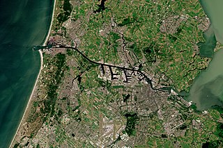
WAmsterdam, capital of the Netherlands, has more than 100 kilometers (62 mi) of grachten (canals), about 90 islands and 1,500 bridges. The three main canals, dug in the 17th century during the Dutch Golden Age, form concentric belts around the city, known as the Grachtengordel. Alongside the main canals are 1550 monumental buildings. The 17th-century canal ring area, including the Prinsengracht, Keizersgracht, Herengracht and Jordaan, were listed as UNESCO World Heritage Site in 2010, contributing to Amsterdam's fame as the "Venice of the North".
 W
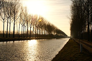
WThe Damme Canal is a canal in the Belgian province of West Flanders. The canal links Bruges with the Western Scheldt at Sluis, Netherlands. It was constructed on the orders of Napoleon Bonaparte who wished to create a canal network in order to permit the efficient transport of troops without the risk of disruptive interventions from the British navy.
 W
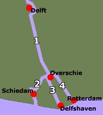
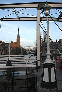
WSchie the name for four waterways in the area of Overschie, South Holland, the Netherlands. There are the Delftse Schie, the Delfshavense Schie, the Rotterdamse Schie and the Schiedamse Schie. The existence of these four streams is the result of medieval rivalry among the cities of Delft, Rotterdam, and Schiedam for toll rights.
 W
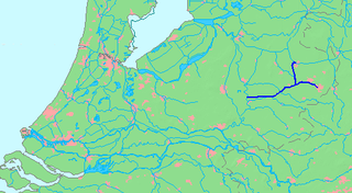
WThe Eindhovensch Kanaal is a canal in the Dutch province of North-Brabant. It connects the center of Eindhoven with the Zuid-Willemsvaart. It was dug in the period 1843-1846, commissioned by the town of Eindhoven. The canal is 13.9 kilometers long and runs by a number of Eindhoven industrial areas and the towns of Geldrop, Mierlo and Helmond. The canal runs over the Kleine Dommel and the Goorloop, which are led under the canal by ducts.
 W
WThe Fossa Eugeniana or Spanish Rhine-Maas canal was a large-scale ambitious project of the Spanish-Dutch Eighty Years' War planned by the then Spanish regent in Brussels, Isabella Clara Eugenia, after whom it was named, during the years 1626–1630. It consisted of a fortified canal intended to blockade the United Provinces and to divert trade from the Rhine near Rheinberg just south of Wesel and reroute it to Venlo on the Maas, in Spanish territory. The Spanish Rhine-Maas canal had military importance, when at the time Spanish garrisons in north-western Germany reached their maximum extent, amounting to around fifty fortresses and forts. It was to be 25 metres (82 ft) wide, 1.4 metres (4.6 ft) deep and 60 kilometres (37 mi) long. The Fossa Eugeniana was never finished. A 5.7 km section west of Geldern is in use as drainage canal. It is known under the name Grift.
 W
WThe Haarlemmertrekvaart [ˌhaːrlɛmərˈtrɛkfaːrt] is a canal between Amsterdam and Haarlem in the province of North Holland, the Netherlands. It was dug in 1631, making it the oldest tow-canal in Holland. Travel on such canals was historically done by barges which were towed by animals on a path along the canal's edge (towpath).
 W
WThe Heusden Canal is a canal on the border of the Dutch provinces North Brabant and Gelderland, roughly between Wijk en Aalburg and Heusden. The canal connects the Afgedamde Maas and Bergse Maas and has a total length of approximately 2.3 km. The canal used to connect the city of Heusden to the main branch of the river Meuse. Later on, the original main branch was closed off and the river received a new, artificial mouth: the Bergse Maas. After that, the Heusden Canal was improved to maintain a shipping connection between the two Meuse branches.
 W
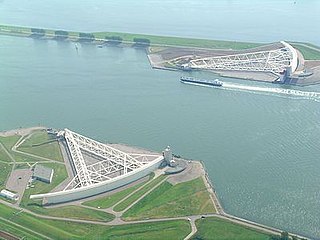
WThe IJgeul or IJ trench is a man-made excavation on the bottom of the North Sea, off the coast of IJmuiden, which provides access to large vessels with deep drafts to the port of IJmuiden, and also via the North Sea Canal, to the port of Amsterdam.
 W
WThe Juliana Canal, named after Queen Juliana of the Netherlands, is a 36 km long canal in the southern Netherlands, providing a bypass of an unnavigable section of the river Meuse between Maastricht and Maasbracht. It is an important transport connection between the ports of the Rhine delta and the industrial areas of southern Limburg and southern Belgium.
 W
WThe Leidsevaart is a canal between the cities of Haarlem and Leiden in the Netherlands. It was dug in 1657, making it one of the oldest canals in the Netherlands. It was the major means of transport between Leiden and Haarlem for almost two centuries until the rail connection was established in the 19th century. The original stops along the railway mirrored the toll bridges of the canal.
 W
WThe Mark-Vlietkanaal is a navigable canal in North Brabant.
 W
WThe Nieuwe Merwede is a Dutch canal, mainly fed by the river Rhine, that was constructed in 1870 to form a branch in the Rhine-Meuse delta. It was dug along the general trajectories of a number of minor Biesbosch creeks to reduce the risk of flooding by diverting the water away from the Beneden Merwede, and to facilitate navigation and regulate river traffic in the increasingly silted-up delta.
 W
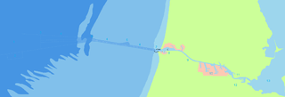
WThe Nieuwe Waterweg is a ship canal in the Netherlands from het Scheur west of the town of Maassluis to the North Sea at Hook of Holland: the Maasmond, where the Nieuwe Waterweg connects to the Maasgeul. It is the artificial mouth of the river Rhine.
 W
WThe North Sea Canal is a Dutch ship canal from Amsterdam to the North Sea at IJmuiden, constructed between 1865 and 1876 to enable seafaring vessels to reach the port of Amsterdam. This man-made channel terminates at Amsterdam in the closed-off IJ Bay, which in turn connects to the Amsterdam-Rhine Canal.
 W
WThe Oudegracht, or "old canal", runs through the center of Utrecht, the Netherlands. It starts in the southeast of the city. Here the Kromme Rijn and the Vaartse Rijn arrive to meet the original moat of the fortified town, and the Oudegracht goes from there into the center of town. Parts of the Oudegracht follow the original flow of the river Rhine, but there is some disagreement on what parts. The northern part is most likely an early canal connecting the Rhine section to the river Vecht. The southern part was started in 1122, after the water level of the Rhine in Utrecht dropped because of the new dam at Wijk bij Duurstede. The ground excavated was used to raise the sides of the canal, to reduce the chance of flooding. When the city's system of locks was finished in 1275 the water level was constant, enabling the creation of permanently dry cellars and new quays at water level, hence the typical wharfs below street level. Warehouses used to line the canal. Today many of these warehouses have been converted into restaurants and cafés.
 W
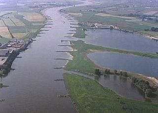
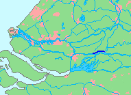
WThe Pannerdens Kanaal is a canal in the Netherlands that was dredged between 1701 and 1709 to cut off a large, shallow bend of river Rhine and so improve river traffic and water regulation.
 W
WThe Ringvaart is a canal in the province of North Holland, the Netherlands. The Ringvaart is a true circular canal surrounding the Haarlemmermeer polder and forms the boundary of the Haarlemmermeer municipality. Ringvaart is also the name of the dike bordering the canal.
WSchie the name for four waterways in the area of Overschie, South Holland, the Netherlands. There are the Delftse Schie, the Delfshavense Schie, the Rotterdamse Schie and the Schiedamse Schie. The existence of these four streams is the result of medieval rivalry among the cities of Delft, Rotterdam, and Schiedam for toll rights.
 W
WThe Steenenhoek Canal is a Dutch canal in southeastern Netherlands.
 W
WStieltjeskanaal is a canal in the Netherlands and it is part of the Coevorden municipality in Drenthe. It has an altitude of 11 meters (39 feet).
 W
WTrekschuit is an old style of sail- and horse-drawn boat specific to the Netherlands, where it was used for centuries as a means of passenger traffic between cities along trekvaarten, or tow-canals.
 W
WThe Twentekanaal is a canal running through the Dutch provinces of Gelderland and Overijssel, connecting the three largest cities of the Twente region, Almelo, Hengelo and Enschede to the national network of rivers and canals. Because the canal forks to reach Almelo, the canal is officially plural, which is Twentekanalen.
 W
WThe van Harinxmakanaal is a major canal in western Frisland. It runs from the sea at Harlingen eastwards to Leeuwarden. Major places along the canal include Franeker, Dronrijp and Deinum. The canal is 37.5 kilometers long. It was named after Pieter Albert Vincent van Harinxma thoe Slooten in 1950 who was King's Commissioner to Friesland from 1909 to 1945. Prior to this date it was called Harlinger Trekvaart. However this was widened and deepened, and a few corners cut off in 1951. At Suawoude it joins the Prinses Margrietkanaal.
 W
WThe Vliet is a canal in the western Netherlands, in the province of South Holland. It starts at the Oude Rijn at Leiden and joins the Delfshavense Schie canal at Delft. Places along its banks include Voorschoten, Leidschendam, Voorburg, The Hague and Rijswijk.
 W
WThe Voorne Canal was the first canal to connect Rotterdam to the sea. Construction of the canal started in 1826 and was completed in 1829. At inception, the canal was 8 mile long, with locks at each end. The estimated cost was 27,630,000 florins. It was built for and suitable for sailing ships of the time, but as trade vessels got larger, it was inadequate for the larger ships. The path of the canal traverses Voorne, with one end at the eastern harbor of Hellevoetsluis and the other near Heenvliet.
 W
WThe Winschoterdiep is a canal in the province Groningen of the Netherlands. It leads to the Rensel, which is actually part of this canal. Construction was started in 1618 and finished in 1634. The Winschoterdiep's total length is 35.5 kilometres, and it is approximately 100 metres in width. Sixteen bridges and locks are built across this canal, as well as many other passages. Ships must be less than 16 m in breadth to pass through some of these. It is one of the oldest canals ever built in Groningen still in use. In the section between Hoogezand and Waterhuizen, there are several shipwharfs. Hoogezand was founded near the canal in 1618.
 W
WThe Zuid-Willemsvaart is a canal in the south of the Netherlands and the east of Belgium.