 W
WBar Beach is an inner city suburb of Newcastle, New South Wales, Australia, located 1.6 km (1.0 mi) southwest of Newcastle's central business district. The suburb is named for the beach that extends along its eastern border.
 W
WCarrington is a suburb of Newcastle, New South Wales, Australia, and is named after Lord Carrington, governor of New South Wales in 1887 when the area was proclaimed a municipality.
 W
WHamilton South is a suburb of Newcastle, New South Wales, Australia, located 4 kilometres (2.5 mi) west of Newcastle's central business district.
 W
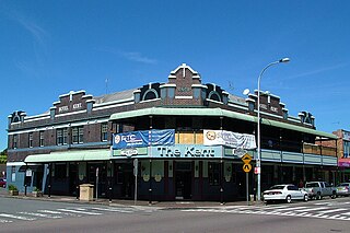
WHamilton is a suburb of Newcastle, New South Wales, Australia, located 4 kilometres (2.5 mi) from Newcastle's central business district. The main commercial centre is located around Beaumont Street and boasts a vibrant multicultural atmosphere providing an array of restaurants, retail, fashion and commercial outlets along with day-to-day services such as pharmacies, banks, florists, hairdressers, fruit shops and delicatessens.
 W
WHexham is a suburb of the city of Newcastle, about 15 km (9 mi) inland from the Newcastle CBD in New South Wales, Australia on the bank of the Hunter River.
The Hill is an inner city, residential suburb of Newcastle, in the Hunter Region of New South Wales, Australia, located immediately south of Newcastle's central business district. The Hill is filled with historic Victorian terraces and is the site of a historic convict prison block. As of January 2009, the average house price in The Hill was about A$537,500.
 W
WIslington is a suburb of the city of Newcastle in the Hunter Region of New South Wales, Australia. Located only 3.4 kilometres (2.1 mi) from the Newcastle CBD on one of Newcastle's major arterial roads, it was initially developed as a residential suburb. Today it includes a small industrial area and is adjacent to the Newcastle campus of the Hunter Institute of Technology. Its southeastern border is occupied entirely by the Hunter and Newcastle and Central Coast railway lines. The suburb has one railway station, which is shared with, and named after, adjacent Hamilton.
 W
WJesmond is a suburb of the City of Newcastle LGA, located about 9.5 km (6 mi) west of the Newcastle CBD in the Hunter Region of New South Wales, Australia. It is both a commercial centre and dormitory suburb of Newcastle. Residents include Australian and international students attending the University of Newcastle in adjacent Callaghan. The suburb also has numerous aged housing facilities. The suburb is very multicultural due to many international university students. According to the 2006 Census there were 2,442 people in 1,144 dwellings.
 W
WThe Junction is a small, inner city suburb of Newcastle, New South Wales, Australia, located 2.8 km (1.7 mi) southwest of Newcastle's central business district. It was originally part of Merewether, which is reflected in the names of some of the suburb's establishments, but was gazetted as a suburb on 17 May 1991.
 W
WKooragang is the northernmost and largest suburb of the city of Newcastle, in the Hunter Region of New South Wales, Australia. Dominated by Kooragang Island, the eastern part of the suburb is primarily industrial, while the western part of the suburb consists of nature reserves. Covering an area of 35.4 km2 (13.7 sq mi), at the 2016 census, there were no people living in the suburb.
 W
WKotara is a suburb of Newcastle, New South Wales, Australia, located 9 kilometres (6 mi) from Newcastle's central business district. It is part of the City of Newcastle local government area.
 W
WLambton is a suburb of Newcastle, New South Wales, Australia, 8 kilometres (5.0 mi) from Newcastle's central business district.
WMaryland is a suburb of Newcastle, New South Wales, Australia, located 14 kilometres (9 mi) from Newcastle's central business district. It is part of the City of Newcastle local government area.
 W
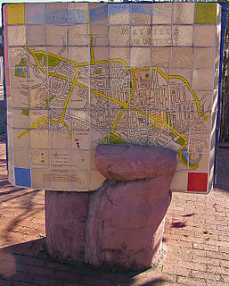
WMayfield is a north-western suburb of Newcastle, New South Wales, which takes its name from Ada May a daughter of the landowner there, John Scholey. Its boundaries are the Hunter River to the north, the Main Northern railway line to the south, the railway line to Newcastle Harbour to the east, and open ground to the west.
 W
WMerewether Heights is a suburb of Newcastle, New South Wales, Australia, located 6 kilometres (4 mi) southwest of Newcastle's central business district near the Glenrock State Recreation Area. It is part of the City of Newcastle local government area.
 W
WMerewether is a suburb of Newcastle, New South Wales, Australia, located 3 km (2 mi) from Newcastle's central business district with a population of around 11,000. The suburb stretches 3 km (2 mi) from Merewether Beach in the east to Adamstown in the west.
WNew Lambton is a suburb of Newcastle, in the Hunter Region of New South Wales, Australia. It is located about 6 km (4 mi) west of the Newcastle CBD. It includes two shopping districts, schools and other general facilities. At the 2016 Australian census it had a population of approximately 10,000.
 W
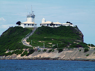
WNewcastle East is an inner city suburb of Newcastle, New South Wales, Australia, located immediately east of Newcastle's central business district at the mouth of the Hunter River. The suburb includes Fort Scratchley, Newcastle Ocean Baths and Newcastle Beach. Formerly a site of heavy industry and railway yards, the suburb now contains the large Foreshore Park, and historic terraced housing.
 W
WNewcastle West is an inner city suburb of Newcastle, New South Wales, Australia, part of which forms the western end of Newcastle's central business district. The suburb is primarily a retail/commercial trading district but includes one high school.
 W
WThe Newcastle metropolitan area is the second most populated area in the Australian state of New South Wales and includes the Newcastle and Lake Macquarie local government areas. It is the hub of the Greater Newcastle area which includes most parts of the local government areas of City of Newcastle, City of Lake Macquarie, City of Cessnock, City of Maitland and Port Stephens Council.
 W
WSandgate is a suburb of Newcastle, New South Wales, Australia, located 11 kilometres (6.8 mi) from Newcastle's central business district. It is part of the City of Newcastle local government area.
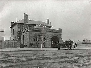
WStockton is a suburb of Newcastle, New South Wales, Australia, located 600 m (0.4 mi) from Newcastle's central business district. It is the only residential suburb of the City of Newcastle that lies north of the Hunter River.
 W
WTarro is a north-western suburb of the Newcastle City Council local government area in the Hunter Region of New South Wales, Australia. It, and parts of nearby Beresfield, was originally known as Upper Hexham, "lower" Hexham being an older settlement located about 5 kilometres (3 mi) to the east on the Hunter River. The name "Tarro" reportedly means "stone" in an Aboriginal language.
 W
WWallsend is a western suburb of Newcastle, New South Wales, Australia 11 kilometres (6.8 mi) from Newcastle's central business district. It is part of the City of Newcastle local government area.
WWarabrook is a north-western suburb of Newcastle, New South Wales, Australia, located 8 kilometres (5 mi) from Newcastle's central business district. It is part of the City of Newcastle local government area. The suburb is primarily residential but also includes a shopping centre, an aged care facility and a light industrial area. Warabrook was originally a small agricultural base which had a cattleyard and abattoir.. Warabrook has the Eucalyptus Circuit Reserve which has a cycle way and children's play equipment..
WWaratah West is a suburb of Newcastle, New South Wales, Australia, located 8 kilometres (5 mi) from Newcastle's central business district. It is part of the City of Newcastle local government area.
 W
WWaratah is a north-western residential suburb of Newcastle, New South Wales, Australia 6 kilometres (4 mi) from Newcastle's central business district and bounded on the north by the Main North railway line. Waratah station was opened in 1858 and is served by NSW TrainLink's Hunter line.
WWickham is an inner suburb of Newcastle, New South Wales, Australia, located 3 kilometres (1.9 mi) from Newcastle's central business district.