 W
WThe Adour is a river in southwestern France. It rises in High-Bigorre (Pyrenees), in the commune of Aspin-Aure, and flows into the Atlantic Ocean near Bayonne. It is 308.3 kilometres (191.6 mi) long, of which the uppermost ca. 11 kilometres (6.8 mi) is known as the Adour de Payolle. At its final stretch, i.e. on its way through Bayonne and a short extent upstream, the river draws the border between the Northern Basque Country and Landes regions.
 W
WAgen La Garenne Airport or Aérodrome d'Agen - La Garenne is an airport located in Le Passage and 3 km southwest of Agen, both communes of the Lot-et-Garonne département in the Nouvelle-Aquitaine région of France.
 W
WThe Antenne is a 49.0 km long river in the Charente-Maritime département, in southwestern France. Its source is in the commune of Fontaine-Chalendray. It flows into the Charente near Cognac.
 W
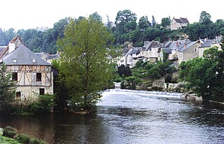
WThe Ardour is a 33.5 km (20.8 mi) long river flowing in the departments of the Creuse and Haute-Vienne, in the Nouvelle-Aquitaine region of France. The river is a tributary of the Gartempe, and so a sub-tributary of the Loire. It flows into the Gartempe near Bersac-sur-Rivalier.
 W
WThe Baïse is a 188-kilometre (117 mi) long river in south-western France, left tributary of the Garonne. Its source is in the foothills of the Pyrenees, near Lannemezan. It flows north through the following départements and towns:Hautes-Pyrénées: Lannemezan, Trie-sur-Baïse Gers: Mirande, Castéra-Verduzan, Valence-sur-Baïse, Condom Lot-et-Garonne: Nérac, Lavardac
 W
WThe Boivre is a 46.1 km (28.6 mi) long river in western France, a left tributary of the Clain. Its source is near Vasles, in the Deux-Sèvres department.
 W
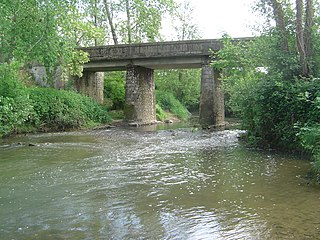
WThe Bonnieure is a river in the Charente département, southwestern France, left tributary to the river Charente. It is 46.8 km (29.1 mi) long. Its source is in Genouillac, in the east of the department. It flows into the Charente near Mansle. Another town along the Bonnieure is Chasseneuil-sur-Bonnieure. The Tardoire is a left tributary of the Bonnieure.
 W
WThe Cher is a river in central France, a left tributary of the Loire. It is 367.8 km (228.5 mi) long and its basin area is 13,718 km2 (5,297 sq mi). Its source is in the Creuse department, north-east of Crocq. It joins the river Loire at Villandry, west of Tours.
 W
WCôte d’Argent is a tourist name given to a section of the French Atlantic coast.
 W
WCôte des Landes or Côte landaise is a touristic name given to a section of the French seashore. It is a section of Côte d'Argent.
 W
WThe Creuse is a 263-kilometre (163 mi) long river in western France, a tributary of the Vienne. Its source is in the Plateau de Millevaches, a north-western extension of the Massif Central.
 W
WThe Douze is the right source river of the Midouze, in the Landes, in the southwest of France. It is 123.5 km (76.7 mi) long.
 W
WThe Dronne is a 201-kilometre (125 mi) long river in southwestern France, right tributary of the Isle. Its source is in the north-western Massif Central, east of the town of Châlus at an elevation of 510 metres (1,670 ft). It flows south-west through the following départements and towns:Haute-Vienne Dordogne: Saint-Pardoux-la-Rivière, Brantôme, Ribérac Charente: Aubeterre-sur-Dronne Charente-Maritime Gironde: Coutras
 W
WThe Dropt is a river in Aquitaine, France. It is a right tributary to the Garonne. It is 132 km (82 mi) long.
 W
WThe Forest of la Coubre is a large forest in the region of Nouvelle-Aquitaine, near the city of Royan. Its area is roughly 7916 hectares, making it the third largest forêt domaniale of the north of the region, behind forest of la Double and the forest d'Horte.
 W
WThe Gartempe is a French river, 205 kilometres (127 mi) long. It is a left tributary of the Creuse, which it joins in La Roche-Posay. Its source is in the municipality of Peyrabout.
 W
WThe Gave d'Oloron is a river of south-western France near the border with Spain. It takes its name from the city Oloron-Sainte-Marie, where it is formed from the rivers Gave d'Aspe and Gave d'Ossau. It joins the Gave de Pau in Peyrehorade to form the Gaves réunis, a tributary of the Adour. The Gave d'Oloron is used for fishing. The river is 148 kilometres (92 mi) long, including its source rivers Gave d'Ossau and Gave du Brousset.
 W
WThe Gave de Pau is a river of south-western France. It takes its name from the city of Pau, through which it flows. The river is 181.3 kilometres (112.7 mi) long, and its source is at the Cirque de Gavarnie in the Pyrenees mountains. The Gave de Pau joins the Gave d'Oloron in Peyrehorade to form the about 9-kilometre (6 mi) long Gaves réunis, which is a left tributary of the Adour. The Gaves réunis is often considered to be part of the Gave de Pau.
 W
WThe history of Limousin, one of the traditional provinces of France, reaches back to Celtic and Roman times. The region surrounds the city of Limoges. Limousin in the foothills of the western edge of the Massif Central, with cold weather in the winter. Its name is derived from the name of a Celtic tribe, the Lemovices whose main sanctuary was recently found in Tintignac and became a major site for Celtic study which were found such as the carnyces in the whole Celtic world During the 10th century, Limousin was divided into many seigneuries; the most important of them, located in the southern part of the region, were the vicomtés of Limoges, Comborn, Ventadour, and Turenne. The northernmost part of Limousin belonged to the County of La Marche, while the bishops of Limoges controlled most of present-day Haute-Vienne. Such political fragmentation led to the construction of many castles, whose ruins still evoke memories of that historical period.
 W
WThe Isle is a 255-kilometre (158 mi) long river in south-western France, right tributary of the Dordogne. Its source is in the north-western Massif Central, near the town Nexon. It flows south-west through the following départements and towns:Haute-Vienne: Le Chalard Dordogne: Périgueux, Mussidan Gironde: Libourne
 W
WThe Louts is a left tributary of the Adour, in Aquitaine, in the Southwest of France. It is 85.7 km (53.3 mi) long.
 W
WMediolanum Santonum was a Roman town in Gallia Aquitania, now Saintes. It was founded in about 20 BC in connection with an expansion of the network of Roman roads serving Burdigala. The name means "the central town of the Santones", the tribe that then inhabited the area; the town became an important center in the Roman province of Gallia Aquitania.
 W
WThe Né is a 66.1-kilometre (41.1 mi) river in the Charente and Charente-Maritime départements, in southwestern France. It is a left tributary of the Charente.
 W
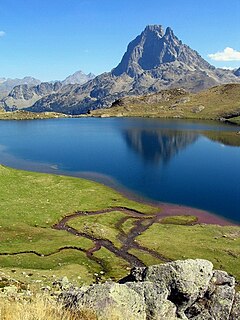
WThe Pyrénées National Park is a National Park of France located within the French departments of Hautes-Pyrénées and Pyrénées-Atlantiques.
 W
WThe Seudre is a river in the Charente-Maritime département, southwestern France, flowing into the Atlantic Ocean. It is 68.2 km (42.4 mi) long. Its source is near Saint-Genis-de-Saintonge. It flows northwest through Saint-André-de-Lidon, Saujon and La Tremblade. It flows into the Atlantic Ocean near Marennes. The lower course of the Seudre is brackish, and is used for oyster farming.
 W
WThe Sèvre Niortaise is a 158.4 km (98.4 mi) long river in the Nouvelle-Aquitaine and Pays de la Loire regions in western France, flowing into the Atlantic Ocean. Its source is in the Deux-Sèvres department, near Sepvret, north of Melle.
 W
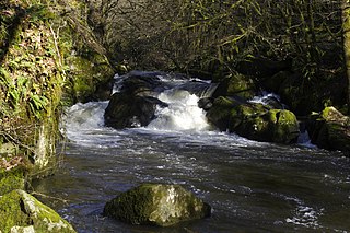
WThe Tardoire is a river in southwestern France, left tributary to the river Bonnieure. It is 114 km (71 mi) long. Its source is in Châlus, in the Haute-Vienne département. It flows into the Bonnieure near Saint-Ciers-sur-Bonnieure. Over much of its length, the Tardoire flows underground.
 W
WThe Taurion, as it is known in Haute-Vienne, or Thaurion, as it is known in Creuse, is a 107.5 km long river in western France, tributary of the Vienne river.
 W
WThe Vendée is a 82.5-kilometre-long (51.3 mi) river in the Nouvelle-Aquitaine and Pays de la Loire regions in western France. It a right tributary of the Sèvre Niortaise.