 W
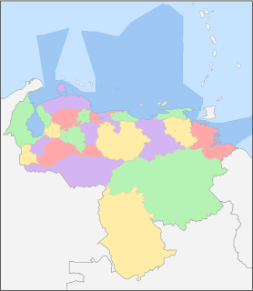
WThe Bolivarian Republic of Venezuela is a federation made up of twenty-three states, a Capital District and the Federal Dependencies, which consist of many islands and islets on the Caribbean Sea. Venezuela also claims the Guayana Esequiba territory which comprises six districts in the independent nation of Guyana.
 W
WThe Capital District is a federal district of Venezuela. It has an area of 433 km2 and there is only one administrative division (municipio), Libertador, which contains about half of Caracas, the Venezuelan capital city, which is also the seat of the three branches of the federal government of Venezuela. The population in 2004 was 2,073,768. The District borders on the states of Vargas and Miranda.
 W
WThe Federal Dependencies of Venezuela encompass most of Venezuela's offshore islands in the Caribbean Sea and the Gulf of Venezuela, excluding those islands that form the State of Nueva Esparta. These islands, with a total area of 342 square kilometres, are sparsely populated – according to the preliminary results of the 2011 Census only 2,155 people live there permanently, with another hundred from Margarita Island who live there seasonally to engage in fishing. Local government is officially under the authority of the mayor of Caracas, although de facto power is often held in the heads of the sparse and somewhat isolated communities that decorate the territories.
 W
WBelow is a list of trees that symbolise Venezuela and each state of the country:
 W
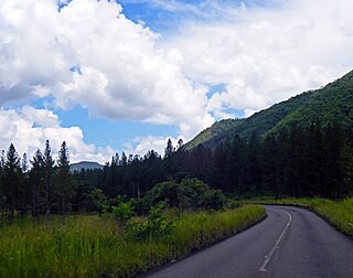
WAmazonas State is one of the 23 states (estados) into which Venezuela is divided. It covers nearly a fifth of the area of Venezuela, but has less than 1% of Venezuela's population.
 W
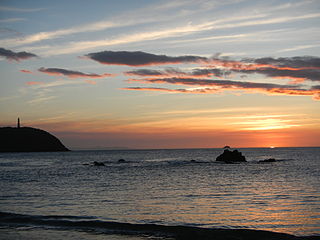
WAnzoátegui State is one of the 23 component states of Venezuela, located in the northeastern region of the country. Anzoátegui is well known for its beaches that attract many visitors. Its coast consists of a single beach approximately 100 km (62 mi) long. Its capital is the city of Barcelona, and significant cities include Puerto la Cruz and El Tigre.
 W
WApure State is one of the 23 states (estados) into which Venezuela is divided. Its territory formed part of the provinces of Mérida, Maracaibo, and Barinas, in accordance with successive territorial ordinations pronounced by the colonial authorities. In 1824 the Department of Apure was created, under jurisdiction of Barinas, which laid the foundations for the current entity. In 1856 it separated from Barinas and for the first time Apure appeared as an independent province, which in 1864 acquired the status of state. In 1881, however, a new territorial division combined Apure and Guayana to form a single state named Bolívar. In 1899 it reestablished its autonomy and finally, by means of the Constitution of 1909, gained its current borders.
 W
WAragua State is located in the north-central region of Venezuela. It has plains and jungles and Caribbean beaches. The most popular are Cata and Choroni. It has Venezuela's first national park which is called Henri Pittier. The capital is Maracay, other important cities include Turmero and El Limón.
 W
WBarinas State is one of the 23 states of Venezuela. The state capital is Barinas.
 W
WBolívar is one of the 23 states into which Venezuela is divided. The state capital city is Ciudad Bolívar, but the largest city is Ciudad Guayana. Bolívar State covers a total surface area of 242,801 km2 (93,746 sq mi) and as of the 2011 census, had a population of 1,410,964. The state contains Angel Falls.
 W
WCarabobo State is one of the 23 states of Venezuela, located in the north of the country, about two hours by car from Caracas. The capital city of this state is Valencia, which is also the country's main industrial center. The state's area is 4,369 km2 (1,687 sq mi) and as of the 2011 census, had a population of 2,245,744.
 W
WCojedes State is one of the 23 states of Venezuela. The state capital is San Carlos.
 W
WDelta Amacuro State is one of the 23 states of Venezuela, and is the location of the Orinoco Delta. The Paria Gulf and the Atlantic Ocean are found to the north, Bolívar State is found to the south, the Atlantic Ocean and Guyana are found to the east, and Monagas State is found to the west. The state capital city is Tucupita.
 W
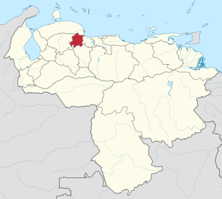
WFalcón State is one of the 23 states (estados) that constitute Venezuela. The state capital is Coro.
 W
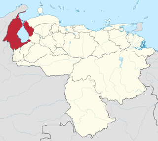
WGuárico State is one of the 23 states of Venezuela. The state capital is San Juan de Los Morros. Guárico State covers a total surface area of 64,986 km2 (25,091 sq mi) and, in 2011, had a census population of 747,739. It is named for the Guárico River.
 W
WLara State is one of the 23 states (estados) into which Venezuela is divided. The state capital is Barquisimeto.
 W
WList of governors of states of Venezuela. Governors in Venezuela are in charge of the government and administration of each State. A Governor must be a Venezuelan over the age of 25 who is not a member of the clergy. The Governor can be elected for a term of four years by a majority vote. The Governor can be re-elected to an additional term only immediately and only once.
 W
WThis is a list of the state-level constitutions of Venezuela.
WThis is a list of the state-level legislative councils of Venezuela. Legislative Authority is exercised in each State by a Legislative Council, consisting of no more than fifteen and at least seven members, who proportionally represent the population of the State and the Municipalities. The Legislative Council has the following powers:(1) To legislate matters within state competence. (2) Pass the state's Budget Law. (3) Any others vested in it by this Constitution or by the law.
 W
WThe State of Mérida commonly known simply as Mérida', IPA: [esˈtaðo ðe ˈmeɾiða]) is one of the 23 states of Venezuela. The state capital is Mérida, in the Libertador Municipality.
 W
WMiranda State is one of the 23 states (estados) of Venezuela and the second most populous after Zulia State. As of the 2011 census, it had a population of 2,675,165 residents. It also has the greatest Human Development Index in Venezuela, according to the Venezuelan National Institute of Statistics. The most recent population estimate was 3,194,390 in mid-2016.
 W
WMonagas State is one of the 23 states of Venezuela.
 W
WThe State of Nueva Sparta (in Spanish: Estado Nueva Esparta, is one of the 23 states of Venezuela. It comprises Margarita Island, Coche, and the largely uninhabited Cubagua.
 W
WPortuguesa State is one of the 23 states of Venezuela. Located in the west of the Republic, it is considered the "breadbasket of Venezuela" for the large amount of agricultural products produced there. The state is bordered on the north by the state of Lara, on the east by Cojedes, on the west by Trujillo and south by Barinas.
 W
WSucre State is one of the 23 states of Venezuela. The state capital is Cumaná city. Sucre State covers a total surface area of 11,800 km2 (4,600 sq mi) and, as of the 2011 census, had a population of 896,921. The most important river in the state is the Manzanares River.
 W
WTáchira State is one of the 23 states of Venezuela. The state capital is San Cristóbal.
 W
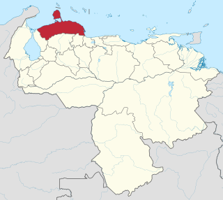
WLa Guaira State, officially La Guaira, and known until 2019 as Vargas State is one of the 23 states of Venezuela. Named after Venezuela's first non-military president, José María Vargas, Vargas comprises a coastal region in the north of Venezuela, bordering Aragua to the west, Miranda to the east, the Caribbean Sea to the north and the Capital District to the south. It is home to both the country's largest seaport and airport. The state capital is La Guaira. The Litoral Varguense conurbation is the principal urban agglomeration in the state, which is part of the Greater Caracas Area.
 W
WYaracuy State is one of the 23 states of Venezuela. It is bordered by Falcón in the north, in the west by Lara, in the south by Portuguesa and Cojedes and in the east by Cojedes and Carabobo.
 W
WZulia State is one of the 23 states of Venezuela. The state capital is Maracaibo. As of the 2011 census, it has a population of 3,704,404, the largest population among Venezuela's states. It is also one of the few states in Venezuela in which voseo is widespread. The state is coterminous with the eponymous region of Zulia.