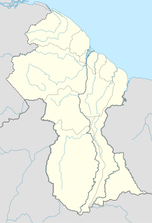
 W
WAnnandale is a community in the Demerara-Mahaica region of Guyana, located on the Atlantic Ocean between Buxton, and Lusignan. Many of the inhabitants originally came from the Lusignan estate, while the former slaves of the plantation, bought the neighbouring Orange Nassau plantation and named it Buxton. Annandale is mainly an Indo-Guyanese community. It is divided in Annandale North, South, West and Courabane Park. The economy used to be dependant on the nearby sugar estates. The secondary school for the region is located in Annandale.
WBelfield is a village in the Demerara-Mahaica Region of Guyana, standing on the Atlantic coast, three kilometres west of Enmore.
WBeterverwagting, also Betterverwagting or abbreviated to B.V., is a village in Guyana, on the East Coast of the Demerara River.
WBetter Hope is a town located in the Demerara-Mahaica region of Guyana. The village has been named after the Plantation Betterhoop It was originally a fishing village with many working on the sugar estates and nearby farms. The majority of the population is Indo-Guyanese with a minority of Afro-Guyanese.
WBuxton is a village in the Demerara-Mahaica Region of Guyana, standing about midway between Georgetown and Enmore.
WCane Grove is an agricultural community in the Demerara-Mahaica Region of Guyana, standing at sea level on the coastal plain, along the Mahaica River, about eight kilometres upstream of its mouth. John Carter, Guyana's first ambassador to the United States and a key figure in the pre-independence turmoil of what was, before 1966, British Guiana was born in Cane Grove.
 W
WClonbrook is a village in the Demerara-Mahaica region of Guyana. The village itself has a population of about 1,193 as of 2012. The village is located along the East Coast Highway and is about 16.5 miles from Georgetown and about 6 miles from Mahaica. It is bordered in the east by the village of Bee Hive and by Ann's Grove in the west.
WCove and John is located on the Atlantic coast of Guyana, 18 miles east of Georgetown and bordered by Nabacalis to the west and Victoria to the east. It has a population of 494 people as of 2012. This village has the Guyana Sevashram.
WEnmore is a village in the Demerara-Mahaica region along the coastal belt of Guyana. It is about two square miles (5.1 km2) in size and has a multi-ethnic population of 1,002 as of 2012, with large concentrations of Indo-Guyanese. Enmore is known for the Enmore Martyrs, who were slain during a 1948 labour dispute.
 W
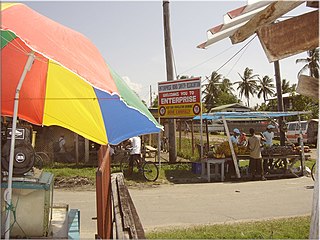
WEnterprise is a village in the Demerara-Mahaica region along the coastal belt of Guyana. It is about two square miles in size and has a population of 2,657 as of 2012. It is located about 14 miles (23 km) southeast of the capital city Georgetown. This small community is flanked by Bachelors Adventure and a little further, Enmore to the east; Strasthpey on its west; Melanie Damishana and the Atlantic Ocean sits to the North. Some of the country's largest sugarcane fields are just beyond its southern horizon.
 W
WGeorgetown is a city and the capital of Guyana, located in Region 4, which is also known as the Demerara-Mahaica region. It is the country's largest urban centre. It is situated on the Atlantic Ocean coast at the mouth of the Demerara River and it was nicknamed the "Garden City of the Caribbean."
WHyde Park is a community in the Demerara-Mahaica Region of Guyana. It stands on the right bank of the Demerara River, at two metres above sea level, about 40 km upstream from the river's mouth, and Georgetown. Cheddi Jagan International Airport, is nearby.
WJonestown is a village in the Demerara-Mahaica region of Guyana. The old name of the village was Voorzigtigheid. The village is located 37,5 kilometres from Georgetown between Hand-en-Veldt and the Atlantic Ocean, and near the town of Mahaica. Therefore it tends to be called "Jonestown, Mahaica" or "Jonestown, Mahaica, ECD", even today, although by current Guyanese administrative regions it is in Demerara-Mahaica.
WKuru Kururu or Newtown Settlement is the first and largest village on the Soesdyke-Linden Highway in Guyana. It is situated approximately 38 kilometres south of Georgetown, Guyana's Capital City.
WLong Creek is a village located 24.5 km up the Soesdyke-Linden Highway in the Demerara-Mahaica region of Guyana. Long Creek is hidden out of sight at the end of a trail off the highway.
WLusignan is a community in Guyana, South America. Located on the East Coast of Demerara, it was originally a village inhabited mainly by indo-Guyanese, sustained by subsistence farming and fishing. Ecotourism is also an emerging industry.
WMahaica, also called Mahaica Village, is a town located in region 4 of Demerara-Mahaica in Guyana. Mahaica is often used as a subregion for the adjoining villages near the Mahaica River like Hand-en-Veldt,, Good Hope,, Chelsey Park, and of course the other Jonestown which is often referred to as Mahaica or its old Dutch plantation name Voorzigtigheid.
WNabaclis also Nabacalis is a community on the East Coast of Demerara, in the Demerara-Mahaica region. It is in low-lying country by the coast, which is subject to flooding in the rainy season.
WNonpareil also Non Pareil was the name of a sugarcane plantation, and later a village, on the east coast Demerara Region of Guyana that operated until the mid 20th century. Although the factory and village were torn down and disassembled in the 1940s, its population survived and formed the majority of the population of Enterprise, a modern village located one mile away from the site of old Nonpareil.
WParadise is a town located in the Demerara-Mahaica region of Guyana, and used to be its regional capital, however the administrative building burnt down in 2006, and the regional capital moved to Triumph.
WPlaisance is a village in Guyana between Better Hope and Goedverwagting. It was purchased by freed slaves from cattle farmer A J Watershodt for $39,000 after the abolition of slavery in 1838. It was officially declared a village in 1892.
 W
WPlantation Peter's Hall was a plantation on the east bank of the River Demerara in Dutch Guiana and British Guiana. It was probably laid out in the mid-eighteenth century and by the early nineteenth century had over 200 slaves before that institution was abolished in the British Empire.
WProvidence is a community in the Demerara-Mahaica Region of Guyana, on the east bank of the Demerara River, located at 6°46′0″N 58°10′0″W, altitude 1 metre. Providence is approximately 10 kilometres (6.2 mi) south of the capital, Georgetown.
WSilver Hill is a very small settlement in the Demerara-Mahaica Region of Guyana, 48 km (30 mi) up the Soesdyke-Linden Highway, which runs along the east bank of the Demerara River.
WSoesdyke is a village in the Demerara-Mahaica Region, Guyana, located between the Demerara River and the East Bank Public Road. Soesdyke is located just after the village called Den Heuvel (Coverden) if you are coming from Georgetown, which is the capital of Guyana. On the other end of Soesdyke is the village Timehri about 3 miles northeast of the Cheddi Jagan International Airport.
WSt. Cuthbert's Mission is an Amerindian village on the Mahaica River in the Demerara-Mahaica region of Guyana. It comprises approximately 200 households. St. Cuthbert's is regarded by many people in Guyana as the "cultural capital" for Amerindians.
WTimehri is a town in Guyana located 41 kilometers to the south of the nation's capital Georgetown. The name "Timehri" is an Amerindian word meaning "paintings and drawings on the rock"
WTriumph is a village and regional capital of the Demerara-Mahaica region in Guyana.
WUnity Village is a rural village in the East Coast district of the Demerara region of Guyana. The village is notable for being the birthplace of both Shivnarine Chanderpaul, former captain of the West Indies cricket team and Bharrat Jagdeo, former president of Guyana.
WVictoria is located on the Atlantic coast of Guyana, 29 kilometres (18 mi) east of Georgetown and bordered by Cove and John to the west and Belfield to the east. It was the first village in Guyana to be bought by the combined resources of Africans who had recently won their freedom from slavery.