 W
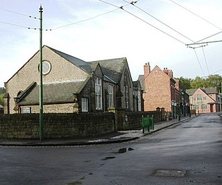
WAmblecote is an urban village in the Metropolitan Borough of Dudley in the West Midlands, England. It lies immediately north of the historic town of Stourbridge, extending about one and a half miles from it, and is on the southwestern edge of the West Midlands conurbation. Historically, Amblecote was in the parish of Oldswinford, but unlike the rest of the parish it was in Staffordshire, and as such was administered separately.
 W
WBrierley Hill is a small town and electoral ward of the Dudley Metropolitan Borough in the West Midlands of England, and is situated approximately 2.5 miles south of central Dudley and 2 miles north of Stourbridge. Part of the Black Country and in a heavily industrialised area, it has a population of 13,935 at the 2011 census. It is best known for glass and steel manufacturing, although industry has declined considerably since the 1970s. One of the largest factories in the area was the Round Oak Steelworks, which was closed down and redeveloped in the 1980s to become the Merry Hill Shopping Centre. Brierley Hill was originally in Staffordshire.
WBrierley Hill is a small town and electoral ward of the Dudley Metropolitan Borough in the West Midlands of England, and is situated approximately 2.5 miles south of central Dudley and 2 miles north of Stourbridge. Part of the Black Country and in a heavily industrialised area, it has a population of 13,935 at the 2011 census. It is best known for glass and steel manufacturing, although industry has declined considerably since the 1970s. One of the largest factories in the area was the Round Oak Steelworks, which was closed down and redeveloped in the 1980s to become the Merry Hill Shopping Centre. Brierley Hill was originally in Staffordshire.
 W
WCoseley is a village in the north of the Dudley Metropolitan Borough, in the English West Midlands. Part of the Black Country, it is situated approximately three miles north of Dudley itself, on the border with Wolverhampton. Though it is a part of Dudley for statistical and administrative purposes, it is divided between the Bilston and Tipton postal districts, and mostly falls within the Wolverhampton South-East parliamentary constituency.
 W
WCradley is a village in the Black Country and Metropolitan Borough of Dudley; near Halesowen and the banks of the River Stour. Colley Gate is the name of the short road in the centre of Cradley. It was part of the ancient parish of Halesowen, but was always in Worcestershire, until the creation of the West Midlands County in 1974. This meant that for civil administrative purposes, Cradley formerly had the officers which a parish would have had. The population of the appropriate Dudley Ward taken at the 2011 census was 13,340.
 W
WDudley is a large industrialised market town and administrative centre in the county of West Midlands, England, 9.7 kilometres (6.0 mi) south-east of Wolverhampton and 16.9 kilometres (10.5 mi) north-west of Birmingham. Historically an exclave of Worcestershire, the town is the administrative centre of the Metropolitan Borough of Dudley and in 2011 had a population of 79,379. The Metropolitan Borough, which includes the towns of Stourbridge and Halesowen, had a population of 312,900. Dudley is the capital of the Black Country.
 W
WEve Hill is a residential area of Dudley in the West Midlands of England. It was part of Worcestershire until 1966 and briefly part of Staffordshire until 1974.
 W
WGornal is a suburban area and electoral ward of the Dudley Metropolitan Borough, in the West Midlands county in England. It encompasses three historic villages: Upper Gornal, Lower Gornal, and Gornal Wood. Gornal was formerly part of Staffordshire, prior to the creation of the West Midlands in 1974.
 W
WHaden Hill is a residential area in the West Midlands of England, straddling the border of Halesowen and Cradley Heath townships and the modern boroughs of Dudley and Sandwell.
 W
WHalesowen is a market town in the Metropolitan Borough of Dudley, in the county of West Midlands, England. It is considered as one of the largest towns in the United Kingdom without a railway station.
WHasbury is a suburb of Halesowen in the Metropolitan Borough of Dudley in West Midlands, England. Its main focal point is the small shopping centre at the Wassell Road/Hagley Road junction, surrounded to the north by municipal housing development and with owner-occupier housing estates located to the south and west. The local primary school is St Margaret's at Hasbury Church of England Primary School, which is located on Hagley Road adjacent to St. Margaret of Antioch church.
 W
WHurst Green is a suburb of Halesowen in the Metropolitan Borough of Dudley, located on its north-eastern side. Its principal thoroughfares are Narrow Lane/Fairfield Road, Summerfield Avenue and Hurst Green Road and Woodbury road with a small shopping centre at the eastern end of the latter bordering the M5 motorway. It is a mixture of owner-occupied and municipal housing, the latter concentrated around Brandon Road/Westfield Road. There is an industrial area to its north along Fairfield Road and Cakemore Road.
 W
WKates Hill, or Kate's Hill, is a residential area in Dudley, West Midlands, England.
WKingswinford is a town of the Metropolitan Borough of Dudley in the English West Midlands, situated 5 miles (8.0 km) west-southwest of central Dudley. In 2011 the area had a population of 25,191, down from 25,808 at the 2001 Census.
 W
WLutley is an area of Halesowen in the West Midlands, England. Site of a mill, called the Lutley Mill, also the name of a local Pub. Lutley Mill is situated on Puddings Brook. The Lutley Gutter runs through Lutley.
 W
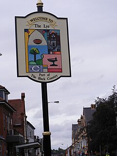
WLye or The Lye is an area in the Dudley Metropolitan Borough, in the West Midlands county, England. It was formerly a village within the parish of Oldswinford, historically situated within the boundaries of the county of Worcestershire. It used to be famous for the manufacture of nails, anvils, vices, chain, crucibles and firebricks. Lye Waste, adjacent to the original village of Lye, was an area of uncultivated common land but it was settled by people who, by building houses including a fireplace within 24 hours by using mud and clay as the main building materials, acquired freehold rights as a result of the passing of the Inclosure Acts [sic] from 1604 onwards, and it became thickly built upon. The village of Careless Green, now part of Lye but once a separate village immediately to the south-east, was noted for insurance clubs called Stewpony societies and the Stewpony Allotment Society which tried to improve conditions for the labouring classes.
 W
WMilking Bank is a residential area of Dudley, West Midlands, England.
 W
WMushroom Green is a hamlet in the Dudley Wood/Netherton area of Dudley, UK. It is known for its traditional chain making shop.The Chain Shop is open to the public for free demonstrations of traditional chain making which is ethe only remaining chain shop in its original grounds in Europe. On the second Sunday of the month from April to October between 2pm and 5pm. The chainshop is run by volunteers and curated by local sculptor Luke Perry, director of the non-profit Black Country company the Industrial Heritage Stronghold (IHS).
 W
WNetherton is a town of the Metropolitan Borough of Dudley, 1.5 miles (2 km) south of Dudley town centre in the West Midlands of England, but historically in Worcestershire. In the Black Country, Netherton is bordered by nature reserves to the east and west, and an industrial area and the Dudley Southern By-Pass to the north.
WNorton is a suburb and council ward in the town of Stourbridge, West Midlands. It has a population of 11,943 in an area of 569 hectares. The population is largely White British and self-identifies as predominantly Christian.
 W
WPensnett is an area of the Metropolitan Borough of Dudley, West Midlands, England, situated 2.3 miles (3.7 km) south-west of central Dudley. Pensnett has been a part of Dudley since 1966, when the Brierley Hill Urban District, of which it was a part, was absorbed into the County Borough of Dudley, later the Metropolitan Borough of Dudley from 1974.
 W
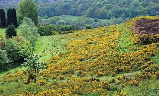
WPensnett Chase was a wooded area of land owned by the Lords of Dudley Castle in the parishes of Kingswinford and Dudley. As a chase, it was originally used by them to hunt game in although it was also used as common land by local people. At some periods it was regarded as extending into Gornal and including Baggeridge Wood at one end and perhaps Cradley Heath at the other. By the 17th century the ancient woodlands had largely been cleared.
 W
WQuarry Bank is an area in the Metropolitan Borough of Dudley, West Midlands, England, which exists within the Brierley Hill DY5 postal district. Locally, the name is often pronounced, "Quarry Bonk".
 W
WSedgley is a town in the north of the Metropolitan Borough of Dudley, in the West Midlands, England.
 W
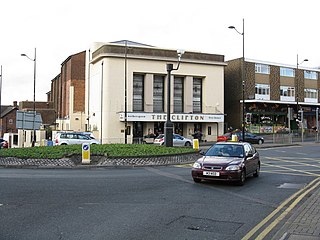
WStourbridge is a market town in the West Midlands, England. Situated on the River Stour, it was the centre of British glass making during the Industrial Revolution. The 2011 UK census recorded the town's population as 63,298.
 W
WStraits Estate is a housing estate located near Sedgley, West Midlands, England, to the north-west of Gornal Ward, and was built for homeowners during the late 1950s and early 1960s. The streets within the estate are all named after famous poets and wordsmiths.
WWall Heath is a village in the Dudley Metropolitan Borough in the West Midlands of England. It is located on the A449 road, approximately 5 miles west of Dudley Town Centre and 9 miles north of Kidderminster.
WWollaston is a village on the outskirts of Stourbridge in the English West Midlands. It is located in the south of the Dudley Metropolitan Borough, one mile from Stourbridge town centre.
WWoodsetton is an area of the Dudley Metropolitan Borough in the West Midlands of England, roughly 2.0 miles (3 km) northwest of Dudley Town Centre. Formerly in the Sedgley Urban District, a part of Woodsetton was transferred into the Dudley County Borough in 1926 to allow for the building of the Priory Estate. This reorganisation also saw this part of the area transferred from Staffordshire to Worcestershire.
WWoodside is a residential area of Dudley in the West Midlands of England.
WWordsley is a village of Stourbridge in the West Midlands, England. It is part of the Metropolitan Borough of Dudley and falls into the Stourbridge (DY8) postcode and address area, being just north of the River Stour. Wordsley is part of the Dudley South Parliamentary constituency and backs onto open countryside with an extensive array of luxury property.