 W
WAkaroa Harbour, is part of Banks Peninsula in the Canterbury region of New Zealand. The harbour enters from the southern coast of the peninsula, heading in a predominantly northerly direction. It is one of two major inlets in Banks Peninsula, on the coast of Canterbury, New Zealand; the other is Lyttelton Harbour on the northern coast.
 W
WAotea Harbour is a settlement and smallest of three large natural inlets in the Tasman Sea coast of the Waikato region of New Zealand's North Island. It is located between Raglan Harbour to the north and Kawhia Harbour to the south, 30 kilometres southwest of Hamilton.
 W
WThe Auckland Harbour Board was a public body that operated the ports of both Auckland and Onehunga from 1871 to 1988 and was dissolved in 1989. Its successor organisation is Ports of Auckland, which assumed the possessions and responsibilities of the Harbour Board.
 W
WBluff Harbour is a harbour and lagoon in the South Island, New Zealand town of Bluff. The main port facilities are located close to the entrance of a large natural inlet which includes a large, low-lying eastern arm, Awarua Bay, immediately to the east of the promontory which gives the town and harbour its name.
 W
WCarnley Harbour is a large natural harbour in the south of the Auckland Islands, a subantarctic part of the New Zealand Outlying Islands. Formed from the drowned crater of an extinct volcano, the harbour separates the mainland of Auckland Island from the smaller Adams Island. The harbour is sometimes referred to as the Adams Straits.
New Zealand Sugar Company Limited is a long-established business and landmark in Birkenhead, New Zealand, located on the northern shore of Auckland's Waitemata Harbour. The company is also known colloquially as "Chelsea Sugar", taking reference from the company's branded sugar "Chelsea", and the site is also colloquially known as the "Chelsea Sugar Refinery", or "sugar works".
 W
WHerekino is a locality in Northland, New Zealand. It lies 26 km south west of Kaitaia. The Herekino Harbour, also called the Herekino River, is an estuary and inlet from the Tasman Sea to the west. The Herekino Forest, which contains a stand of large kauri, is to the north, and the Tauroa Peninsula lies to the north west.
 W
WThe Hokianga is an area surrounding the Hokianga Harbour, also known as the Hokianga River, a long estuarine drowned valley on the west coast in the north of the North Island of New Zealand.
 W
WKaipara Harbour is a large enclosed harbour estuary complex on the north western side of the North Island of New Zealand. The northern part of the harbour is administered by the Kaipara District and the southern part is administered by the Auckland Council. The local Māori tribe is Ngāti Whātua.
 W
WKawhia Harbour is one of three large natural inlets in the Tasman Sea coast of the Waikato region of New Zealand's North Island. It is located to the south of Raglan Harbour, Ruapuke and Aotea Harbour, 40 kilometres southwest of Hamilton. Kawhia is part of the Otorohanga District Council and is in the King Country. It has a high-tide area of 68 km2 (26 sq mi) and a low-tide area of 18 km2 (6.9 sq mi).
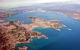
WLyttelton Harbour / Whakaraupō is one of two major inlets in Banks Peninsula, on the coast of Canterbury, New Zealand; the other is Akaroa Harbour on the southern coast.
WThe Manukau Harbour is the second largest natural harbour in New Zealand by area. It is located to the southwest of the Auckland isthmus, and opens out into the Tasman Sea.
 W
WNapier Port is in Napier, New Zealand, on Hawke Bay. It is the North Island's second largest export port by tonnage, and is owned by the Port of Napier Ltd.
 W
WOtago Harbour is the natural harbour of Dunedin, New Zealand, consisting of a long, much-indented stretch of generally navigable water separating the Otago Peninsula from the mainland. They join at its southwest end, 21 km (13 mi) from the harbour mouth. It is home to Dunedin's two port facilities, Port Chalmers and at Dunedin's wharf. The harbour has been of significant economic importance for approximately 700 years, as a sheltered harbor and fishery, then deep water port.
 W
WParengarenga Harbour is a natural harbour close to the northernmost point on the North Island of New Zealand. Located at the northern end of the Aupouri Peninsula, it extends inland for over 10 kilometres, almost severing the northern tip of the island from the rest of the peninsula. The harbour's mouth is towards the norther end of Great Exhibition Bay. The island's northernmost point, at the Surville Cliffs is only about 10 kilometres north of the harbour. Te Hapua is a settlement at the western side of the harbour.
 W
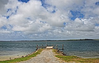
WPaterson Inlet is a large natural harbour in the eastern coast of Stewart Island/Rakiura, New Zealand, much of which is unspoilt forest.
 W
WPearl Harbour is a small harbour at the head of the Waiau River, in the town of Manapouri on the South Island of New Zealand.
 W
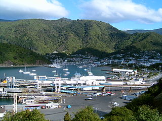
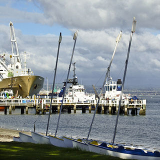
WPicton is a town in the Marlborough Region of New Zealand's South Island. The town is located near the head of the Queen Charlotte Sound / Tōtaranui, 25 km (16 mi) north of Blenheim and 65 km (40 mi) west of Wellington. Waikawa lies just north-east of Picton.
 W
WTe Awarua-o-Porirua Harbour, commonly known as Porirua Harbour, is a natural inlet in the south-western coast of the North Island of New Zealand. The city of Porirua, one of the four cities in the Wellington conurbation, surrounds it. The city centre is to the south of the harbour. The harbour has an entrance only a few hundred metres in width, close to the suburb of Plimmerton. It opens up into two arms, Onepoto Arm to the south and Pauatahanui Arm to the north-east. Each arm is around three kilometres in length.
WPort Chalmers is a town serving as the main port of the city of Dunedin, New Zealand, with a population of 3,000. Port Chalmers lies ten kilometres inside Otago Harbour, some 15 kilometres northeast of Dunedin's city centre.
 W
WPort Levy is a long, sheltered bay and settlement on Banks Peninsula in Canterbury, New Zealand. The current population is under 100, but in the mid-19th century it was the largest Māori settlement in Canterbury with a population of about 400 people. It is named after Solomon Levey, an Australian merchant and ship owner who sent a number of trading vessels to the Banks Peninsula area during the 1820s.
 W
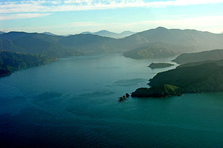
WTe Whanganui / Port Underwood is a sheltered harbour which forms the north-east extension of Cloudy Bay at the northeast of New Zealand's South Island, on the east coast of the Marlborough Sounds. With only a relatively narrow entrance to the south-south-east it is sheltered from almost all winds. Originally considered part of Cloudy Bay the port was named after Joseph Underwood of the shipping firm Kabel and Underwood in the early 19th century.
 W
WPorts of Auckland Limited (POAL), the successor to the Auckland Harbour Board, is the Auckland Council-owned company administering Auckland's commercial freight and cruise ship harbour facilities. As the company operates all of the associated facilities in the Greater Auckland area, this article is about both the current company and the ports of Auckland themselves.
 W
WRangaunu Harbour is a shallow harbour in the far north of New Zealand. It is situated on the east coast at the base of the Aupouri Peninsula. The name in Māori means "To pull out a shoal of fish". With an area of 115 square kilometres (44 sq mi) it is the fifth-largest harbour in New Zealand.
Port Taranaki is a port complex located in New Plymouth, New Zealand. It is the only deep water port on the west coast of New Zealand, and is owned by the Taranaki Regional Council. The port handles a wide range of coastal and international cargoes, mostly relating to the farming, engineering and petrochemical industries. Shipping volumes decreased significantly over the period 2012 to 2015.
 W
WThe Port of Tauranga is situated in Tauranga, New Zealand. It is the largest port in the country both in terms of total cargo volume, and in terms of container throughput with container volumes exceeding 950,000 TEUs. The port is operated by Port of Tauranga Ltd. This article is about both the company and the port itself.
 W
WTauranga Harbour is the natural tidal harbour that surrounds Tauranga CBD and the Mount Maunganui area of Tauranga, New Zealand, and which flows into the Pacific Ocean at Mount Maunganui. The harbour is effectively two flooded river systems separated from the Pacific Ocean by Matakana Island.
WWaitematā Harbour is the main access by sea to Auckland, New Zealand. For this reason it is often referred to as Auckland Harbour, despite the fact that it is one of two harbours adjoining the city. The harbour forms the northern and eastern coasts of the Auckland isthmus and is crossed by the Auckland Harbour Bridge. It is matched on the southern side of the city by the shallower waters of the Manukau Harbour.
 W
WWellington Harbour is the large natural harbour on the southern tip of New Zealand's North Island. New Zealand's capital city, Wellington, is located on its western side. The harbour, the sea area bounded by a line between Pencarrow Head to Petone foreshore, was officially named Port Nicholson, until it assumed its current name in 1984.
 W
WWhangape Harbour is a harbour on the west coast of Northland, New Zealand. There is a settlement called Whangape on the northern side of the harbour. Another, called Pawarenga, is located on the southern side. Kaitaia is 42 km north east.
WWhangapoua Harbour is a shallow natural harbour in the northeast of the Coromandel Peninsula. It is located between Whangapoua in the north, Te Rerenga in the southwest, and Matarangi on the Omara Spit in the north separating it from the ocean. Two boat ramps and a jetty provide boat access into the harbour.
 W
WWhangārei Harbour is a large harbour on the east coast of the North Island of New Zealand.
WWhangaroa Harbour, previously spelled Wangaroa Harbour, is an inlet on the northern coast of Northland, New Zealand. Whangaroa Bay and the Pacific Ocean are to the north. The small settlements of Totara North and Saies are on the west side of the harbour, Waitaruke on the south side, and Whangaroa on the east. State Highway 10 runs through Waitaruke. The name comes from the lament "Whaingaroa" or "what a long wait" of a woman whose warrior husband had left for a foray to the south. The harbour was formed when rising sea levels drowned a river valley about 6,000 years ago. Steep outcrops remain from ancient volcanic rocks.
 W
WWhangaruru is a rural community and harbour on the east coast of Northland, New Zealand. Mokau, Helena Bay, Whakapara, Hikurangi and Whangarei are to the south and the Bay of Islands is to the northwest.