 W
WThe Nomenclature of Territorial Units for Statistics (NUTS) is a geocode standard for referencing the subdivisions of Ireland for statistical purposes. The standard is developed and regulated by the European Union. The NUTS standard is instrumental in delivering the European Union's Structural Funds. The NUTS code for Ireland is IE and a hierarchy of three levels is established by Eurostat. Below these is a further levels of geographic organisation - the local administrative unit (LAU). In Ireland, the LAUs are electoral divisions.
 W
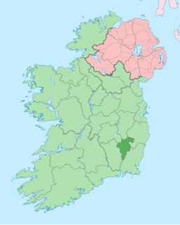
WCounty Carlow is a county located in the South-East Region of Ireland, within the province of Leinster. Carlow is the second smallest and the third least populous of Ireland's 32 traditional counties. Carlow County Council is the governing local authority.
 W
WCounty Cavan is a county in Ireland. It is in the province of Ulster and is part of the Border Region. It is named after the town of Cavan and is based on the historic Gaelic territory of East Breffny (Bréifne). Cavan County Council is the local authority for the county, which had a population of 76,176 at the 2016 census.
 W
WCounty Clare is a county in Ireland, in the Mid-West Region and the province of Munster, bordered on the west by the Atlantic Ocean. Clare County Council is the local authority. The county had a population of 118,817 at the 2016 census. The county town and largest settlement is Ennis.
 W
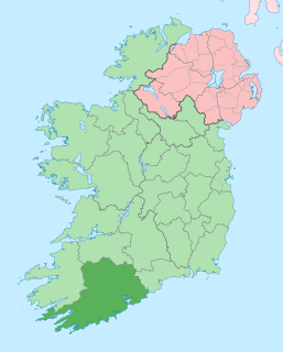
WCounty Cork is a county in Ireland. It is the largest and southernmost county of Ireland, situated in the province of Munster and named after the city of Cork, Ireland's second-largest city. The Cork County Council is the local authority for the county. Its largest market towns are Mallow, Macroom, Midleton, and Skibbereen. In 2016, the county's population was 542,868, making it the third-most populous county in Ireland. Notable Corkonians include Michael Collins, Jack Lynch, and Sonia O'Sullivan.
 W
WCork is the second largest city in Ireland, located in the south-west of Ireland, in the province of Munster. Following an extension to the city's boundary in 2019, its population is c. 210,000.
 W
WCounty Donegal is a county of Ireland in the province of Ulster. It is named after the town of Donegal in the south of the county. It has also been known as County Tyrconnell, after the historic territory of the same name, on which it was based. Donegal County Council is the local council and Lifford the county town.
 W
WDublin is the capital and largest city of Ireland. Situated on a bay on the east coast, at the mouth of the River Liffey, it lies within the province of Leinster. It is bordered on the south by the Dublin Mountains, a part of the Wicklow Mountains range. It has an urban area population of 1,173,179, while the population of the Dublin Region as of 2016 was 1,347,359. The population of the Greater Dublin Area was 1,904,806 per the 2016 census.
 W
WDún Laoghaire–Rathdown is a county in Ireland. It is part of the Dublin Region in the province of Leinster. It is named after the former borough of Dún Laoghaire and the barony of Rathdown. Dún Laoghaire–Rathdown County Council is the local authority for the county. The population of the county was 218,018 at the time of the 2016 census.
 W
WFingal is a county in Ireland. It is located in the province of Leinster and, within that, is part of the Dublin Region. Its name is derived from the medieval territory of Scandinavian foreigners that settled in the area. Fingal County Council is the local authority for the county. In 2016 the population of the county was 296,214, making it the second-most populous county in the state.
 W
WGalway is a city in the West of Ireland, in the province of Connacht. It is the county town of County Galway, which is named after it. It lies on the River Corrib between Lough Corrib and Galway Bay, and is the sixth most populous city in Ireland, with a population at the 2016 Census of 79,934.
 W
WCounty Galway is a county in Ireland. It is in the West of Ireland, taking up the south of the province of Connacht.
 W
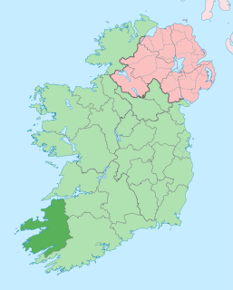
WCounty Kerry is a county in Ireland. It is located in the South-West Region and forms part of the province of Munster. It is named after the Ciarraige who lived in part of the present county. The population of the county was 147,707 at the 2016 census.
 W
WCounty Kildare is a county in Ireland. It is located in the province of Leinster and is part of the Mid-East Region. It is named after the town of Kildare. Kildare County Council is the local authority for the county which has a population of 222,504.
 W
WCounty Kilkenny is a county in Ireland. It is in the province of Leinster and is part of the South-East Region. It is named after the city of Kilkenny. Kilkenny County Council is the local authority for the county. As of the 2016 census the population of the county was 99,232. The county was based on the historic Gaelic kingdom of Ossory (Osraighe), which was co-terminus with the Diocese of Ossory.
 W
WCounty Laois is a county in Ireland. It is located in the south of the Midlands Region and in the province of Leinster. It was formerly known as "Queen's County." The modern county takes its name from Loígis, a medieval kingdom. Historically, it has also been known as County Leix.
 W
WCounty Leitrim is a county in the Republic of Ireland. It is in the province of Connacht and is part of the Border Region. It is named after the village of Leitrim. Leitrim County Council is the local authority for the county, which had a population of 32,044 according to the 2016 census. The county encompasses the historic Gaelic territory of West Breffny (Bréifne) corresponding to the northern part of the county, and Muintir Eolais or Conmaicne Réin, corresponding to the southern part.
 W
WLimerick is a city in County Limerick, Ireland. It is located in the Mid-West Region and is also part of the province of Munster. With a population of 94,192 at the 2016 census, Limerick is the third-most populous urban area in the state, and the fourth-most populous city on the island of Ireland at the 2011 census. The city lies on the River Shannon, with the historic core of the city located on King's Island, which is bounded by the Shannon and Abbey Rivers. Limerick is also located at the head of the Shannon Estuary, where the river widens before it flows into the Atlantic Ocean. Limerick City and County Council is the local authority for the city.
 W
WCounty Limerick is a county in Ireland. It is located in the province of Munster, and is also part of the Mid-West Region. It is named after the city of Limerick. Limerick City and County Council is the local council for the county. The county's population at the 2016 census was 194,899 of whom 94,192 lived in Limerick City, the county capital.
 W
WCounty Longford is a county in Ireland. It is in the province of Leinster. It is named after the town of Longford. Longford County Council is the local authority for the county. The population of the county was 40,873 at the 2016 census. The county is based on the historic Gaelic territory of Annaly (Anghaile), formerly known as Teffia (Teathbha).
 W
WCounty Louth is a county in the Republic of Ireland. It is in the province of Leinster and is part of the Mid-East Region. It is named after the village of Louth. Louth County Council is the local authority for the county. According to the 2016 census, the population of the county was 128,884.
 W
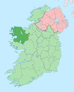
WCounty Mayo is a county in Ireland. In the West of Ireland, in the province of Connacht, it is named after the village of Mayo, now generally known as Mayo Abbey. Mayo County Council is the local authority. The population was 130,507 at the 2016 census. The boundaries of the county, which was formed in 1585, reflect the Mac William Íochtar lordship at that time.
 W
WCounty Meath is a county in Ireland. It is in the province of Leinster and is part of the Mid-East Region. It is named after the historic Kingdom of Meath. Meath County Council is the local authority for the county. At the 2016 census, the population of the county was 195,044. The county town of Meath is Navan. Other towns in the county include Trim, Kells, Laytown, Ashbourne, Dunboyne, and Slane.
 W
WCounty Monaghan is a county in Ireland. It is part of the Border Region and is in the province of Ulster. It is named after the town of Monaghan. Monaghan County Council is the local authority for the county. The population of the county was 61,386 according to the 2016 census.
 W
WNorth Tipperary was a county in Ireland. It was part of the Mid-West Region and was also located in the province of Munster. It was named after the town of Tipperary and consisted of 48% of the land area of the traditional county of Tipperary. North Tipperary County Council was the local authority for the county. In 2011, the population of the county was 70,322. It was abolished on 3 June 2014, merged with South Tipperary under a new Tipperary County Council.
 W
WCounty Offaly is a county in Ireland. It is part of the Midlands Region and is also located in the province of Leinster. It is named after the ancient Kingdom of Uí Failghe and was formerly known as King's County. Offaly County Council is the local authority for the county. The county population was 77,961 at the 2016 census.
 W
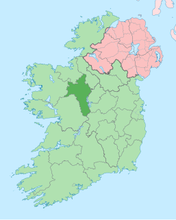
WCounty Roscommon is a county in Ireland. In the western region, it is part of the province of Connacht. It is the 11th largest Irish county by area and 27th most populous. Its county town and largest town is Roscommon. Roscommon County Council is the local authority for the county. The population of the county was 64,544 at to the 2016 census.
 W
WCounty Sligo is a county in Ireland. It is located in the Border Region and is part of the province of Connacht. Sligo is the administrative capital and largest town in the county. Sligo County Council is the local authority for the county. The population of the county was 65,535 at the 2016 census. It is noted for Benbulben Mountain, one of Ireland's most distinctive natural landmarks.
 W
WSouth Dublin is a county in Ireland, within the province of Leinster, and the Dublin Region, the successor to County Dublin, from which its name derives. South Dublin County Council is the local authority for the county. The county contains both dense suburbs of Dublin and stretches of unpopulated mountain. In 2011 it had a population of 278,749, making it the third most populous county in the state.
 W
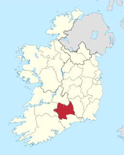
WSouth Tipperary was a county in Ireland. It was part of the South-East Region and was also located in the province of Munster. It was named after the town of Tipperary and consisted of 52% of the land area of the traditional county of Tipperary. South Tipperary County Council was the local authority for the county. The population of the county was 88,433 according to the 2011 census. It was abolished on 3 June 2014, merged with North Tipperary under a new Tipperary County Council.
 W
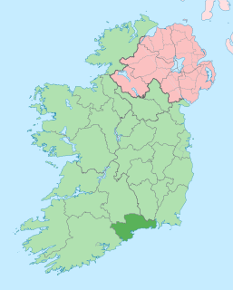
WCounty Waterford is a county in Ireland. It is in the province of Munster and is part of the South-East Region. It is named after the city of Waterford. Waterford City and County Council is the local authority for the county. The population of the county at large, including the city, was 116,176 according to the 2016 census. The county is based on the historic Gaelic territory of the Déise. There is an Irish-speaking area, Gaeltacht na nDéise, in the south-west of the county.
 W
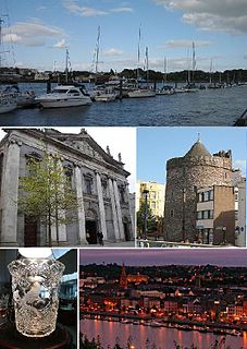
WWaterford is a city in Ireland. It is in County Waterford in the south-east of Ireland and is located in the province of Munster. The city is situated at the head of Waterford Harbour. It is the oldest and the fifth most populous city in the Republic of Ireland. It is the tenth most populous settlement on the island of Ireland. Waterford City and County Council is the local government authority for the city. According to the 2016 Census, 53,504 people live in the city, with a wider metropolitan population of 82,963.
 W
WCounty Westmeath is a county in Ireland. It is in the province of Leinster and is part of the Midlands Region. It originally formed part of the historic Kingdom of Meath. It was named Mide because the kingdom was located in the geographical centre of Ireland. Westmeath County Council is the administrative body for the county, and the county town is Mullingar. At the 2016 census, the population of the county was 88,770.
 W
WCounty Wexford is a county in Ireland. It is in the province of Leinster and is part of the South-East Region. Named after the town of Wexford, it was based on the historic Gaelic territory of Hy Kinsella, whose capital was Ferns. Wexford County Council is the local authority for the county. The population of the county was 149,722 at the 2016 census.
 W
WCounty Wicklow is a county in Ireland. The last of the traditional 32 counties to be formed, as late as 1606, it is part of the Mid-East Region and also part of the traditional province of Leinster. It is named after the town of Wicklow, which derives from the Old Norse name Víkingaló, meaning "Vikings' Meadow". Wicklow County Council is the local authority for the county. The county had a population of 142,425 at the 2016 census.