 W
WAmbassa is a census town and the headquarters of the Dhalai district of the Indian state of Tripura.
WAmtali is a town in Tripura. It is 10 km away from Agartala in West Tripura district of Tripura state. There is one post-office in the Amtali Bazar and one Police station also. It is approximately 2 km away from the Tripura University. This town is located in Dukli Rural Development Block.
WBadharghat is a census town in West Tripura district in the state of Tripura, India.
 W
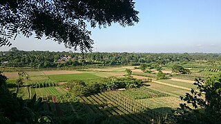
WBaramura also known as Hatai Kotor is a hill range in Tripura, India. Baramura also known for its great Hornbill. The 8 National Highway(Assam-Agartala road) cross through the Baramura hill range. Baramura has a gas thermal and power plant.
WBelonia is a town and municipal council in South Tripura district, Tripura, India. It is also the headquarters of South Tripura District. It is linked with Agartala by National Highway 108A from Belonia to Jolaibari and via National Highway 8 from Jolaibari to Agartala. Belonia lies on the border with Bangladesh.
 W
WBetlingchhip, also known as Betalongchhip, Balinchhip and Thaidawr is the highest peak of the Jampui Hills. It is located in the state of Tripura.
 W
WChabimura or Chobimura (Bengali:ছবিমুড়া) also known as Chakwrakma or Chakrakma is famous for its panels of rock carving on steep mountain wall on the bank of river Gomti in Indian state Tripura. There are huge carved images of Shiva, Vishnu, Kartika, Mahisasura Mardini Durga and other Gods and Goddesses.
WChampaknagar is a small town some 30 km away from Agartala, the State capital on the banks of river Saidra.
WChittamara is a Village in South Tripura district in the Indian state of Tripura, located in the UTC 5.30 time zone and it follows Indian standard time (IST). Chittamara sun rise time varies -36 minutes from IST. The vehicle driving side in Chittamara is left, all vehicles should take left side during driving. Chittamara people are using its national currency which is Indian Rupee and its international currency code is INR. Chittamara phones and mobiles can be accessed by adding the Indian country dialing code +91 from abroad. Chittamara people are following the dd/mm/yyyy date format in day-to-day life. It lies on the border with Bangladesh. It contains a SBI Branch and tehsil. The native language of Chittamara is Bengali, Kokborok and most of the village people speak Bengali, Kokborok. Chittamara people use Bengali, Kokborok language for communication.
 W
WClouded Leopard National Park is a national park in the Sipahijola Wildlife Sanctuary Tripura, India. It covers an area of about 5.08 square kilometres (1.96 sq mi) and is home to four species of primate monkey including Phayre’s langur.
 W
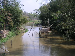
WThe Dhalai River a trans-boundary river in India and Bangladesh. It rises in the mountains of the Indian state of Tripura. It enters Kulaura Upazila of Maulvibazar District of Bangladesh. Later it joins Manu River in Rajnagar Upazila. The co-ordinates of Dhalai River at Ambassa are 23.55'128'' N and 91.51'204'' E in degrees minutesseconds(DMS). It originate from Atharamura Hill and is 117 kilometres (73 mi) long. Some of the popular riverside townships of Dhalai River are the towns of Ambassa, Baralutma and Kamalpur.
 W
WGandhigram is a town in Tripura, India. located around 10 km from city centre Agartala. It comes under Sadar district. It has an old age home called Sandhyoneer.
 W
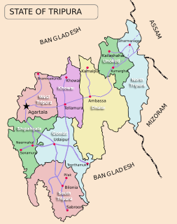
WGomati district is a district of Tripura, India. This district was created in January 2012 when four new districts were created in Tripura, taking the number of districts in the state from four to eight. Udaipur is its headquarters.
WIndranagar is a census town in West Tripura district in the Indian state of Tripura. The locality is famous for the Kali temple. Everyday many devotees are found to offer worship to the goddess Kali. During Dewali a fair is held for three days. Large gathering is observed. ITI is another landmark of the place.
WJirania is a small town in Tripura state of India on the banks of river Saidra. It is a nagar panchayat and also the headquarters of Jirania Rural Development Block. It is also the headquarters of Jirania Sub Division. It has 3 major high schools. Its market is of great importance for the local business and its sustainence. It lies on the National Highway 8 of India.
 W
WKamalasagar is an artificial lake in Tripura, India, constructed by King Dhanya Manikya of Tripura in the 15th century and is a popular spot for picnickers. A mela is held there every October during the Navaratri festival.
WKamalpur is a town and a nagar panchayat in Dhalai district in the Indian state of Tripura. Around 93 km from the state capital Agartala. Kamalpur is the largest Sub-divisional town in Dhalai District.
WKhowai district is a district of Tripura state of India. This district was created in January, 2012 when four new districts were created in Tripura, taking the number of districts in the state from four to eight. The district headquarters are located in the town Khowai. The district was carved out of West Tripura district along with new Sipahijala district. The district is divided into two subdivisions, namely Khowai and Teliamura.
 W
WKhowai River is a trans-boundary river that originates in the eastern part of the Atharamura Hills of Tripura in India.
WKumarghat is a town, municipality, block and a sub-division in Unakoti district in the Indian state of Tripura.
 W
WThe Longai River is a trans-boundary river in India and Bangladesh. It rises in the Jampui Hills of the Indian state of Tripura. It flows through some part of Mizoram before entering Karimganj district of Assam. Later it enters Bangladesh, and drains in Hakaluki Haor.
 W
WThe Lushai (Pron: ˌlʊˈʃaɪ) Hills are a mountain range in Mizoram and Tripura, India. The range is part of the Patkai range system and its highest point is 2,157 m high Phawngpui, also known as 'Blue Mountain'.
WNarsingarh is a census town in West Tripura district in the Indian state of Tripura.
 W
WNorth Tripura is an administrative district in the state of Tripura in India. The district headquarters are located at Dharmanagar. The district occupies an area of 1422.19 km² and has a population of 693,947.
WPanisagar is a town and a nagar panchayat in North Tripura district in the state of Tripura, India. It is also the headquarters of Panisagar Tehsil.
WPratapgarh is a census town in West Tripura district in the Indian state of Tripura.
WSabroom is a town and a nagar panchayat in South Tripura district in the Indian state of Tripura.
 W
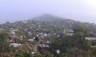
WSabual is a village in the northeastern part of Tripura state in Northeast India. It is one of the ten Mizo-Reang villages which compose the Jampui Hills range under Kanchanpur Sub-Division. The District headquarter, Dharmanagar is approximately 85 kilometers from Sabual. It sits at about 1000 meters above sea level. Summer is cool and winter season is cold. The economy of the village depend on shifting cultivation and Gardening.
WSantirbazar is a town and Municipal Council in South Tripura district, Tripura, India. It is linked with Agartala by National Highway 8 via Udaipur and Bishramganj.
 W
WSepahijala District is a district of Tripura, India. This district was created in January 2012 when four new districts were established in Tripura, taking the number of districts in the state from four to eight. Part of the district was formed from the former district of West Tripura. The principal towns in the district are Bishalgarh, Bishramganj, Melaghar and Sonamura.
 W
WSepahijala Wildlife Sanctuary is a wildlife sanctuary in Tripura, India of some 18.53 square kilometres (7.15 sq mi), about 25 kilometres (16 mi) from the city centre, located in Bishalgarh. It is a woodland with an artificial lake and natural botanical and zoological gardens. It is famous for its clouded leopard enclosures.
WSonamura India is a town and the headquarter of Sonamura Subdivision in Sipahijala district in the Indian state of Tripura. It lies on the border with Bangladesh, to the east of Comilla. It contains a hospital, police station, jail, and a town hall.
 W
WSouth Tripura is an administrative district in the state of Tripura in northeastern India.
WTeliamura is a town and a nagar panchayat in Khowai district in the Indian state of Tripura. It is on the National Highway No.08 of India. It is also the headquarters of the recently included sub-division of Teliamura. It is 45 km from Agartala, Capital of Tripura, 35 km from Khowai and 42 km from Ambassa.
WBorokathal as it is known generally, now officially known as Uatlok Twithu, is a small town located in the interiors of Sadar sub-division of West Tripura district of Tripura, India. The Sumli river flows through the town. The locality consist of the ethnic Tripuri people. The town has the only high secondary school of the area.
 W
WUnakoti district is a district of Tripura, India. This district was created on 21 January 2012 when four new districts were created in Tripura, taking the number of districts in the state from four to eight.