 W
WRalph Agas was an English land surveyor and cartographer. He was born at Stoke-by-Nayland, Suffolk, in about 1540, and lived there throughout his life, although he travelled regularly to London. He began to practise as a surveyor in about 1566, and has been described as "one of the leaders of the emerging body of skilled land surveyors".
 W
WJoão Teixeira Albernaz I also referred to as João Teixeira Albernaz, the Elder (Lisbon, late 16th century – c. 1662), to distinguish him from his grandson, was the most prolific Portuguese cartographer of the seventeenth century. His works include nineteen atlases, a total of two hundred and fifteen maps. He stands out for the variety of themes, which record the progress of maritime and land exploration, particularly in the Portuguese colony of Brazil. João Teixeira Albernaz belonged to a prominent family of cartographers whose work extended from mid-sixteenth century until the late eighteenth century, including his father Luís Teixeira, uncle Domingos Teixeira, brother Pedro Teixeira Albernaz and grandson João Teixeira Albernaz, the younger, as well as Estevão Teixeira.
 W
WRichard Blome (1635-1705) was an engraver, cartographer, and publisher in the Kingdom of England.
 W
WGeorg Braun was a topo-geographer. From 1572 to 1617 he edited the Civitates orbis terrarum, which contains 546 prospects, bird's-eye views and maps of cities from all around the world. He was the principal editor of the work, he acquired the tables, hired the artists, and wrote the texts. He died as an octogenarian in 1622, as the only survivor of the original team to witness the publication of volume VI in 1617.
 W
WGiacomo Cantelli da Vignola was an Italian cartographer and engraver of the 17th century.
 W
WCount Erik Jönsson Dahlbergh was a Swedish military engineer, Governor-general and Field marshal. He rose to the level of nobility through his military competence. As an architect and draftsman, he was renowned for fortification works. He is most known for his collection of engravings Suecia Antiqua et Hodierna, a collection of engravings of topographical research.
 W
WLucas Jacobsøn Debes was a Danish priest, topographer and celebrated writer about the Faroe Islands. He wrote the first book about the Faroes, which was printed and drew the first detailed map of the Faroe Islands.
 W
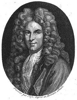
WGuillaume Delisle, also spelled Guillaume de l'Isle, was a French cartographer known for his popular and accurate maps of Europe and the newly explored Americas.
 W
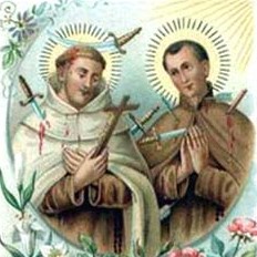
WPierre Berthelot was a French sailor and cartographer in the service of the king of Portugal, and later Discalced Carmelite friar in Goa, taking the name Denis. He was killed in Sumatra while taking part in a diplomatic mission there on behalf of the Portuguese Empire. He was beatified by Pope Leo XIII in 1900 as Blessed Denis of the Nativity, O.C.D..
 W
WSir Robert Dudley was an English explorer and cartographer. In 1594, he led an expedition to the West Indies, of which he wrote an account. The illegitimate son of Robert Dudley, 1st Earl of Leicester, he inherited the bulk of the Earl's estate in accordance with his father's will, including Kenilworth Castle. In 1603–1605, he tried unsuccessfully to establish his legitimacy in court. After that he left England forever, finding a new existence in the service of the grand dukes of Tuscany. There, he worked as an engineer and shipbuilder, and designed and published Dell'Arcano del Mare (1645-1646), the first maritime atlas to cover the whole world. He was also a skilled navigator and mathematician. In Italy, he styled himself "Earl of Warwick and Leicester", as well as "Duke of Northumberland", a title recognized by Emperor Ferdinand II.
 W
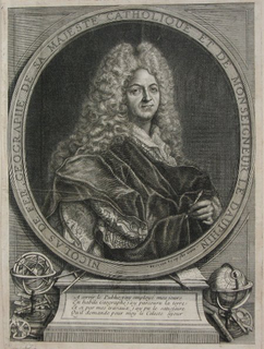
WNicolas de Fer was a French cartographer and geographer. He also was an engraver and publisher. His works focused more on quantity than quality, there were often geographical errors, and they were more artistic than accurate.
 W
WJean-Baptiste-Louis Franquelin was born at Saint-Michel de Villebernin, France in 1650. He died in France around 1712. He was a cartographer, a royal hydrographer, and a teacher of navigation. He was also the first official cartographer in Canada.
 W
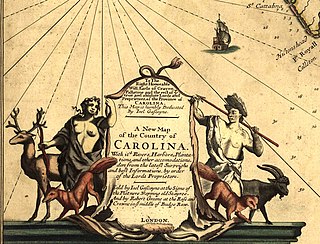
WJoel Gascoyne was an English nautical chartmaker, land cartographer and surveyor who set new standards of accuracy and pioneered large scale county maps. After achieving repute in the Thames school of chartmakers, he switched careers and became one of the leading surveyors of his day and a maker of land maps. He is best known for his maps of: the colonial Province of Carolina; of the county of Cornwall; and of the early 18th-century Parish of Stepney, precursor of today's East End of London. Gascoyne's distinctive style of chart and map-drawing was characterised by the use of bold and imaginative cartouches.
 W
WMoses Glover, was an English cartographer. He described himself as "paynter And Architectur", although very little is known about him apart from his maps and the church records. Glover's marriage licence, issued in 1622, described him as "painter-stainer of Isleworth". In 1635 he created a survey map of Isleworth Hundred for Algernon Percy, 10th Earl of Northumberland. It is preserved at the Syon House in London.
 W
WMatthaeus Greuter (1564–1638), known in Italian as Matteo Greuter, was a German etcher and engraver who worked in Rome. He is known for his cartographical prints.
 W
WFranciscus Haraeus, , was a theologian, historian, and cartographer from the Low Countries. He is best known for his history of the origins of the Dutch Revolt, written from a Catholic perspective but without polemical bias. He was one of the first cartographers to make thematic maps and globes.
 W
WHendrik Hondius I was a Flemish-born and trained engraver, cartographer, and publisher who settled in the Dutch Republic in 1597.
 W
WWillem Hondius or Willem Hondt was a Dutch engraver, cartographer and painter who spent most of his life in Poland.
 W
WGuillaume Levasseur de Beauplan or William le Vasseur de Beauplan was a French-Polish cartographer, engineer and architect.
 W
WPhilip Lea was an English cartographer, globemaker, instrument maker, and publisher. He was a prolific printer and reviser of maps, frequently collaborating with other contemporary mapmakers including Herman Moll, Robert Morden, John Ogilby, and John Seller.
 W
WAlain Manesson Mallet (1630–1706) was a French cartographer and engineer. He started his career as a soldier in the army of Louis XIV, became a Sergeant-Major in the artillery and an Inspector of Fortifications. He also served under the King of Portugal, before returning to France, and his appointment to the court of Louis XIV. His military engineering and mathematical background led to his position teaching mathematics at court.
 W
WMartino Martini was a Jesuit missionary, born and raised in Trent, a Prince-Bishopric in the Holy Roman Empire. As cartographer and historian he mainly worked on ancient Imperial China.
 W
WCaptain John Mason (1586–1635) was a sailor and colonizer born at King's Lynn, Norfolk, England, and educated at Peterhouse, Cambridge. In 1610, he was appointed by James I to help reclaim the Hebrides. As a reward, he was granted exclusive fishing rights in the North Sea. This was ignored by the Dutch and he was treated as a pirate by the Scots. In 1615, he was arrested, but soon released after the seizure of his ship. He was appointed the second Proprietary Governor of Newfoundland's Cuper's Cove colony in 1615, succeeding John Guy. Mason arrived on the island in 1616 and explored much of the territory. He compiled a map of the island and wrote and published a short tract of his findings.
 W
WMatthäus Merian der Ältere was a Swiss-born engraver who worked in Frankfurt for most of his career, where he also ran a publishing house. He was a member of the patrician Basel Merian family.
 W
WHerman Moll was a London cartographer, engraver, and publisher.
 W
WUrbano Monti was an Italian cartographer.
 W
WRobert Morden was an English bookseller, publisher, and mapmaker, globemaker and engraver. He was among the first successful commercial map makers.
 W
WJohn Norden was an English cartographer, chorographer and antiquary. He planned a series of county maps and accompanying county histories of England, the Speculum Britanniae. He was also a prolific writer of devotional works.
 W
WJohn Ogilby was a Scottish translator, impresario and cartographer. Best known for publishing the first British road atlas, he was also a successful translator, noted for publishing his work in handsome illustrated editions.
 W
WAdriaan Reland was a noted Dutch Orientalist scholar, cartographer and philologist. Even though he never left the Netherlands, he made significant contributions to Middle Eastern and Asian linguistics and cartography, including Persia, Japan and the Holy Lands.
 W
WMatteo Ricci, was an Italian Jesuit priest and one of the founding figures of the Jesuit China missions. He created the Kunyu Wanguo Quantu, a 1602 map of the world written in Chinese characters. He is considered a Servant of God by the Catholic Church.
 W
WNicolas Sanson was a French cartographer who served under two kings in matters of geography. He has been called the "father of French cartography."
 W
WChristopher Saxton was an English cartographer who produced the first county maps of England and Wales.
 W
WDon Carlos de Sigüenza y Góngora was one of the first great intellectuals born in the New World - Spanish viceroyalty of New Spain. He was a criollo patriot, exalting New Spain over Old. A polymath and writer, he held many colonial government and academic positions.
 W
WJohn Speed was an English cartographer and historian. He is, alongside Christopher Saxton, one of the best known English mapmakers of the early modern period.
 W
WPedro Teixeira Albernaz was a Portuguese cartographer born in 1595 in Lisbon, Kingdom of Portugal. He came from a family of cartographers including his father Luís Teixeira, uncle Domingos Teixeira, and his brother João Teixeira Albernaz I who he collaborated with. Around 1610, Pedro went to work in Spain. Pedro served as the royal cosmographer to Philip III of Spain and Philip IV (1621-1665). In the years 1622 to 1630 he worked on mapping the coasts of the Iberian Peninsula. Pedro changed his works from nautical charts to topographical survey chart throughout this time period. Pedro was appointed with his brother to make a map of Straits of Magellan and St. Vincent. Pedro died in 1662 in Madrid.
 W
WJohann Weikhard Freiherr von Valvasor or Johann Weichard Freiherr von Valvasor or simply Valvasor was a natural historian and polymath from Carniola, present-day Slovenia, and a fellow of the Royal Society in London.
 W
WEdward Wright was an English mathematician and cartographer noted for his book Certaine Errors in Navigation, which for the first time explained the mathematical basis of the Mercator projection by building on the works of Pedro Nunes, and set out a reference table giving the linear scale multiplication factor as a function of latitude, calculated for each minute of arc up to a latitude of 75°. This was in fact a table of values of the integral of the secant function, and was the essential step needed to make practical both the making and the navigational use of Mercator charts.