 W
WMount Achkasar is a 3,196 m (10,486 ft) tall mountain in Northern Armenia. Achkasar is highest peak of the Javakhk range in the Lesser Caucasus Mountains.
 W
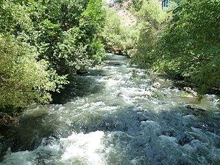
WAghstev River is a river in Armenia and Azerbaijan, and is a right tributary of the Kura River.
 W
WThe Anti-Taurus is the central chain of the mountain ranges of the Armenian Highlands, which runs from west to east across Western Armenia parallel to the Armenian Taurus. The Anti-Taurus consists of two parts, western and eastern. In the west, the Anti-Taurus departs north of the Cilician Taurus, and passing through the center of the Armenian plateau, ends in the east with the Ararat summits. The highest point of the Anti-Taurus is Mount Ararat, which is the highest peak of the Armenian Highlands and all of Turkey and also the highest mountain in the world from the foot to the crown(relative to the plain), the height of the cone above sea level is 5165 meters, the distance from the foot to the top - 4365 meters.
 W
WThe Aramazd mountains are located in Armenia. Mount Aramazd located in the south-east to Mount Aragats in the north-west.
 W
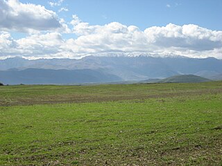
WThe Ararat Plain, alternatively known as the Iğdır Plain, is one of the largest plains of the Armenian Plateau. It stretches west of the Sevan basin, at the foothills of the Geghama mountains. In the north, the plain borders on Mount Aragats, and Mount Ararat in the south. It is divided into two sections by the Aras River, the northern part located in Armenia, and the southern part in Turkey. Turkish part of the plain is an Important Bird Area.
 W
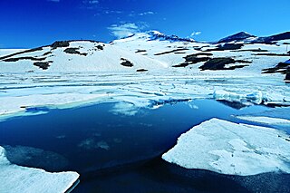
WLake Arpi is located in the Shirak Province of Armenia, on the Ashotsk plateau in the northwestern part of the country. The lake sits at an altitude of 2,025 m with an area of 220 km2. It originates from a volcano tectonic earthquake.
 W
WThe Azat is a river in the Kotayk Province of Armenia. Its source is on the western slope of the Geghama mountains. It flows through Garni, Lanjazat and Arevshat. It flows into the Arax near Artashat. The main purpose of the Azat dam is to serve for irrigation and hydro power generation. Its hazard potential is ranked to be high.
 W
WBagrevand was a region of Armenia.
 W
WThe house Baluni (Բալունի) & de Lavoies Lords of the Principality of Taron and Kings of mount Cilicia was a region and family of the old Armenia c. From 400 ad to the present. Baluni or Paluni were a family of Armenians from the Ministerial lands in Balahovit (Bolbitine) and Tsopk Sofine : branch also had lands in Vaspurakan. The princes of Paluni were a remnant of the territorial dominion of the people of Lope or Puli of the Hittite annals, situated between Astyan and Taron ; another remnant was the Prince of balabitena. In 439, when the Taron West pass of Gregory-Rides passed to the Mamikonians, Palunik, which may have been a dependency of Gregory-rides, it became the property of the new lords. It was then that the branch emigrated to Vaspurakan where it would create a small domain which it named Paluniq or Baluniq.
 W
WThe Borchaly Uyezd was a county of the Tiflis Governorate of the Caucasus Viceroyalty of the Russian Empire and then of Democratic Republic of Georgia and of Democratic Republic of Armenia with its administrative center in Shulaveri. Now, it is part of the Armenia's region of Lori and Georgia's region of Kvemo Kartli.
 W
WThe Debed or Debeda or Tona is a river in Armenia and Georgia. It also serves as a natural boundary between Armenia and Georgia at the village Sadakhlo, Georgia.
 W
WThe Dzoraget is a river in the Debeda hydrological region in the Lori region in Northern Armenia. It originates in the Bazum Mountains and flows west to east through spectacular gorges around Stepanavan. It finally feeds into the Debed river near Dzoragyugh, which ultimately drains to the Kura river.
 W
WThe Garni Gorge is situated 23 km east of Yerevan, Armenia, just below the village of the same name. On a promontory above the gorge the first-century AD Temple of Garni may be seen. Along the sides of the gorge are cliff walls of well-preserved basalt columns, carved out by the Goght River. This portion of the Garni Gorge is typically referred to as the "Symphony of the Stones." It is most easily reached via a road that leads left down the gorge just before reaching the temple of Garni. Another road leads to the gorge through the village, down a cobblestone road, and into the valley. Once in the valley, turning right will lead to Garni Gorge, an 11th-century medieval bridge, and the "Symphony of the Stones". Taking a left will lead along the river past a fish hatchery, up to the Khosrov Forest State Reserve, and a little further Havuts Tar Monastery.
 W
WGetik is a river in Armenia, the right tributary of the Aghstev River. It begins on the eastern slope of the Sevan ridge near the apex Kashatakh. Average incline of approximately 31,9 m/km. Nourishment is predominantly snow-rain.
 W
Wİstisu is a village in the Kalbajar District of Azerbaijan.
WJavakheti Range or Javakhk Range – is a volcanic range in southern Georgia and northern Armenia. The range is about 50 km (31 mi) long and runs north to south from Trialeti to Bazum Range. The highest peak is Achkasar at an elevation 3196 m (10485 ft) above sea level. Other notable peaks include Leyli (3154), Yemlikli (3054), Garanlig (3039), Aghrigar (2973) and Shambiani (2923). Javakheti/Javakhk Range is known with a lot of rainfall too. The name of Wet Mountains originated herein. Range are mainly covered with alpine meadows and grasslands. There are a number of small-sized lakes in and around the Javakheti Range.
 W
WKaputjugh is a mountain in the Caucasus. It has an elevation of 3,905 metres (12,812 ft) and is on the international border between Armenia and Nakhchivan Autonomous Republic, an exclave of Azerbaijan.
 W
WKasagh is a river in the west-central region of modern Armenia which flows north to south. It originates near Mount Aragats in Aragatsotn province, flows south into Armavir province and into the Metsamor River, which itself is a tributary of the Aras River.
 W
WLake Akna is a crater lake located in the Gegham mountains at the east of Kotayk Province of Armenia.
WLake Arpi National Park is one of four protected national parks of Armenia. Occupying an area of 250 km², it is in the northwestern Shirak Province. Formed in 2009, it is located around Lake Arpi at the Shirak and Javkheti plateau, at a height of 2000 meters above sea level. The park is surrounded by the Yeghnakhagh mountains in the west and the Javakheti Range in the northwest.
 W
WLake Akna is a small lake located in the Ararat plain west of Ejmiatsin in Armenia. The area of the lake is 0.07 square meters, while its maximum depth is 9.4 meters.
 W
WLake Kari is a lake in Armenia located on the slopes of Mount Aragats. Most of its water comes from ice and snow. It is located 3,185 m above the sea level and has a perimeter of 1,150 m. From Byurakan village an asphalt automobile road stretches towards the source of Arkashen River, the lake Kari, located on a plateau below the peaks. On the eastern side of the lake there is a meteorological station.
WLake Parz is a small lake located in the Dilijan National Park east of Dilijan in Armenia. The lake was formed by natural climatic changes. "Parz" in Armenian means clear.
 W
WThe Lesser Caucasus, also called Caucasus Minor, is the second of the two main mountain ranges of Caucasus mountains, of length about 600 km (370 mi). The western portion of the Lesser Caucasus overlaps and converges with the high plateau of Eastern Anatolia, in the far northeast of Turkey.
WLake Lessing is one of the few natural lakes in Armenia. It lies in the Aragats mountain range.
 W
WArmenia a land of rugged mountains and extinct volcanoes, its highest point is Mount Aragats, 13,435 ft.
 W
WPambak, is a river in the region of Lori Province in Northern Armenia and a tributary of the Debed river. It originates in the Pambak Mountains and flows west to east through spectacular gorges around Bazum Mountains. It finally feeds into the Debed river near Dzoragyugh, which ultimately drains to the Kura river.
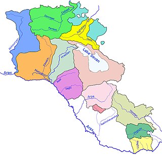
WThe Rivers and lakes in Armenia are mainly powered by fresh water. Throughout history Armenia has been called Nairi by the Assyrians meaning the "Land of the lakes and rivers". Armenia is home to many rivers and lakes.
 W
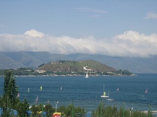
WSevan Island, now Sevan Peninsula was an island in the northwestern part of Lake Sevan in Armenia. After the artificial draining of Lake Sevan, which started in the Joseph Stalin era, the water level fell about 20 metres, and the island transformed into a peninsula. At the southern shore of this newly created peninsula, a guesthouse of the Armenian Writers' Union was built. The eastern shore is occupied by the Armenian president's summer residence, while the monastery's still active seminary moved to newly constructed buildings at the northern shore of the peninsula.
 W
WShamshadin is a historical region of Armenia and rayon of Armenian SSR. It is now the eastern part of Tavush province (marz).
 W
WSquare of Russia is a square in Yerevan, Armenia. It is located in Grigori Lusavorich and Argishti Streets. Armenian President Serzh Sargsyan and Russian President Dmitry Medvedev took part in the opening ceremony. It is located near Alexander Myasnikyan square. The City Hall and the House of Moscow are located the square.
WTandzut, is a river in Lori Province, Northern Armenia. The source of the river is located on the Northern side of Pambak mountain range. Tandzut stretches for 23 kilometres (14 mi). It flows through the town of Vanadzor and drains into the river Pambak. The main tributary of Tandzut is Vanadzor River.
 W
WTskhouk-Karckar or Qarqar is a group of pyroclastic cones which is located in the central part of the Siunik volcanic ridge at the border of Armenia and Azerbaijan (Artsakh) 60 km SE of Lake Sevan. The volcanoes lie on the northwest side of Tskhouk volcano and are constructed on a volcanic basement or rhyolites, basaltic andesites and dacites. The volcanoes erupted voluminous and long lava flows, grouped in three age-based stages of varying age and conservation. Petroglyphs have been found buried under the most recent stages and broken by earthquake activity, suggesting activity between the 4th–early 3rd millennium BC and 4720 ± 140 years BP, a date established by C14 analysis on graves inside the lava flows. There is evidence indicating that the last stage of activity resulted in abandonment of the area by humans, only resuming during the Middle Ages.
 W
WVachagan is a river in the southern Syunik Province of Armenia. The river has a length of 5 km and flows through the town of Kapan. It is a tributary of the Voghji River. Its origin is at the northern edge of Mount Khustup in the Syunik Mountains range. It has a basin of 35 km².
 W
WVardahovit is a town in the Vayots Dzor Province of Armenia.
 W
WThe Vorotan (Որոտան), Bargushad, or Bazarchay is a river in Transcaucasia, a left tributary of the Aras River. It rises in the northern part of the South-Armenian province of Syunik, flows for 119 kilometres (74 mi) in a generally southeastern direction through Armenia and then for another 59 km (37 mi) through Azerbaijan's Nagorno-Karabakh, before emptying into the Aras at the border with Iran. The river flows mostly through mountainous country and in several places through deep canyons. The towns of Sisian and Kubatly lie along its course. During the Soviet period, three reservoirs with adjoining hydro-power stations creating the Vorotan Cascade were constructed along its course.
 W
WYerevan Lake is an artificial reservoir located in the capital of Armenia in Yerevan. It was formed between 1963 and 1966, to be opened in 1967.
 W
WThe Zangezur Mountains comprise a mountain range that defines the border between Armenia's southern provinces of Syunik, Vayots Dzor and Nakhichevan Autonomous Republic. The Zangezur region is internationally recognized as being the second largest tracts of forests in Armenia, which are located in the Zangezur Mountains where they cover more than 20% of the territory of Armenian Syunik province and reach an elevation of 2,200-2,400 m.