 W
WThe Aberdare National Park is a protected area in the Aberdare Mountain Range in central Kenya located east of the East African Rift Valley. It covers the higher areas and the Aberdare Salient to the east.
 W
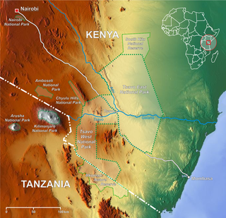
WAmboseli National Park, formerly Maasai Amboseli Game Reserve, is a national park in Kajiado South Constituency in Kajiado County, Kenya. The park is 39,206 hectares in size at the core of an 8,000 km2 (3,100 sq mi) ecosystem that spreads across the Kenya-Tanzania border. The local people are mainly Maasai, but people from other parts of the country have settled there attracted by the successful tourist-driven economy and intensive agriculture along the system of swamps that makes this low-rainfall area, average 350 mm (14 in), one of the best wildlife-viewing experiences in the world with 400 species of birds including water birds like pelicans, kingfishers, crakes, hamerkop and 47 raptor species.
 W
WThe Arabuko Sokoke Forest Reserve is located on the coast of Kenya, 110 km north of Mombasa and is protected as a national Forest Reserve. The Arabuko Sokoke National Park, situated at the north-western edge of the Arabuko Sokoke Forest Reserve, is only a few square kilometres in size and constitutes only a small portion of the latter.
 W
WThe Boni National Reserve is a national reserve for conservation and lies in the Garissa County, Kenya. The reserve covers an area of 1,339 km2 (517 sq mi) and is managed by Kenya Wildlife Service. It was gazetted in 1976 as a dry season sanctuary for elephants in the former Kenyan Ijara, and Lamu districts and Somalia. Unfortunately, elephant population has been greatly reduced by poaching.
 W
WCentral Island, also known as Crocodile Island, is a volcanic island located in the middle of Lake Turkana in Kenya. It is also the location of Central Island National Park, which is governed by the Kenya Wildlife Service.
WThe Chyulu Hills is a mountain range in Makueni County, South Eastern Kenya. It forms a 100 kilometre long volcanic field in elongated NW-SE direction. Its highest peak is 2188 metres high.
 W
WHell's Gate National Park lies south of Lake Naivasha in Kenya, north west of Nairobi. Hell's Gate National Park is named after a narrow break in the cliffs, once a tributary of a prehistoric lake that fed early humans in the Rift Valley. It was established in 1984. A small national park, it is known for its wide variety of wildlife and for its scenery. This includes the Fischer's Tower and Central Tower columns and Hell's Gate Gorge. The national park is also home to three geothermal power stations at Olkaria. The park is equipped with three basic campsites and includes a Maasai Cultural Center, providing education about the Maasai tribe's culture and traditions.
 W
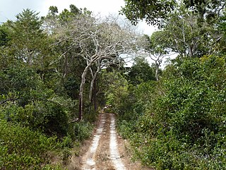
WKakamega Forest is a tropical rainforest situated in the Kakamega and Nandi County of Kenya, northwest of the capital Nairobi, and near to the border with Uganda. It is Kenya's only tropical rainforest and is said to be Kenya's last remnant of the ancient Guineo-Congolian rainforest that once spanned the continent.
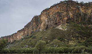
WThe Kerio Valley National Reserve is a protected area in the Kerio Valley, Kenya, a branch of the Great Rift Valley. The 66 square kilometres (25 sq mi) reserve was created in 1983 and is managed by the Kenya Wildlife Service.
 W
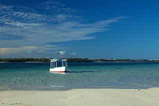
WKisite-Mpunguti Marine National Park is situated on the southern coast of Kenya near Shimoni and south of Wasini Island in Kwale District near the Tanzanian border. Kisite park covers 11 square kilometres while Mpunguti reserve covers 28 square kilometres.
WLocated within Kisumu city, Kisumu Impala Sanctuary lies on the shores of Lake Victoria, covering less than 1km2. The facility was gazetted in 1992. In March 2010, the sanctuary was branded as ‘a lakeshore walk with impalas'. There are a diverse number of flora and fauna both free ranging and captive. Over 115 species of birds have been recorded. Presently, the sanctuary boasts of all the big five game except for the elephant. A number of nature trail circuits are also available for clients.
 W
WKiunga Marine National Reserve is situated along the Indian Ocean coast of Lamu District, Coast Province, Kenya. Kiunga park covers 270 square kilometres (100 sq mi).
WKora National Park is located in Tana River County, Kenya. The park covers an area of 1,788 square kilometres. It is located 125 kilometres east of Mount Kenya. The park was initially gazetted as a nature reserve in 1973. It was gazetted as a national park in 1989, following the murder of George Adamson by poachers.
 W
WLake Turkana National Parks is a group of three national parks located around Lake Turkana in Kenya. It was inscribed as a UNESCO World Heritage Site in 1997 and expanded in 2001. Reasons for the park's importance include its use as a stopping point for migratory birds, as a breeding ground for the Nile crocodile, hippopotamus, and snakes. It also contains fossils in the Koobi Fora deposits which are unique in the world. Lake Turkana National Parks consist of Sibiloi National Park and two islands on Lake Turkana.
 W
WThe Lewa Wildlife Conservancy is located in northern Kenya. It was formed in 1995. It is a wildlife sanctuary incorporating the Ngare Ndare Forest and covering over 62,000 acres (250 km2). The Conservancy is home to a wide variety of wildlife including the rare and endangered black rhinos, Grevy's zebras and sitatungas. It also includes the big five. Lewa holds over 12% of Kenya's eastern black rhinoceros population and the largest single population of Grevy's zebras in the world.
 W
WMount Longonot is a stratovolcano located southeast of Lake Naivasha in the Great Rift Valley of Kenya, Africa. It is thought to have last erupted in the 1860s. Its name is derived from the Maasai word Oloonong'ot, meaning "mountains of many spurs" or "steep ridges".
WMalindi Marine National Park is located in the Indian Ocean, off the coast of Kenya. It is claimed to be oldest marine park in Africa. The park lies at Malindi, about 118 km north of Mombasa and is protected and administered by the Kenya Wildlife Service. Along with Watamu Marine National Park, Malindi Marine Park is enclosed by the Malindi Marine National Reserve.
WMalka Mari National Park is a national park of Kenya, situated along the Dawa River on the Kenya-Ethiopia border. It is approximately 1,500 square kilometres in size. It is accessible via the Mandera Airport, and is probably the least visited national park in the nation.
WThe Marsabit National Park is a national park and nature reserve located at Mount Marsabit in northern Kenya, near the town of Marsabit. It is located 560 km north of Nairobi in Marsabit County in the former Eastern Province and its reserve is noted for its zebra population and bird sanctuary.
WMeru National Park is a Kenyan national park located east of Meru, 350 km (220 mi) from Nairobi. Covering an area of 870 km2 (340 sq mi), it is one best known national parks in Kenya. Rainfall in this area is abundant with 635–762 mm (25.0–30.0 in) in the west of the park and 305–356 mm (12.0–14.0 in) in the east. The rainfall results in tall grass and lush swamps.
 W
WMombasa Marine National Park and Reserve is a marine park and national reserve in Mombasa, Kenya. The park is 10 km2 while the reserve is 200 km2.
 W
WMount Elgon National Park is a national park 140 kilometres (87 mi) northeast of Lake Victoria. The park covers an area of 1,279 square kilometres (494 sq mi) and is bisected by the border of Kenya and Uganda. The Ugandan part of the park covers 1,110 km2 (430 sq mi) while the Kenyan part covers 169 km2 (65 sq mi). The Kenyan part of the park was gazetted in 1968, the Ugandan part in 1992.
 W
WMount Kenya National Park was established in 1949 to protect Mount Kenya, the wildlife and surrounding environment, which forms a habitat for wild animals, as well as acting as an area for the catchment of water, to supply Kenya's water.
WMount Kulal is an eroded-down extinct volcano located in northern Kenya, just east of Lake Turkana. The mountain has an elevation of 2,285 metres (7,497 ft). The lakeside town of Loiyangalani is located 50 kilometres (31 mi) west of Mount Kulal.
WMount Longonot is a stratovolcano located southeast of Lake Naivasha in the Great Rift Valley of Kenya, Africa. It is thought to have last erupted in the 1860s. Its name is derived from the Maasai word Oloonong'ot, meaning "mountains of many spurs" or "steep ridges".
 W
WNairobi National Park is a national park in Kenya that was established in 1946 about 7 km (4.3 mi) south of Nairobi. It is fenced on three sides, whereas the open southern boundary allows migrating wildlife to move between the park and the adjacent Kitengela plains. Herbivores gather in the park during the dry season. Nairobi National Park is negatively affected by increasing human and livestock populations, changing land use and poaching of wildlife. Despite its proximity to the city and its relative small size, it boasts a large and varied wildlife population, and is one of Kenya's most successful rhinoceros sanctuaries.
 W
WLake Nakuru is one of the Rift Valley soda lakes at an elevation of 1,754 m (5,755 ft) above sea level. It lies to the south of Nakuru, in the rift valley of Kenya and is protected by Lake Nakuru National Park.
 W
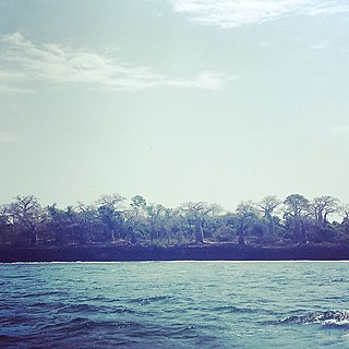
WNdere Island is a small island in Winam Gulf of Lake Victoria in Kenya. It was gazetted as the Ndere Island National Reserve in November 1986 and has since that time been uninhabited.
 W
WThe Ol Donyo Orok mountain, also called Namanga Hills, is situated in southern Kenya next to the Tanzanian border in the Namanga Division. The mountain has a stretched triangular shape, almost like an arrow pointing north. The short side faces the Tanzanian border. The highest peak is 2548 m.
WOl Donyo Sabuk, or Kyanzavi in Kamba, is a mountain and an adjacent small town near Thika Kenya. The town is located in Kyanzavi Division, Machakos County. The peak, height 2,145 metres (7,037 ft), was named by Maasai pastoralists, meaning big mountain. The Kamba name, Kyanzavi means the mountain of nzavi or Lablab beans. Kilimambogo, has two parts, Kilima - meaning a hill or mountain in Swahili, and mbogo meaning a buffalo in many Bantu languages. Incidentally, the forested part of the mountain has a large population of buffaloes. Buffalo is called Nyati in Swahili. The town stands at the edge of Machakos County.
 W
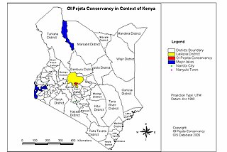
WThe Ol Pejeta Conservancy is a 360 km2 (140 sq mi) not-for-profit wildlife conservancy in Central Kenya's Laikipia County. Situated on the equator west of Nanyuki, between the foothills of the Aberdares and Mount Kenya. The Ol Pejeta Conservancy works to conserve wildlife, provide a sanctuary for great apes and to generate income through wildlife tourism and complementary enterprises for re-investment in conservation and community development.
 W
WThe ruins of Gedi are a historical and archaeological site near the Indian Ocean coast of eastern Kenya. The site is adjacent to the town of Gedi in the Kilifi District and within the Arabuko-Sokoke Forest.
 W
WRuma National Park is the only terrestrial park in Kenya's Nyanza Province. Dubbed the "Last Retreat of the Roan Antelope", the park protects the only indigenous population of rare roan antelopes within Kenya. At present, the population is on the verge of extinction with individual populations numbering approximately 40. The park was established in 1966 as Lambwe Valley Game Reserve. It was later renamed “Ruma” after one of Kenya's most powerful wizard, the much feared Gor Mahia who lived around the park. The park is located in the vast Lambwe Valley.
WSaiwa Swamp National Park is located near Kitale, in Trans-Nzoia County, Rift Valley Province, Kenya. It is the smallest national park in Kenya, only 3 km2, and was created as habitat for the Sitatunga, a rare aquatic antelope. There are a variety of trees at the national park.Saiwa Swamp National Park is the smallest tour destination park in kenya, a Sanctuary of the Sitatunga antelope and packed with a lot of wildlife to explore from plants, birds, Insects and reptiles.
 W
WSibiloi National Park lies on the northeastern shore of Lake Turkana in northern Kenya. Established in 1973 by the government of Kenya for the protection of wildlife and paleontologist sites there, it covers 1,570 km2 (610 sq mi) and is internationally known for its fossils. It was listed as a UNESCO World Heritage Site in 1997 as a part of Lake Turkana National Parks.
 W
WTaita Hills Wildlife Sanctuary is a privately owned wildlife sanctuary and national park in Kenya. It is located in Taita-Taveta County approximately 220 kilometers from Mombasa. The sanctuary covers an area of 28,000 acres (110 km2), and is adjacent to Tsavo West National Park and the LUMO Community Wildlife Sanctuary. It hosts cape buffalo, African bush elephant, leopard, lion, cheetah, Masai giraffe, zebra, hartebeest, impala, waterbuck, Thomson's gazelle, lesser kudu, dik-dik, Hyena, and other smaller animals, including a diversity of birdlife
WTsavo East National Park is one of the oldest and largest parks in Kenya at 13,747 square kilometres. Situated in a semi-arid area previously known as the Taru Desert it opened in April 1948, and is located near the town of Voi in the Taita-Taveta County of the former Coast Province. The park is divided into east and west sections by the A109 road and a railway. Named for the Tsavo River, which flows west to east through the national park, it borders the Chyulu Hills National Park, and the Mkomazi Game Reserve in Tanzania.
WTsavo West National Park is located in the Coast Province of Kenya. The park covers an area of 9,065 square kilometres. The A109 road Nairobi-Mombasa and a railway divides it from the adjoining Tsavo East National Park. Together with adjoining ranches and protected areas, they comprise the Tsavo Conservation Area. Tsavo West is a more popular destination on account of its magnificent scenery, Mzima Springs, rich and varied wildlife, good road system, rhino reserve, rock climbing potential and guided walks along the Tsavo River. The park is operated by Kenya Wildlife Service.
 W
WWatamu Marine National Park and Reserve is located in Kenya. Established in 1968, it was one of Kenya's first marine parks. It is located about 90 miles (140 km) north of Mombasa, Kenya's second largest city. Its coral gardens are merely 300 metres (980 ft) from the shore and are home to approximately 600 species of fish, 110 species of stony coral and countless invertebrates, crustaceans and molluscs. Water temperature varies from 20 degrees Celsius to 30 degrees Celsius. The park was designated as a biosphere reserve in 1979.