 W
WAlder Hills is an suburb in Dorset that crosses the boundaries of Bournemouth and Poole. It is south of Wallisdown, east of Alderney and north of Parkstone.
 W
WAlum Chine is the largest chine in Bournemouth, England. The gorge was crossed by a suspension bridge by the early part of the twentieth century.
 W
WBear Cross is a suburb on the north-western edge of Bournemouth, Dorset, taking its name from the crossroads made by the main road (A348) between Poole and Ringwood and the Wimborne Road/Magna Road (A341).
 W
WBoscombe is a suburb of Bournemouth, England. Historically in Hampshire, but today in Dorset, it is located to the east of Bournemouth town centre and west of Southbourne.
 W
WBournemouth Town Centre is an area of Bournemouth, Dorset. The town centre is the central business district and is located near the coast between West Cliff and East Cliff.
 W
WCharminster is a residential and commercial suburb of Bournemouth in Dorset, situated between the suburbs of Springbourne and Winton. It was incorporated into the County Borough of Bournemouth in 1901.
 W
WDurley Chine is an award-winning Blue Flag beach and chine in Bournemouth, Dorset in England. It is to the west of Bournemouth Town Centre, north of West Cliff, and east of Westbourne.
 W
WEast Cliff is a suburb and ward in Bournemouth, Dorset, England.
 W
WEast Howe is a residential district of the town of Bournemouth, Dorset on the south coast of England.
 W
WEnsbury Park is a mainly residential suburb of Bournemouth, in Dorset, England. It inclues the housing estate of Slades Farm and lies within the ward district of Northbourne and Redhill.
 W
WHengistbury Head is a headland jutting into the English Channel between Bournemouth and Mudeford in the English county of Dorset. It is a site of international importance in terms of its archaeology and is scheduled as an Ancient Monument. Declared a Local Nature Reserve in 1990, the head and its surroundings form part of the Christchurch Harbour Site of Special Scientific Interest. It is also a Special Area of Conservation, Special Protection Area, an Environmentally Sensitive Area and a Site of Nature Conservation Interest. The name "Hengistbury Head" refers to the immediate area; the elevated portion is called Warren Hill.
WIford is a suburb of Bournemouth, situated in the eastern part of the borough. It is also known as a bridging-point over the River Stour, connecting Bournemouth with Christchurch.
 W
WKings Park is one of the largest parks that is in Boscombe, Bournemouth, Dorset. It is home to Vitality Stadium, where AFC Bournemouth play.
 W
WKinson is a former village which has been absorbed by the town of Bournemouth in the county of Dorset in England. The area became part of Bournemouth on 1 April 1931. There are two electoral wards containing the name Kinson(North & South). Their joint population at the 2011 Census was 19,824.
 W
WKnighton Heath is an area of Bournemouth, Dorset in England. Knighton Heath is south of Bearwood, west of Wallisdown and West Howe, and north of Alderney.
 W
WLansdowne is a suburb of Bournemouth. It occupies the north-east part of the main built-up area around Bournemouth Town Centre.
 W
WLittledown is a suburb of Bournemouth, in Dorset, England. Originally it was a small settlement to the south of the much more important Holdenhurst Village, and for centuries it existed as a huddle of farm buildings on the edge of heathland. As the town of Bournemouth expanded, Littledown remained as a farming community with areas of open fields on the town's northern edge, with the Cooper-Dean family residing in Littledown House. Eventually however the only Cooper-Dean descendants were two spinster sisters who sold Littledown House, with the surrounding farmland, to Bournemouth Council in the early 1980s. After public discussion on what the Council would do with the area, eventually much of the land was sold off for housing, although a large section was set by for a park and a sports centre.
 W
WMeyrick Park is a suburb and area of Bournemouth, Dorset.
WMoordown is a suburb of Bournemouth, situated in the northern part of the borough. It was incorporated into the borough of Bournemouth in 1901, having previously been part of the Christchurch rural district.
 W
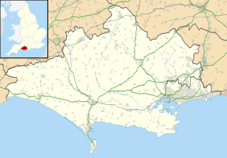
WBournemouth is a coastal resort town on the south coast of England. At the 2011 census, the town had a population of 183,491, making it the largest in the administrative county of Dorset. With Poole to the west and Christchurch in the east, Bournemouth is part of the South East Dorset conurbation, which has a population of 465,000.
 W
WNorthbourne is a suburb of Bournemouth, Dorset in England. It is in the north of the town and borders Ensbury Park.
 W
WPokesdown is a suburb of Bournemouth in Dorset, England. It lies just east of Boscombe and west of Southbourne.
 W
WQueen's Park is one of the largest parks that is in Bournemouth, Dorset. It is home to Queen's Park Golf course.
 W
WRedhill is a northern suburb of Bournemouth, Dorset in England.
 W
WSlades Farm is an area of Ensbury Park, Bournemouth, Dorset, England.
 W
WSouthbourne is a suburb of Bournemouth in Dorset, England. It is situated between Boscombe and Christchurch, in the unitary authority of Bournemouth, Christchurch and Poole. The area was previously known as Stourfield. Strictly, Southbourne refers to the area near to the coast; areas further inland are West Southbourne, Tuckton and Wick.
 W
WSpringbourne is a suburb of Bournemouth in Dorset, England. It occupies the north-east part of the main built-up area, north of Boscombe. Its formal boundaries are Northcote Road to the west, the Wessex Way (A338) to the north, Ashley Road to the east, and the railway line to the south.
 W
WStrouden Park is an area of Bournemouth, Dorset, England. Strouden Park is north of Queen's Park, west of Townsend and east of Redhill.
 W
WTalbot Woods is an area of Bournemouth, Dorset. Talbot Woods is south of Talbot Village.
 W
WTalbot Village is located on the boundary of Bournemouth and Poole in Dorset, England.
WTalbot Woods is an area of Bournemouth, Dorset. Talbot Woods is south of Talbot Village.
 W
WTownsend is a area of Bournemouth, Dorset. It is located in the suburbs along the north eastern boundary of the town and is close to the Royal Bournemouth Hospital.
WTuckton is a suburb of Bournemouth, situated on the River Stour in the eastern part of the borough. First recorded in 1271, this was a hamlet in the tithing of Tuckton and Wick until 1894, when the Local Government Act replaced all tithings in England and Wales with civil parishes and district councils. At that point, Tuckton became part of the civil parish of Southbourne, which was absorbed into the Borough of Bournemouth in 1901.
 W
WTurbary Park is an area of West Howe, Bournemouth in Dorset. Turbary Park is south of Kinson and north of Wallisdown.
 W
WVictoria Park is a area of Bournemouth, Dorset. The area is south of Moordown, north-west of Winton and east of Talbot Village, Wallisdown and Ensbury Park.
 W
WWallisdown is a residential and commercial area situated partly in Bournemouth and partly in Poole, in southern England. The appropriate ward is called Wallisdown and Winton West.
 W
WWest Cliff is a suburb of Bournemouth, Dorset, England. West Cliff is south of Westbourne and east of Branksome in Poole.
 W
WWest Howe is a suburb of Bournemouth, Dorset, located in the north-west provinces of the borough.
 W
WWestbourne is an affluent residential and shopping area of Bournemouth, Dorset. It is located in between Branksome, Poole and the centre of Bournemouth, just off the main A338. Poole Road, mainly full of specialised shops and small cafes, runs through the centre Westbourne with Seamoor Road curving round bringing more shops and services. Many of the shops have residential property above them.
WWinton is a suburb of Bournemouth in Dorset, England. It lies approximately 1 mile (1.6 km) north of Bournemouth town centre, along Wimborne Road. Winton is to the east of Wallisdown, Victoria Park and Talbot Woods and south of Moordown.